Rauhhornzug
| Rauhhornzug | ||
|---|---|---|
| Highest peak | Glasfelderkopf ( 2271 m above sea level ) | |
| location | Bavaria , Germany ; Tyrol , Austria | |
| part of | Vilsalpseeberge , Allgäu Alps | |
| Classification according to | Alpine Club Guide Allgäu Alps | |
|
|
||
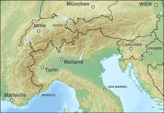
| Coordinates | 47 ° 27 ' N , 10 ° 28' E | |
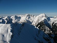
The Rauhhornzug is a mountain ridge in the Allgäu Alps .
description
In older Alpine Club guides , the Rauhhornzug was run as an independent subgroup of the Allgäu Alps. It runs roughly south-north between the Bockkarscharte (2162 m) and the Oberjochpass (1175 m) near Oberjoch . The western boundary is the Ostrach , which flows from south to north . In the east, the valley of the Schwarzwasserbach , the Karmulde with the Alplsee (1620 m) and the young Vilstal with the Vilsalpsee (1124 m) border the Rauhhornzug. In the northeast, the slopes of the mountains descend into the Tannheimer Tal .
In the current version (status: 2008) of the Alpine Club Guide Allgäu Alps, the Rauhhornzug is largely subordinate to the Vilsalpsee mountains. It is only divided at the Notländesattel (1879 m) and the subsequent mountains Sattelkopf (2097 m) and Glasfelderkopf (2271 m) are assigned to the Hochvogel group.
mountains
The mountains and peaks that make up the Rauhhornzug from south to north.
|
|
Several side arms branch off from this main ridge, which also have peaks. At the Lahnerkopf a ridge branches off to the north over the Schreckenjöchle to the Älpelekopf (2024 m). In the area of the Zirleseck (1872 m) a side ridge stretches to the north, carrying the Rohnenspitze (1990 m). The massif around the Kühgundkopf still has the elevation of the Iseler summit (1876 m) in the west .
Jubilee path
A large part of the Jubiläumsweg is located along the Rauhhornzug . It starts at the Willersalpe (1459 m) and leads over the Gaiseckjoch (2088 m) to the south, past the Schrecksee (1813 m) into the Lahnerscharte (1988 m). From there it continues to the Bockkarscharte and to its end point the Prinz-Luitpold-Haus (1846 m).
Individual evidence
- ↑ Ernst Zettler, Heinz Groth: Alpine Club Guide - Allgäu Alps . 12th, completely revised edition. Bergverlag Rudolf Rother , Munich 1985, ISBN 3-7633-1111-4 .
- ↑ Ernst Zettler, Heinz Groth: Alpine Club Guide - Allgäu Alps . 12th, completely revised edition. Bergverlag Rudolf Rother, Munich 1985 (p. 305).
- ↑ Dieter Seibert: Alpine Club Guide alpine - Allgäu Alps and Ammergau Alps . 17th edition. Bergverlag Rother , Munich 2008, ISBN 978-3-7633-1126-2 .

