Vilsalpsee
| Vilsalpsee | ||
|---|---|---|

|
||
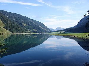
| Vilsalpsee with Aggenstein in the background | ||
| Geographical location | Allgäu Alps | |
| Tributaries | Vils , Traualpsee drain | |
| Drain | Vils | |
| Places on the shore | Weltingalpe, Vilsalpe | |
| Location close to the shore | Tannheim | |
| Data | ||
| Coordinates | 47 ° 27 '46 " N , 10 ° 30' 8" E | |
|
|
||
| Altitude above sea level | 1165 m above sea level A. | |
| surface | 57.22 ha | |
| length | 1.4 km | |
| width | 500 m | |
| volume | 8,583,000 m³ | |
| Maximum depth | 30 m | |
| Middle deep | 15 m | |
The Vilsalpsee is a 1165 m high lake in the Austrian Alps . The river Vils flows through it . Located below Gaishorn and Rauhorn , it is a popular tourist destination in the Tannheimer Tal . An easy hiking trail leads around the lake, which leads to the Bergaicht waterfall at the end of the valley. Since 1957 it has been surrounded by the Vilsalpsee nature reserve , in which many species thrive, including rare orchids . For the great crested grebe , the lake is the highest nesting area in Austria.
Location and surroundings
The Vilsalpsee belongs to the state of Tyrol , Reutte district , Tannheim municipality . It is located in the Vilsalptal, a southern side valley of the Tannheimer Tal, which runs from southwest to northeast. At the transition from Vilsalptal for Tannheim Valley is the town of Tannheim . From here a road leads to the north bank, which continues as a closed driveway to the end of the valley in the south-west.
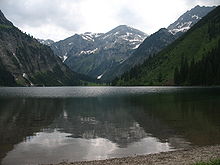
The surrounding mountains belong to the Eastern Alps and are counted among the Northern Limestone Alps . They are part of the Vilsalpsee Mountains , which are assigned to the Allgäu Alps . The surrounding mountains are the Sulzspitze (2,084 m), Bläser (1,961 m), Geierköpfl (1,872 m), Rote Spitze (2,130 m), Kugelhorn (2,126 m), Rauhorn (2,241 m) and Gaishorn (2,247 m) in a clockwise direction .
Inflow and outflow
There are two above-ground tributaries into the Vilsalpsee. From the south-east there is a tributary from the Traualpsee drain and a waterfall between Paleness and Schochenspitze . An alluvial fan has formed in the lake from this direction . The second tributary comes from the west and arises between Rauhorn and Gaishorn. There are also two more underground tributaries. In addition to the above-ground outflow of the Traualp reservoir, there is an underground aqueduct that flows into the Vilsalpsee southwest of the natural inflow. From the rear part of the Vilsalptal the lake gets inflow through the seeping runoff water of the Alplesees .
The only outflow of the Vilsalpsee is the Vils , which flows out of the northernmost part of the lake. Gappenfeldbach and Kesselbach flow into the Tannheimer Tal on their way. After merging with the Berger Ache, the Vils flows towards the Lech . The lake thus drains over the Danube into the Black Sea .
geology
The result is the Vilsalpsee by glacial processes during the cold periods of the Quaternary . The glacier in the Vilsalptal was a branch of the Lechtal glacier. Initially, the ice had carved a hollow in the valley floor. A moraine was then deposited , which dammed the streams from the surrounding mountains. The surrounding slopes are also shaped by the Ice Age and consist of karst steps. The slopes that are flatter towards the lake are covered with bumps .
East of the Vilsalpsee is in the range of Schochen- and Sulzspitze the geological boundary between the Allgäu ceiling and the Lechtal with rocks from the triad . There are thrusts and the layers are folded . Most of the area around the Vilsalpsee consists of main dolomite . In hollows, the bottom of a fold, the rock is often made up of red Adnet limestone . The less steep slopes are formed from Jurassic marl and aptych limestone .
Since September 2012, the eastern shore of the Vilsalpsee has been affected by several, in some cases large, rock falls and the path there is therefore closed. The biggest fall so far occurred on the paleness (as of July 2013). However, there is a risk of an even larger rock fall through a roughly 100 meter long and up to two meter wide crevice on the Blaich . According to the regional geology of the state of Tyrol, this could spill a third of the lake.
climate
The climatic zone in which the Vilsalpsee lies is, according to the Köppen classification, "humid with warm summers" ( Cfb ). The lake lies in the global west wind zone, which is supplied with Atlantic humid air. The lake is in an environment that is the first orographic obstacle to oppose the air masses, which leads to increased precipitation activity. Regional conditions such as the mountainous location lead to an alpine climate characterized by wet summers, dry autumns and snowy winters.
nature
The area around the Vilsalpsee has been under nature protection since 1957 and is now part of the Vilsalpsee nature reserve , which is also a Natura 2000 area. It extends over the municipal areas of Tannheim and Weißenbach (both Reutte district ), and includes the higher-lying Lache , Traualpsee and Alplsee .
For nature conservation reasons, car access to the lake is closed from 10 a.m. to 5 p.m.
flora
Around 700 plant species are counted around the lake. These include rare and endangered plants. In the bank area of the Vilsalpsee there are underwater lawns, which are formed from pondweed and candelabrum algae . In the silted areas there are also beak sedge , pond horsetail and swamp pond thread . Boggy areas in the southwest of the lake and wet meadows close to the water are home to Scheuchzer's cotton grass , brown sedge , swamp heart leaf , horsetail and Alpine butterwort . In the surrounding subalpine lawn there are yellow gentian , leafy lice weed and rare orchids such as green hollow tongue , broad-leaved orchid and marsh orchid .
fauna
As a breeding and habitat for birds, the Vilsalpsee is of outstanding importance for Tyrol and Austria. For the great crested grebe , the lake is the highest known breeding area in Austria and one of a total of three in Tyrol. An irregular breeding guest is the Goosander , probably feeding again from the Lech Valley. In addition, breeding mallard , coot and Tufted regularly at the lake.
In the bog at the southwest end of the lake there are amphibians -Nester of Alpine salamander , toad and frog . The fish that swim in the Vilsalpsee are brown trout , lake trout and arctic char . Species that come to the shore to feed are red deer , brown hare and badger .
tourism
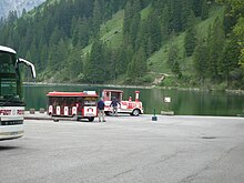
A diverse infrastructure is available for tourists at Vilsalpsee. There is a paid parking lot on the north bank, access until 10 a.m. and 5 p.m., as well as the restaurant-cafés Gasthof Vilsalpsee and Fischerstube . Somewhat away from the west bank is the Vilsalpe , an agriculturally managed alp with a snack station . A bus line leads from Tannheim to the Vilsalpsee. Tourist transport facilities are a horse-drawn carriage and a slow train from the parking lot at the Tourist-Info Tannheim, alternatively there is a footpath that leads mostly through a forest, meadow and river landscape. There is a boat rental and you can fish in the lake.
Since several landslides in 2013, the path on the east side between the power station and Vilsalpe has been closed for safety reasons, and the lake can no longer be completely circumnavigated. However, the ascent to the Obere Traualpe or Landsberger Hütte is possible without restriction. The path on the west side was therefore widened to enable supply and rescue vehicles to access the Vilsalpe etc. (status: October 2014). An extension of this path leads into the rear Vilsalptal, from where the Bergaicht waterfall can be viewed. The lake is the starting point for numerous hiking trails . Route 425 is the access to the Landsberger hut at Traualpsee, from where the surrounding mountains can be climbed. From the Vilsalpe, path 424 heads west up to the Jubiläumsweg , from which the Gaishorn and Rauhorn can be climbed. From the parking lot there is the possibility of a transition to the Älpeletal in the northwest on path 59 .
literature
- Kompass hiking, bike and ski tour map: Sheet 04 Tannheimer Tal (1: 35,000). Rum / Innsbruck 2007, ISBN 978-3-85491-644-4 .
- Th. Schauer: The vegetation of the Vilsalpsee and the Traualpseen near Tannheim in Tyrol . In: Association for the protection of the mountain world (ed.): Yearbook of the association for the protection of the mountain world . tape 45 , 1978, pp. 103-122 .
Movie
- The fjord in the mountains. A year at the Vilsalpsee. Documentary, Germany, 2010, 44 min., Script and director: Christian Hermann, production: BR , series: natur exclusiv, first broadcast: March 27, 2010 on BR, summary by ARD , a. a. with the Allgäu professional diver Sigfried Braun.
Web links
Individual evidence
- ↑ Federal Office for Metrology and Surveying: Austria Map online . 1: 50,000. Retrieved June 8, 2009
- ↑ a b Vilsalpsee nature reserve. Accessed on June 9, 2009
- ↑ Kai Kaszemeik, Junghyun Kim: Report 1995 on geological recordings in the Allgäu Alps on sheet 114 Holzgau . (PDF; 11 kB) Accessed June 9, 2009
- ↑ Community of Tannheim: Danger of rockslides at the Vilsalpsee - lock ( memento of the original from April 21, 2016 in the Internet Archive ) Info: The archive link was inserted automatically and has not yet been checked. Please check the original and archive link according to the instructions and then remove this notice. . June 19, 2013, accessed July 2, 2013.
- ↑ Günther Reichel: Vilsalpsee is threatened by a huge rock fall! . meinviertel.at. July 2, 2013, accessed July 2, 2013.
- ↑ World Map of the Köppen-Geiger climate classification updated. Accessed June 9, 2009
- ↑ Das Klima.Retrieved June 9, 2009
- ↑ a b Vilsalpsee. In: tiroler-schutzgebiete.at: Protected areas. Office of the Tyrolean Provincial Government, Department of Environmental Protection, accessed on June 6, 2010 .
- ↑ a b Site code: AT3302000 . NATURA 2000 Data Form. March 1998 ( tirol.gv.at [PDF; accessed on June 6, 2010] Update 2004-03). ( Page no longer available , search in web archives ) Info: The link was automatically marked as defective. Please check the link according to the instructions and then remove this notice.
- ↑ a b Regional development Ausserfern: Vilsalpsee protected area . Retrieved July 2, 2013
- ↑ Manfred Föger: Vilsalpsee - ornithological significance . Retrieved June 9, 2009
- ↑ Wonderful hiking routes lead through the nature reserve with its remarkably rich flora and fauna ( memento of the original from July 8, 2009 in the Internet Archive ) Info: The archive link was automatically inserted and has not yet been checked. Please check the original and archive link according to the instructions and then remove this notice. . Retrieved June 9, 2009
- ↑ Vilsalpsee nature reserve | Tannheim Valley Tourism. Retrieved March 1, 2019 .


