Kamastausee
| Kama reservoir | |||||||||||
|---|---|---|---|---|---|---|---|---|---|---|---|
|
|||||||||||
|
|
|||||||||||
| Coordinates | 58 ° 40 ′ 37 " N , 56 ° 6 ′ 42" E | ||||||||||
| Data on the structure | |||||||||||
| Construction time: | 1948 or 1954–1956 | ||||||||||
| Height of the barrier structure : | 37 m | ||||||||||
| Building volume: | 27.72 million m³ | ||||||||||
| Crown length: | 2286 m | ||||||||||
| Power plant output: | 504 MW | ||||||||||
| Data on the reservoir | |||||||||||
| Altitude (at congestion destination ) | 108 m above sea level NN | ||||||||||
| Water surface | 1915 km² | ||||||||||
| Reservoir length | 272 km | ||||||||||
| Reservoir width | 30 km | ||||||||||
| Storage space | 12,200 million m³ | ||||||||||
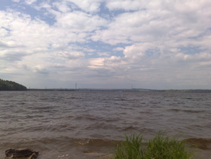
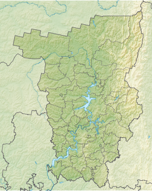
The Kamastausee ( Russian Ка́мское водохрани́лище / Kamskoje wodochranilishche ) is a reservoir in Russia on the middle Kama , the largest tributary of the Volga . The reservoir is located west of the Urals in the European part of Russia. It has a storage capacity of 12 billion cubic meters and a water surface of 1915 km² (this is also given as 1720 km²). The mean depth is 6.3 m, the greatest depth 30 m. The Kamastausee is part of the so-called Volga-Kama Cascade . It is 272 km long and up to 30 km wide.
According to various sources, construction of the dam began in 1948 or 1954. The barrier structure ( ⊙ ), which was completed in 1956, stands above the city of Perm . It is a combination of a dam made of bulk material with a gravity dam . There, electricity is generated in a hydropower plant , with a maximum output of 504 MW . The electricity generated is used for industry in the central Urals. Other purposes of the dam are shipping, water supply and water regulation.
The Kama Reservoir is sometimes Perm Reservoir (Russian Пермское водохранилище / Permskoje wodochranilischtsche called) to distinguish it from the other two Kamastauseen the Kama cascade that were built later down the river: the votkinsk reservoir at Tchaikovsky and Votkinsk on the border of Udmurtia and the Nizhnekamsk Reservoir (Lower Kama Reservoir ) near Naberezhnye Chelny in Tatarstan .
The Perm reservoir extends along the Kama to above the city of Solikamsk . Other larger places on the lake are Berezniki and Dobryanka - both on the left, eastern bank, while only the small towns of Usolye and Chormos are on the right, western bank . The tributaries of the Kama in the area of the reservoir are also dammed over a considerable length, for example the Chusovaya for almost 100 km or the Wischera in its lower reaches.
See also
- List of the largest dams on earth
- List of the largest reservoirs on earth
- List of the largest hydroelectric plants in the world
- List of dams in the world
Web links
Individual evidence
- ↑ a b Article Kamastausee in the Great Soviet Encyclopedia (BSE) , 3rd edition 1969–1978 (Russian)

