Usolye
| city
Usolye
Усолье
|
||||||||||||||||||||||||||||||||||||||||||||
|
||||||||||||||||||||||||||||||||||||||||||||
|
||||||||||||||||||||||||||||||||||||||||||||
| List of cities in Russia | ||||||||||||||||||||||||||||||||||||||||||||
Ussolje ( Russian Усолье ) is a small town in the Perm region ( Russia ) with 5694 inhabitants (as of October 14, 2010).
geography
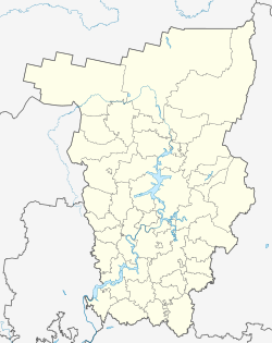
The town lies on the western edge of the Central Urals km approximately 190 north of the regional capital Perm on the right bank of here for Kama Reservoir pent Kama . The big city of Berezniki extends on the opposite, eastern river bank .
Ussolje is the administrative center of the Ussolje Rajon of the same name .
On the northern outskirts of the city, the Kama is crossed by an approximately 800 meter long road bridge.
history
The place was established in 1606 as a settlement near the Nowoje Ussolje salt works ( ussolje is a Russian popular name for facilities for salt production; the name therefore means something like "New Salt Works "). Until the end of the 18th century, the place was the center of the estates of the Stroganov family on the Kama and until the 19th century the center of salt mining in the Ural foothills, which later moved to Berezniki and Solikamsk .
In February 1918 the place became the administrative seat of the Ujesds Solikamsk and thus actually received city rights, in November 1923 also the seat of the Okrug Obere Kama (Verkhne-Kamski okrug) of the Ural Oblast, which existed until 1934 . The administrative seat of the Okrug was moved to Solikamsk in September 1928, and the Okrug was dissolved on July 23, 1930. On March 20, 1932, Ussolje and a few other workers' settlements were incorporated into the newly founded town of Berezniki, which is mostly on the other bank of the Kama. On August 30, 1940, Ussolje became an independent town again. In this context, the place of the same name in Siberia was renamed Usolye-Sibirskoje to avoid confusion . When the Kama reservoir was filled around 1958, part of the city was flooded.
Population development
| year | Residents |
|---|---|
| 1926 | 8,976 |
| 1959 | 11,788 |
| 1970 | 10.091 |
| 1979 | 7,909 |
| 1989 | 6,453 |
| 2002 | 6,144 |
| 2010 | 5,694 |
Note: census data
Culture and sights
Despite the flooding of part of the city, various buildings from the 18th to 19th centuries have been preserved, such as the Christ-Transfiguration Monastery ( Спасо-Преображенский монастырь / Spasso-Preobrazhensky monastyr) with the eponymous cathedral (1724-1731) and bell tower (1730) and trade rows of 1832. from the oldest buildings, the Christiansen Abgar Chapel ( часовня Спаса-Убруса / tschassownja Spasa-Ubrussa) from the first half of the 17th century, a ruin is preserved.
An architectural and ethnographic museum has existed since 1965 .
economy
The economy of the city is determined by timber industry and processing (furniture factory).
See also
Individual evidence
- ↑ a b Itogi Vserossijskoj perepisi naselenija 2010 goda. Tom 1. Čislennostʹ i razmeščenie naselenija (Results of the All-Russian Census 2010. Volume 1. Number and distribution of the population). Tables 5 , pp. 12-209; 11 , pp. 312–979 (download from the website of the Federal Service for State Statistics of the Russian Federation)
Web links
- Ussolye unofficial website (Russian)
- Ussolje on mojgorod.ru (Russian)


