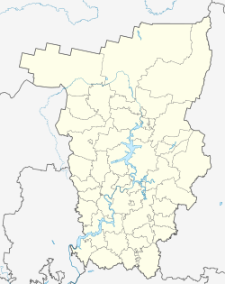
Ossa (Permian)
| city
Ossa
Оса
|
||||||||||||||||||||||||||||||||||||||||
|
||||||||||||||||||||||||||||||||||||||||
|
||||||||||||||||||||||||||||||||||||||||
| List of cities in Russia | ||||||||||||||||||||||||||||||||||||||||
Ossa ( Russian Оса ) is a city in the Perm region ( Russia ) with 21,188 inhabitants (as of October 14, 2010).
geography
The city is located in the foothills of the Middle Urals about 110 km southwest of the regional capital Perm on the left bank of the Kama, which is dammed here to form the Votkinsker reservoir, not far from the mouth of the Tulwa .
Ossa is the administrative center of the Rajons of the same name .
history
Ossa was established in 1591 (or 1596) as a settlement Novonikolskaya sloboda in place of older fortification remains called Ossinskoye Gorodishche . Later the settlement was fortified again to protect the eastern borders of Tsarist Russia .
In the 18th century the most important trade route to Siberia ( Siberian Tract ) passed through the city. In 1708 the town was granted town charter for the first time under its current name, in 1718 it lost it and received it again in 1737 (or 1739). During this time the area around the city was ravaged by a bloody Bashkir uprising . In 1740 the garrison of the fortress of Ossa , which was enlarged to 500 men (mostly Cossacks ) , succeeded in fighting down and pacifying the Bashkirs. In the same year, the French explorer De Lisle arrived in the city. In 1781 the city became the administrative center of a district ( Ujesds ) of the governorship or the later Perm governorate .
The city experienced a certain boom when oil was found in the area around 1960 .
Population development
| year | Residents |
|---|---|
| 1897 | 5,067 |
| 1926 | 5,900 |
| 1939 | 9,170 |
| 1959 | 12,719 |
| 1970 | 15,038 |
| 1979 | 19,993 |
| 1989 | 24,132 |
| 2002 | 23,452 |
| 2010 | 21,188 |
Note: census data (1926 rounded)
Culture and sights
Although part of the city was abandoned when the Votkinsk Reservoir flooded around 1961, a significant number of religious and secular structures from the 18th to early 20th centuries have been preserved. These include the Dormition Cathedral ( Успенский собор / Uspenski Sobor, 1790-1800), the Holy Trinity Cathedral ( Троицкий собор / Troitsky Sobor, 1902-1916), a mosque from the mid-19th century, the building of the provincial governors - and Ujesdkanzlei (both 1800–1802) and the Handelshof ( Gostiny dwor , first half of the 19th century).
There is a local museum in the city.
economy
A machine factory (equipment for the food industry) is located in Ossa, as well as companies in the wood and food industry. Ossinskneft has been producing oil in the Rajon since the 1960s .
sons and daughters of the town
- Natalja Burdyga (* 1983), biathlete
Trivia
The German travel song Am Ural celebrates "Ossa, [the] beautiful city on the Kama".
See also
swell
- ↑ a b Itogi Vserossijskoj perepisi naselenija 2010 goda. Tom 1. Čislennostʹ i razmeščenie naselenija (Results of the All-Russian Census 2010. Volume 1. Number and distribution of the population). Tables 5 , pp. 12-209; 11 , pp. 312–979 (download from the website of the Federal Service for State Statistics of the Russian Federation)
- ↑ De Lisle: Excerpt from a trip to Berezov in Siberia . In: John Green, Thomas Astley (Hrsg.): General history of travel on water and on land or collection of all travel descriptions ... 19th Bd. Verlag Arkstee and Merkus, Leipzig 1769, p. 547-548 . Digitized
Web links
- Ossa on mojgorod.ru (Russian)


