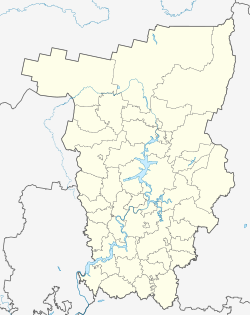
Polasna
| Urban-type settlement
Polasna
Полазна
|
||||||||||||||||||||||||||||||||||||||
|
||||||||||||||||||||||||||||||||||||||
|
||||||||||||||||||||||||||||||||||||||
| List of large settlements in Russia | ||||||||||||||||||||||||||||||||||||||
Polasna ( Russian Пола́зна ) is an urban-type settlement in the Perm region ( Russia ) with 12,753 inhabitants (as of October 14, 2010).
geography
The settlement is located in Uralvorland some 30 km north of the regional administration center of Perm , on the left bank of there to the Kama Reservoir pent Kama , at the mouth of the river Polazna same name.
Polasna belongs to the Dobryanka district and is located about 20 km south of its administrative center Dobryanka . The settlement is the administrative seat of a municipality of the same name (gorodskoje posselenije) , which also includes the twelve villages of Bessowo, Demidkowo, Ivanovka, Gory, Kljutschi, Konstantinowka, Luneschki, Mochowo, Nischneje Sadolgoje, Penki, Senki, Suhaborye, all within a 10 km radius .
history
The place was first mentioned in a statistical compilation of "the land of Greater Perm " from 1624 as a settlement with four farms at the mouth of the Polasna. In 1797 one of the many ironworks in the region was built there and a factory settlement was built.
The plant was finally closed in 1927 and in 1954 part of the town was flooded by the Kamastausee. In 1949, oil production began in the area , which gave the town a new boost. In 1958 Polasna received urban-type settlement status.
Population development
| year | Residents |
|---|---|
| 1624 | 14th |
| 1904 | 2.127 |
| 1926 | 1,520 |
| 1959 | 6,934 |
| 1970 | 8,494 |
| 1979 | 10,264 |
| 1989 | 12,113 |
| 2002 | 13.303 |
| 2010 | 12,753 |
Note: from 1926 census data
Attractions
In Polasna the Trinity Church ( церковь Троицы Живоначальной , tserkow Troitsy Zhivonachalnoi ) has been preserved from 1837 to 1842, which has been in operation again since 1989 after it was closed in 1936.
Economy and Infrastructure
The most important economic factor is the oil production, operated by LUKoil-Perm and Kama-Neft. In addition to the actual oil production, there are also various companies in the service sector of this branch, such as drilling , transport and construction companies.
Polazna is bypassed east from the regional road that the regional center Perm using the shortest route to kamaaufwärts nearby cities Dobryanka, Berezniki and Solikamsk connects. The road was expanded in connection with the construction of a 1.5 km long road bridge over the dammed Chusovaya immediately north of Perm in 1996, which also created a direct road connection between Polasna and Perm. The nearest train station is a good 10 km east of Polasna in Diwja on the Perm - Kisel line .
Individual evidence
- ↑ a b Itogi Vserossijskoj perepisi naselenija 2010 goda. Tom 1. Čislennostʹ i razmeščenie naselenija (Results of the All-Russian Census 2010. Volume 1. Number and distribution of the population). Tables 5 , pp. 12-209; 11 , pp. 312–979 (download from the website of the Federal Service for State Statistics of the Russian Federation)
- ↑ Trinity Church Polasna at sobory.ru (Russian)
Web links
- Municipality website (Russian)


