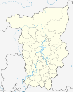
Cherdyn
| city
Cherdyn
Чердынь
|
||||||||||||||||||||||||||||||||||||||||
|
||||||||||||||||||||||||||||||||||||||||
|
||||||||||||||||||||||||||||||||||||||||
| List of cities in Russia | ||||||||||||||||||||||||||||||||||||||||
Cherdyn ( Russian Чердынь ) is a small town in the Perm region ( Russia ) with 4920 inhabitants (as of October 14, 2010).
geography
The city is located on the western flank of the Northern Urals about 300 km north of the regional capital Perm on the right bank of the Kolwa, not far from its confluence with the Wischera , a left tributary of the Kama .
Cherdyn is the administrative center of the Rajons of the same name .
history
Cherdyn was founded in 1451 as a Komi-Permyak settlement and was the capital of the northern Ural foothills ( Velikaya Perm , " Greater Perm ") until the 16th century . The place name is derived from the Komi words for the mouth of a tributary .
Belonging to the Grand Duchy of Moscow since 1472 , the place received official city rights in 1535. This is where the Tscherdyner Strasse ( Чердынская дорога ) had its starting point, which was the most important trade route across the Urals to Western Siberia until the opening of the Babinov Strasse , which ran south, in 1598 . Thereafter, the city lost its importance to the up-and-coming Solikamsk , but remained an important regional transshipment point for grain, fish and fur products until the 19th century.
Population development
| year | Residents |
|---|---|
| 1897 | 3658 |
| 1926 | 3900 |
| 1939 | 8130 |
| 1959 | 7524 |
| 1970 | 6972 |
| 1979 | 6617 |
| 1989 | 6535 |
| 2002 | 5756 |
| 2010 | 4920 |
Note: census data (1926 rounded)
Culture and sights
Since Tscherdyn was practically untouched by the industrialization of the 20th century, the architectural ensemble of the city from the 18th and 19th centuries is relatively well preserved. The most important buildings are the Apostle John 's Church ( церковь Иоанна Богослова / Tserkov Ioanna Bogoslowa, 1705-1718), the Christ Resurrection Cathedral ( Воскресенский собор / Voskresensky Sobor, from 1750 to 1754), the Savior's Transfiguration Church ( церковь Преображения / zerkow Preobrashenija, 1756), the buildings of the former arsenal (first half of the 18th century), the trading yard (Gostiny dvor, 1857) and the city duma .
There is a local museum in Cherdyn.
Personalities
- Ossip Mandelstam (1891–1938), Russian poet, spent his first exile in Cherdyn
economy
Tscherdyn is the center of the timber industry.
See also
Individual evidence
- ↑ a b Itogi Vserossijskoj perepisi naselenija 2010 goda. Tom 1. Čislennostʹ i razmeščenie naselenija (Results of the All-Russian Census 2010. Volume 1. Number and distribution of the population). Tables 5 , pp. 12-209; 11 , pp. 312–979 (download from the website of the Federal Service for State Statistics of the Russian Federation)
Web links
- Cherdyn on mojgorod.ru (Russian)


