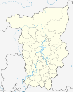
Kungur
| city
Kungur
Кунгур
|
||||||||||||||||||||||||||||||||||||||||||
|
||||||||||||||||||||||||||||||||||||||||||
|
||||||||||||||||||||||||||||||||||||||||||
| List of cities in Russia | ||||||||||||||||||||||||||||||||||||||||||
Kungur ( Russian Кунгу́р ) is a Russian city on the western foothills of the Ural Mountains in the Perm region with 66,074 inhabitants (as of October 14, 2010).
geography
Kungur is located about 100 km southeast of the regional capital Perm on the Sylwa River , which is part of the Kama river system .
The city is named for the geological stage of the Kungurium ( Unterperm ), the deposits of which were described in the area towards the end of the 19th century.
History of the city
Kungur came into being in 1648 after the state authorities ordered a settlement to be built nearby for fleeing, former serf farmers, who were each given a piece of land and granted three years of tax exemption. This circumstance made the settlement attractive for more fleeing farmers, and so dozens of villages with a total population of over 1000 were created in the area. However, in 1662 the settlement was attacked by troops from neighboring Tatar and Bashkir feudal rulers and burned down completely; all residents were expelled or killed.
Soon afterwards, the fugitive Kungur people asked Tsar Alexei Mikhailovich for state aid to rebuild the city. In 1663, Alexei ordered a suitable place to be found near the former settlement for the rebuilding of the city, which this time was to be protected from attack by a fortress. Such a place was found about 20 kilometers from the original settlement; A walled Kremlin was built on a hill . Thus 1663 became the second year of Kungur's birth. The strategically secure location of the new city saved it from destruction more than a hundred years later, when rebel troops of Jemeljan Pugachev tried unsuccessfully to take Kungur during the Peasants' War.
In the course of the 17th century the economic importance of the city increased, which was also due to its location between the European part of Russia and Siberia , which was then just being developed. At the end of the century the city had almost 3,000 inhabitants, 337 of whom were merchants. In the middle of the 18th century the importance of the city increased when a trade route from Europe to Siberia was moved through Kungur. Kungur became an important trade fair city , where trade in agricultural products flourished. In the 18th century, several leather factories emerged in Kungur, and their products made the city famous throughout the country. This development continued until the October Revolution . In the 20th century a mechanical engineering company was added as well as several factories for the production of textiles and food. To this day, the shoe factory, which emerged from earlier leather factories, has made a significant contribution to the city's economic performance. Due to the attractive landscape of the city, tourism is also experiencing an upswing.
Population development
| year | Residents |
|---|---|
| 1897 | 14,295 |
| 1939 | 36,296 |
| 1959 | 64,796 |
| 1970 | 74,488 |
| 1979 | 80.143 |
| 1989 | 81,402 |
| 2002 | 68,943 |
| 2010 | 66,074 |
Note: census data
Attractions
In the city itself, the old town is particularly architecturally worth seeing, as many houses and churches from the 18th and 19th centuries have been preserved. For tourists, however, the low mountain ranges in the vicinity of the city are particularly attractive . The Kungur ice cave is a special attraction : with a total length of around 5,600 meters and around 70 lakes, it is the most famous show cave in Russia; In addition to its importance as a natural monument, it is also historically known because, according to tradition, Yermak's troops on the way to and from Siberia should have stayed there or in the vicinity between 1578 and 1579 .
The Belogorsky Monastery is located about 50 km west of the city.
sons and daughters of the town
- Dmitri Fyodorov († 1922), aircraft designer
- Jelena Tschurakowa (* 1986), track and field athlete
- Grigory Weritschew (1957-2006), judoka
See also
Individual evidence
- ↑ a b Itogi Vserossijskoj perepisi naselenija 2010 goda. Tom 1. Čislennostʹ i razmeščenie naselenija (Results of the All-Russian Census 2010. Volume 1. Number and distribution of the population). Tables 5 , pp. 12-209; 11 , pp. 312–979 (download from the website of the Federal Service for State Statistics of the Russian Federation)
Web links
- Unofficial website (Russian)
- kungur.ru - unofficial portal (Russian)
- Kungur on mojgorod.ru (Russian)


