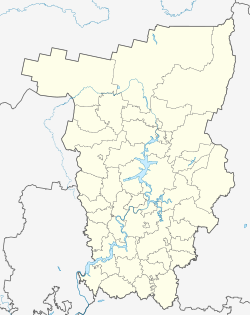
Beryosovka (Perm)
| Village
Beryosovka
Berzovka
|
||||||||||||||||||||||||||||||||||
|
||||||||||||||||||||||||||||||||||
|
||||||||||||||||||||||||||||||||||
Berjosowka ( Russian Берёзовка ) is a village (selo) in the Perm region in Russia with 6904 inhabitants (as of October 14, 2010).
geography

The place is about 75 km as the crow flies southeast of the regional administrative center Perm in the western foothills of the Urals . It is located on a river of the same name, which is dammed in the local situation to a larger pond and from the left to the right on the northwestern outskirts Sylva creek Shakva River flows.
Berjosowka is the administrative center of Berjosowski Rajons and the seat of the rural municipality Berjosowskoje selskoje posselenije. The municipality also includes the eight villages Bartym (7 km north-northeast), Koptschikowo (5 km northeast) and Matschino (3 km east) as well as Wanino, Jaburowo, Karnauchowo, Pentjurino and Schischkino (which actually merge 2 km west to 4 km north-west of the center on the right bank of the Shakva). The Tatar population is relatively high at around one sixth for the region.
history
The place was first mentioned in 1652 as Vosnesenski ostroschok ; Vosnesenski from Russian Vosnessenije Gospodnje for " Ascension of Christ " after the church located there, a predecessor of today's church of the same name, and ostroschok for "small Ostrog ". Initially, people condemned to katorga from north-west Russia, the area of the later Arkhangelsk and Vologda governorates , settled there . Around 1800 the place name was shortened to Voznesenskoje . The village belonged to the Ujesd Kungur , from 1781 as part of the governorship and from 1796 of the Perm Governorate , and became the seat of a Volost in the 19th century . Towards the end of the 19th century the name was changed to Berjosowskoje after the river, whose name refers to the Russian berjosa for " birch ".
In December 1923, a Rajon with its seat in Berjosowka was designated for the first time, initially in the holdings of the Okrug Kungur, after its dissolution on January 1, 1930, briefly in the Okrug Perm, the Ural Oblast , from mid-1930 directly subordinated to the Oblast. The Rajon was dissolved in 1931, but restored on January 25, 1935, as part of the now existing Sverdlovsk Oblast and belonging to the Rajons that were spun off as Perm Oblast on October 3, 1938. From February 1, 1963 to January 12, 1965 the Rajon was again temporarily dissolved and its territory assigned to the neighboring Kungurski rajon to the west.
In the 1980s, the population of the village doubled as a natural gas pipeline through the area of Western Siberia, where compressor stations were built, what in this area workers and equipment from the GDR under the "project gas pipeline route " were involved. Various other companies were settled in the village, a prefabricated housing estate was built in the eastern part and several small villages (Filatowo, Gratschi, Karga, Kukuschki) were connected to Berjosowka.
Population development
| year | Residents |
|---|---|
| 1897 | 770 |
| 1939 | 1359 |
| 1959 | 1911 |
| 1970 | 2947 |
| 1979 | 3545 |
| 1989 | 6978 |
| 2002 | 7062 |
| 2010 | 6904 |
Note: census data
traffic
The regional road 57K-0001 runs past the south-eastern edge of the village.It begins not far from the town of Kungur, 30 km south-west, on the federal trunk road R242 (Perm - Yekaterinburg ) and continues in a northerly direction via Lysva and Chusovoy to Beresniki and Solikamsk .
In Kungur and in the village of Tulumbassy , about the same distance to the south-east over a local road from Berjosowka, there are also the nearest railway stations on the main line of the Trans-Siberian Railway .
Web links
Individual evidence
- ↑ a b Itogi Vserossijskoj perepisi naselenija 2010 goda. Tom 1. Čislennostʹ i razmeščenie naselenija (Results of the All-Russian Census 2010. Volume 1. Number and distribution of the population). Tables 5 , pp. 12-209; 11 , pp. 312–979 (download from the website of the Federal Service for State Statistics of the Russian Federation)


