Wendisch Rietz canal meadows
|
Wendisch Rietz canal meadows
|
||
| location | Brandenburg , Germany | |
| surface | 108 ha | |
| Identifier | 1441 | |
| WDPA ID | 318629 | |
| Geographical location | 52 ° 13 ' N , 14 ° 0' E | |
|
|
||
| Setup date | March 18, 2003 | |
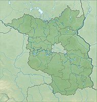
The nature reserve Kanalwiesen Wendisch Rietz is located in the area of the city of Storkow (Mark) and the municipality of Wendisch Rietz in the Oder-Spree district in Brandenburg .
The area with the identification number 1441 has been a nature reserve since December 17, 2002. The 108 hectare nature reserve extends northwest of the core town of Wendisch Rietz along the Storkow waters . The B 246 runs to the west, the 3.7 km² large Storkower See extends to the north and the 12.1 km² large Scharmützelsee to the east .
meaning
The nature reserve includes a muddy meltwater channel , an extension of an inland dune range with boiler and swamp moors, and an area on the south-west bank of the Großer Storkower See.
See also
Web links
Individual evidence
- ↑ Ordinance on the "Kanalwiesen Wendisch Rietz" nature reserve of December 17, 2002 on bravors.brandenburg.de, accessed on May 7, 2020

