Lower Schlaubetal
|
Lower Schlaubetal
|
||
| location | Brandenburg , Germany | |
| surface | 3.63 km² | |
| Identifier | 1409 | |
| WDPA ID | 319246 | |
| Geographical location | 52 ° 13 ' N , 14 ° 25' E | |
|
|
||
| Setup date | April 4, 2003 | |
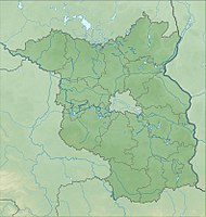
The nature reserve Unteres Schlaubetal lies in the area of the communities Mixdorf and Siehdichum and the town of Müllrose in the Oder-Spree district in Brandenburg .
The area with the identification number 1409 was placed under nature protection by ordinance of February 14, 2003 . The approximately 363 hectare nature reserve, which contains a small southern part of the 132 hectare Großer Müllroser See , extends east of the core town of Mixdorf along the Schlaube . The B 87 runs to the northwest and the L 37 state road to the east . The L 435 runs to the west and through the northwestern part of the area.

