Dammühlen river lowlands
|
Dammühlen river lowlands
|
||
| location | Brandenburg , Germany | |
| surface | 79 ha | |
| Identifier | 1452 | |
| WDPA ID | 318279 | |
| Geographical location | 52 ° 5 ' N , 14 ° 15' E | |
|
|
||
| Setup date | October 29, 1998 | |
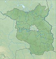
The Dammühlenfließniederung nature reserve lies in the area of the municipality of Schwielochsee in the Dahme-Spreewald district and the city of Friedland (Niederlausitz) in the Oder-Spree district in Brandenburg .
The area with the identification number 1452 has been under nature protection since August 25, 1998. The 79 hectare nature reserve with the northeastern part of the Schwielochsee extends south of the core town of Friedland and north and northeast of Möllen , a district of the town of Friedland, along the Dammühlen river . The B 168 runs along the eastern edge of the area and the L 441 state road runs along the south-eastern edge. The Friedländer Tal nature reserve extends to the north .
See also
- List of nature reserves in the Dahme-Spreewald district
- List of nature reserves in the Oder-Spree district
Web links
- World Database on Protected Areas - Dammühlenfließniederung (English)
- Ordinance on the “Dammühlenfließniederung” nature reserve of August 25, 1998 on bravors.brandenburg.de, accessed on May 8, 2020


