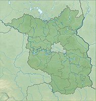
Sutschketal nature reserve
|
Sutschketal nature reserve
|
||
|
NSG Sutschketal |
||
| location | Brandenburg , Germany | |
| surface | 59 ha | |
| WDPA ID | 165806 | |
| Geographical location | 52 ° 15 ' N , 13 ° 36' E | |
|
|
||
| Setup date | June 30, 1995 | |
The Sutschketal nature reserve is a 59 hectare nature reserve between Krummensee and Bestensee in the Dahme-Spreewald district in Brandenburg .
Location and history
Krummensee is an eastern part of the municipality of Schenkendorf in the city of Mittenwalde . The eponymous Krumme See is already part of the nature reserve in the southern area. It extends in a north-south direction to the municipality of Bestensee and its origins can be traced back to a glacial channel that was formed in a plateau made of marl boulder . The valley is around two kilometers long and up to 250 meters wide. The remains of a largely silted-up lake can be seen south of the Krummen See. To the south of this is a water body of around one hectare , the Sutschke Lake. It is connected to the Krummen See by the Pritzelgraben .
The area was used as a hut forest until the 1950s ; the residents cut firewood there . In addition, there was the mining of clay that had deposited on slopes east of the channel. It was used by local residents as a building material for houses, barns and to build stoves. As a result of the use or dismantling, a comparatively large amount of daylight fell on the ground and on the valley slopes. In the 1970s, the farmers gradually gave up the meadows in the valley floor. The degradation of the sound was stopped. From then on, alders and willow bushes grew in the open areas . The regional association Dahmeland of NABU has been performing mowing work on selected wet meadows and dry grass areas in the south of the area since the 1980s. In 1995 it was placed under protection. In 2017 a new moor walkway was inaugurated, which allows you to cross the valley with dry feet.
Flora and fauna
As a protection purpose, the regulation of the state of Brandenburg describes "the preservation and development of the area as a location of rare, threatened wild plant communities, in particular floating leaf communities , reed beds , alder quarries, sedge beds and wet meadows as well as near-natural pedunculate oak forests , dry grassland and fringing communities on the slopes". In addition, the habitat of threatened animal species should be protected. Rails and ducks breed and live in the nature reserve . It serves as a retreat for amphibians and reptiles as well as insects. Another reason for protection are the "mosaic-like, closely interlinked biotope structures."
The valley floor consists of peaty and clayey-silty wet meadows , which alternate with open bog areas, land cane, and alder forests. The wet meadows were pushed back by increasing drainage. The hot buttercup , cabbage thistle and several types of orchid, the carnation , the cuckoo's light carnation and the small valerian grow on the existing areas . Pipe grasses grow on the lime-rich surfaces . The canyon forests are overgrown with oaks; individual areas consist of dry grass. The Ährige speedwell , the Carthusian carnation and the timothy grass grow there . The alders grow mainly in the area of the silted areas, but suffer from the increasing drainage. A total of 426 wild fern and flowering plants were found in the nature reserve, including 75 endangered or endangered species.
The chain of lakes in the midst of the channel are considered eutrophic with a vegetation of Magnopotamion or Hydrocharition . The otter and the moor frog live there . The air is populated by 90 species of breeding birds, including the marsh harrier , the reed bunting and the marsh warbler .
Development and development
The late blooming bird cherry has spread strongly along with lilac and privet on the previously open forest areas and should be pushed back together with its roots. Work on this began in 2016. The dry lawn areas are to be preserved and expanded, as is the light oak forests by removing young trees. It is also planned to expose old oak trees.
A 13-kilometer circular hiking trail, which is marked with a blue cross on a white background, leads through the valley.
The legend of the origin of the Sutschketal
According to popular tradition, the Steinberg, the Mühlenberg and the Mariendorfer Berg formed a plateau. The devil lived on the latter with his grandmother. When he hitched his grandmother to the plow and pushed him with the whip, she got angry and ran north-south across the high-lying field. The plow divided the area and the Sutschketal was created.
See also
Individual evidence
- ↑ Information board : Sutschketal nature reserve , set up at the southern entrance, December 2017.
- ↑ Information board : Sutschketal nature reserve , set up on the eastern shore of Sutschke Lake, December 2017.
- ↑ A new moor walkway for the Sutschketal , website sandrasen.de of the Brandenburg Nature Conservation Fund , accessed on December 20, 2017.
- ↑ Maintenance measures in the Sutschketal , website sandrasen.de of the Brandenburg Nature Conservation Fund Foundation, accessed on December 20, 2017.
- ↑ Bernd Jaschen: A Gem of Nature - A hike through the Sutschketal near Bestensee, website of NABU Dahmeland, [1] , (PDF), accessed on December 20, 2017.
Web links
- Ordinance on the Sutschketal nature reserve , website of the State of Brandenburg, accessed on December 20, 2017
- Sutschketal , website sandrasen.de of the Stiftung Naturschutzfonds Brandenburg, accessed on December 20, 2017.


