Kockot
|
Kockot
|
||
|
Kockot Nature Reserve (May 2016) |
||
| location | Brandenburg , Germany | |
| surface | 2.868 km² | |
| Identifier | 1255 | |
| WDPA ID | 164176 | |
| Geographical location | 52 ° 3 ' N , 13 ° 55' E | |
|
|
||
| Setup date | October 1, 1990 | |
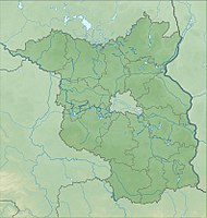
The Kockot nature reserve is located in the municipality of Märkische Heide in the Dahme-Spreewald district in Brandenburg .
The approximately 286.8 hectare area with the identification number 1255 was placed under nature protection by ordinance of October 1, 1990 . The nature reserve extends west of Kuschkow , a district of the Märkische Heide community. On the northern edge of the area runs the B 179 and on the southwestern edge the state road L 42. The Spree flows to the west and the Pretschener Spree , a branch of the Spree, flows through the area .
meaning
The area was placed under protection in order to fulfill “the function of a core zone within the“ Spreewald Biosphere Reserve ”. In particular, natural English oak - hornbeam - and alder - ash woods are on fen - peat gley - and Anmoorstandorten escaped direct human influence, leaving the natural long-term development. "
See also
Web links
- World Database on Protected Areas - Kockot (English)
- Ordinance on the nature reserve "Kockot Nature Development Area" of September 22, 2014 on bravors.brandenburg.de, accessed on March 15, 2020
Individual evidence
- ↑ Ordinance on the nature reserve “Kockot Nature Development Area” of September 22, 2014 on bravors.brandenburg.de, accessed on March 15, 2020


