Görlsdorf Forest
|
Görlsdorf Forest
|
||
|
Görlsdorfer Wald nature reserve (June 2017) |
||
| location | Brandenburg , Germany | |
| surface | 195 ha | |
| Identifier | 1438 | |
| WDPA ID | 318450 | |
| Geographical location | 51 ° 48 ' N , 13 ° 46' E | |
|
|
||
| Setup date | July 1, 2002 | |
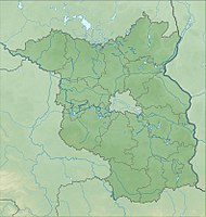
The nature reserve Görlsdorfer Wald lies in the area of the municipality Heideblick and the city of Luckau in the district of Dahme-Spreewald in Brandenburg .
The area with the identification number 1438 was placed under nature protection by ordinance of March 25, 2002 . The approximately 195 hectare nature reserve extends east of Beesdau , a district of the Heideblick community, and south of Görlsdorf , a district of the city of Luckau. The district road 6129 runs to the west, to the east and south the approx. 600 hectare large Schlabendorfer See extends . The Görlsdorfer Fließ flows through the area .
See also
Web links
Commons : Görlsdorfer Wald - collection of images, videos and audio files
- Ordinance on the “Görlsdorfer Wald” nature reserve of March 25, 2002 at bravors.brandenburg.de, accessed on March 27, 2020
- World Database on Protected Areas - Görlsdorfer Wald (English)


