Töpchiner lakes
|
Töpchiner lakes
|
||
|
Northern Töpchiner See |
||
| location | Brandenburg , Germany | |
| surface | 375 ha | |
| WDPA ID | 319219 | |
| Geographical location | 52 ° 11 ' N , 13 ° 35' E | |
|
|
||
| Setup date | May 29, 1988 | |
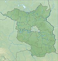
The Töpchiner Lakes are a 374.94 hectare nature reserve in the district of Mittenwalde in the Dahme-Spreewald district in the state of Brandenburg .
location
The FFH area is located south of the city center and there south of Lake Motzen . The Mittenwald district of Motzen borders it to the south and east. The federal motorway 13 runs to the east in a north-south direction. To the south is the town of Teupitz with its district Egsdorf , to the west is the eponymous Mittenwald district of Töpchin . In terms of nature, the area belongs to the East Brandenburg Heath and Lake District .
The area essentially consists of the two Töpchiner lakes, which are traversed by the Gallun Canal and drain into the Motzener See .
history
The landscape in the protected area was created during the Vistula Ice Age . The lakes were created when the ice melted, when a drainage channel for the melt water was formed. The water originally ran off from the north in a southerly direction. Over the millennia, silting bogs formed and the direction of flow was reversed. The peat formed was up to three meters thick. In addition to the silting bogs, lime-rich fens and pipe grass meadows formed, which alternate with lowland hay meadows. As early as the 12th century, the residents of Motzen are said to have built a mill and dammed the water to operate. This only changed in 1862, when the Notte Regulatory Association lowered the water level by 1.30 to 1.40 m. As a result, the two lakes were formed, which are also referred to as Töpchiner Untersee and Töpchiner Obersee for a better distinction. However, due to siltation, the lakes have become significantly smaller in the last 50 years. The area was placed under protection on May 29, 1988.
Use and development
A landscape use is only possible to a limited extent due to the poor subsoil. In connection with a local agricultural enterprise, the foundation NaturSchutzFonds des Landes Brandenburg has settled four water buffalo . They help to keep the bog vegetation free of other plants.
There is a nine-kilometer circular trail around the lake that crosses the European long-distance hiking trail and Fontaneweg F4 . Sports activities such as swimming, boating and sailing are not permitted. Fishing in the northern Töpchiner See is permitted with a fishing license.
A primary goal is to stabilize the previously strongly fluctuating water balance of the moors. To this end, some hydraulic engineering work was carried out in the 2010s. Several seals were used in the Gallun Canal to restore the natural flow conditions. Furthermore, craftsmen built a support threshold in the main river on the road bridge between Töpchin and Waldeck .
Flora and fauna
The common devil bite , the swamp thuja moss , the shiny felt sheep moss and the real swamp moss on an area of around 5000 m² have been detected in the area. The great fire butterfly is under special protection . Eel , pikeperch , perch , pike , carp , roach and catfish live in the water . The otters found there are particularly worthy of protection .
Individual evidence
- ↑ 3847-304 Töpchiner Seen (FFH area) , website of the Federal Agency for Nature Conservation.
- ↑ Information board of the Fontane Clinic: Geological overview , set up at Töpchiner See, May 2019.
- ↑ Our village , Töpchin website, accessed on May 5, 2019.
- ↑ Töpchiner Seen , website of the NaturSchutzFonds Brandenburg foundation, accessed on May 4, 2019.
- ↑ Töpchiner Seen , website of the city of Mittenwalde, accessed on May 5, 2019.
Web links
- Ordinance on the Töpchiner Seen nature reserve of March 26, 1988 , website of the State of Brandenburg, accessed on May 5, 2019


