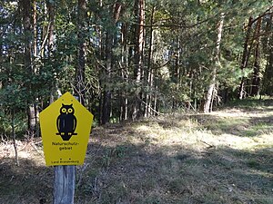
Löptener Fenne – Wustrickwiesen nature reserve
|
Löptener Fenne – Wustrickwiesen nature reserve
|
||
|
Wustrick meadows near Groß-Köris |
||
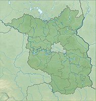
| location | Brandenburg , Germany | |
| surface | 218 ha | |
| WDPA ID | 318749 | |
| Geographical location | 52 ° 10 ' N , 13 ° 40' E | |
|
|
||
| Setup date | May 30, 1998 | |
The nature reserve Löptener Fenne – Wustrickwiesen is a 218.22 hectare nature reserve in the district of Dahme-Spreewald in Brandenburg .
Location and history
The nature reserve is located on parcels of the municipality of Groß Köris , Klein Köris, the district of Löpten and the municipality of Schwerin . It comprises the southern part of the Großer Moddersee , the adjoining south-western strip to the Berlin-Cottbus railway line, the Wustrickwiesen to the west of the railway line as well as some parcels of land west of Löpten and another parcel west of the railway line.
The moor was formed in the Last Ice Age , which ended around 10,000 years ago. It is part of a meltwater channel that extends as far as Fürstenwalde / Spree and in which there are still numerous lakes in the 21st century. The Löptener Fenne was once one of these lakes, but over time silted . In Schmettauschen cards work remains are visible of the originally much larger lake. At the time the map was drawn up (between 1767 and 1787) this had no drain. The exact time of the breakthrough is not known, however, in the original table sheet from 1841, a connection between the Löptener Fenne and the Wustrickwiesen is already drawn. Since the Wustrickwiesen is around 1.5 meters lower than the Fenne, the water flowed from the remaining lake. The surrounding bog areas were drained; a silting bog was created. Beneath a layer of peat , muds more than ten meters thick can still be detected. The work - a trench 400 meters long and almost three meters deep - fell into the time of Friedrich Wilhelm I , who took over the lands of the Schenk von Landsberg family in 1717 . Since he ordered numerous drainage works, experts suspect that this trench was also built on a royal order.
As a result of the drainage, the peat decomposed and the moor surface increasingly sagged. The trench had to be deepened until it was finally no longer possible to drain it via the Fenne. Presumably it was prisoners of war who laid an additional pipeline one meter below the Sohne during the First World War , so that the water level in the moorland could be lowered in favor of further management. In the following decades, different tenants used the area. After the end of the Second World War , the area was divided into several smaller farmers as part of the land reform in Germany , only to be reunited with the establishment of an LPG in the late 1950s. They built a pumping station that pumped water from the Fenne into the main ditch in Löpten. Intensive agricultural use was not possible with this method either, so the plant was shut down again. The previously wood-free moor was forested in a comparatively short time through drainage combined with nutrient inputs. The pipeline was defective, so that the water in the Fenne stagnated in winter or when there was heavy rainfall. In the summer, however, it flowed away, so that the bog was exposed to strong water level fluctuations.
In the 21st century there are hardly any open bog areas left. Since 2013, the NaturSchutzFonds Brandenburg has been carrying out renaturation measures as part of a LIFE (EU) project . The water level in the bog should be stabilized and fluctuations should be mitigated. For this purpose, the pipeline was destroyed and a bed slide with a ford was built. Since then, the water on the surface has been able to flow away via the old opening towards Wustrickwiesen.
Flora and fauna
Braunmoos sedges grow in the northern part of the nature reserve . Some litter meadows are managed with the help of sheep . The wire sedge, the fever clover and the tongue buttercup grow there .
development
The condition of the area is described as inadequate. By mowing nutrients to be taken out of the field of nutrient-rich areas. The drainage system of the Löptener Fenne in the Wustrickwiesen should be set so that the Fenne does not dry out, but can be cultivated at the same time. Experts are planning to reintroduce various vascular plants and mosses .
Individual evidence
- ↑ World Database on Protected Areas - nature reserve Löptener Fenne – Wustrickwiesen (English)
- ↑ Löptener Fenne und Wustrickwiesen ( Memento of the original from March 4, 2016 in the Internet Archive ) Info: The archive link was inserted automatically and has not yet been checked. Please check the original and archive link according to the instructions and then remove this notice. , Website of the EU LIFE project "Kalkmoore Brandenburgs", accessed on October 11, 2015.
literature
- Janine Ruffer: Vom See zum Moor , published in the 2016 book of the Naturschutzbund Deutschland, Regionalverband Dahmeland, Fall 2015, ISSN 1869-0920, p. 122
Web links
- Ordinance on the nature reserve Löptener Fenne-Wustrickwiesen , website of the State of Brandenburg, accessed on October 11, 2015


