Old Spree estuary
|
Old Spree estuary
|
||
| location | Brandenburg , Germany | |
| surface | 108 ha | |
| Identifier | 1249 | |
| WDPA ID | 14414 | |
| Geographical location | 52 ° 4 ' N , 14 ° 12' E | |
|
|
||
| Setup date | May 16, 1990 | |
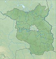
The Alte Spree estuary nature reserve is located in the municipality of Tauche in the Oder-Spree district in Brandenburg .
The area with the identification number 1249 has been a nature reserve since May 16, 1990. The 108 hectare nature reserve extends southeast of the Trebatsch district and east of the Sawall residential area of the Tauche community. It is located north and south of an oxbow lake of the Spree on the northwestern bank of the Schwielochsee . The B 87 runs to the west, and the 110.4 hectare nature reserve near Briescht extends to the north-west .
See also
Web links
- World Database on Protected Areas - Old Spree mouth (English)
- 3951-302 Old Spree Estuary (FFH area) on bfn.de, accessed on May 6, 2020
- Management planning Natura 2000 in the state of Brandenburg. Management plan for the areas "Glieningmoor", "Old Spree estuary", "Spreewiesen south of Beeskow", "Schwarzberge and Spreeniederung", "Spreebögen bei Briescht", "Spree (part of Fürstenwalde to the east)" (final report) on mluk.brandenburg.de, accessed on May 6, 2020

