
Inland dune Waltersberge
The Waltersberge inland dune is one of the largest inland dunes in Brandenburg . It is located in the small town of Storkow in the Oder-Spree district on the eastern edge of the Dahme-Heideseen nature park . The core of the dune complex is around 14 hectares under protection as the Binnendüne Waltersberge nature reserve and is designated as an FFH area in the Natura 2000 network .
Among other things, the protected status is to preserve its characteristic silver grass and carnation corridors and sheep fescue lawns as well as insects such as the ant lions , the mascot of the nature reserve. Almost immediately bordering the north shore of the Great Storkower See , the dune with the 69-meter-high Storkow vineyard rises up to 32 meters above the water surface of the lake.
The inland dune has been shaped over the course of time by numerous anthropogenic interventions. This includes economic uses such as viticulture, afforestation and sand mining for a sand-lime brick plant, which was partly built into the dune. Since only around a quarter of the area was open at the beginning of the 2000s, extensive measures were taken in 2010 and 2011 to stop the succession and to reclaim and clear the ecologically important, open areas with clearing .

Geography and geology
location

The inland dune Waltersberge is located in the urban area of Storkows around 1.5 kilometers northeast of the listed historic city center in the area of the small Storkower Forest. The Reichenwalder Straße, part of the district road K 6749 to Reichenwalde, runs between the dune and the north bank of the Großer Storkower See . The foothills of the area are joined by the Hirschluch in the northeast, a landscape-protected , formerly moored lowland ( Luch ) with a small lake at the "Evangelical youth education and meeting place Hirschluch", which over the Lebbiner See and the Rieploser Fließ to the northeast to the Storkower Canal drained. To the west, the sand hills almost reach the municipal and Jewish cemetery.
Natural space and formation
The site is located south of the Berlin glacial valley, through which the Spree flows, on the western edge of the Storkower Platte in the Storkower valley sand area in the East Brandenburg heath and lake area , which is listed as No. 82 in the main natural areas of Germany . The numerous lakes and sands of the area are a relic of the Brandenburg stage (24,000 to 22,000) of the Vistula Ice Age .
The meltwater of the thawing ice deposited the cargo of the glaciers as glacifluvial sediments and left wide sand areas in the glacial valleys or on plateaus like the Zauche . Since the ground remained frozen and without vegetation after the final thawing of the ice or for a long time without a closed plant cover, the fine-grained sand was blown up unhindered, transported over long distances, thrown around obstacles close to the ground and deposited again elsewhere in inland dunes and fields of drifting sand . While the wind in East and South Brandenburg tended to be blowing sand fields, the up to 69 meters high, undulating deposit north of Storkower See formed one of the largest inland dunes in Germany. The Turkish Mountains, which are up to 53 meters high - only about two kilometers to the west - are said to be such a deposit. However, this extensive "sand pasque" is hardly perceived as a dune, as it is completely covered with pine forest due to afforestation measures in the 1770s ( see below ).
Conservation and protection measures

In contrast to most nature reserves in Brandenburg, there is no separate ordinance as a nature reserve for the Binnendüne Waltersberge nature reserve . 1983 already designated as an area natural monument (FND), the protection status as NSG was made by the "Resolution No. 130 of the District Assembly Frankfurt / Oder of March 14, 1990, coming into force on May 16, 1990, announcement in the Märkische Oderzeitung of May 16, 1990" . 13.66 hectares are specified as the protected area, while the FFH profile states 13.96 hectares.
Natura 2000 and FFH areas
The NSG Binnendüne Waltersberge is part of the coherent European ecological network of special protection areas Natura 2000 . The profile of the Federal Agency for Nature Conservation (BfN) contains the following characterization for the 13.97 hectare FFH area under the number 3749-307:
"[...] largely poorly wooded, open part of a larger inland dune complex with characteristic silver grass and carnation corridors, fescue grass lawns, thermophilic borders as well as lichen-pine forests and forests."
Located on the eastern edge of the Dahme-Heideseen nature park , the inland dune is just outside the nature park . However, it is regularly included in the nature park in publications, excursion offers and development measures by the nature park administration, the State Office for Environment, Health and Consumer Protection (LUGV) and the NABU regional association Dahmeland.
Nature trail Martin-Graef-Weg

In the summer of 2011 the educational trail “Inland dune Waltersberge in Storkow (Mark)” was inaugurated. The nature trail is equipped with numerous information boards about the origins, history, ecology, flora and fauna of the area. There is a four-part board on the ascent that contains, among other things, a map of the area (see illustration above left). By resolution of the Storkow city council, the path was given the nickname "Martin-Graef-Weg". The nickname is the path in memory of Martin Graef (1930-2007), a farmer who campaigned for nature conservation in various regional committees and organizations, including that of the inland dune. The crossing of the dune (along with the Hirschluch) is also part of stage 11 on the 66 lakes hiking trail around Berlin.
Clearance and clearing of the inland dune 2010/2011
At the beginning of the 2000s, less than a quarter of the area was open sand. In order to prevent this landscape from overgrowing and disappearing, on June 3, 2010, on the occasion of Environment Day , conscripts from the Storkow Armed Forces site and the Dahme-Heideseen nature park administration carried out a first deforestation operation. Trees growing in the open space such as pine , birch , robinia , aspen and late blooming bird cherry were removed. On June 12, 2010, a joint campaign by employees of the nature park, the NABU regional association Dahmeland, the Heinz Sielmann Foundation , the Brandenburg nature reserve and students from a Königs Wusterhausen grammar school to record the species in the nature reserve followed. As a result of this measure, it was decided to expand the maintenance and development of the nature reserve. With the participation of the nature park administration, the federal forest division of the Federal Agency for Real Estate Tasks and the city of Storkow, the owner of the area, large parts of the protected area were cleared and cleared in spring 2011. The map of the nature trail main board (see adjacent figure) shows the open dune areas in 2010 and the exposed areas in 2011 (groups of pines, oaks, dead wood , stumps ) .
Flora and fauna
Despite the small space, the inland dune offers very different living conditions. In the open areas exposed to the sun, the rainwater seeps away very quickly and the sand has hardly any nutrients . During the day the sandy soil is heated up to 70 ° C , at night it cools down considerably. Only highly adapted and mostly rare specialists now make their home in these areas. On the north slope the microclimate is a little cooler and on the ruderal edge of the biotope , where wet meadows , moor communities and open water areas were located up until the 19th century , wet and reed communities are still present today.
Plants and plant communities
The Federal Agency for Nature Conservation lists the following plant communities among the habitat types to be protected in the FFH profile :
- Sand heaths with common heather and gorse on inland dunes; EU code according to Annex I of the Habitats Directive : 2310 = dry sandy heaths with Calluna and Genista ,
- Open grass areas with silver grass and ostrich grass on inland dunes; Code 2330 = dunes with open grass areas with Corynephorus and Agrostis ,
- Subcontinental base-rich sand lawns; Code 6120 = Dry, calcareous sand lawn.
→ For the protection classifications specified in the following chapters, see: Hazard categories .
Open areas exposed to the sun and south-facing slope


The tufted clumps of silver grass ( Corynephorus canescens ) are characteristic of the free sandy soils . The pioneer plant is the characteristic type of the silver grass corridors ( Corynephorion canescentis ). Ostrich grasses ( Agrostis ) also form clumps in these areas and their mostly yellowish or reddish colored, stalked panicles rise steeply. In addition, sand sedges ( Carex arenaria ) with their meter-wide creeping rhizome ("root stock"), from which new shoots grow every 5 to 10 centimeters, form their typical, almost dead straight rows. The dry sand lawns determine heather carnations ( Dianthus deltoides ) and mountain sand bells ( Jasione montana ). Sand sheep fescue ( Festuca psammophila ) and blue-green schillergrass ( Koeleria glauca ), both classified as endangered in the Red List of Threatened Species in Brandenburg, form beautiful populations . In summer, blooming groups are formed by the species, which are also endangered in Brandenburg, Astlose grass lily ( Anthericum liliago ) and ear-spoon catchwort ( Silene otites ).
Stocks of the herbaceous mountain hairline ( Peucedanum oreoselinum ) and the red ostrich grass ( Agrostis capillaris ) extend into the dry ruderal areas and penumbra areas of the pines. Consisting formative type of sand Heiden forms the heather ( Calluna vulgaris ), also known as heather known, interspersed with broom plants Genista . A survey in June 2010 also revealed individual occurrences of the endangered plants in Brandenburg, spring sedge ( Carex caryophyllea ) and Dillenius speedwell ( Veronica dillenii ), whose dark blue flowers sit in deep-reaching, racemose inflorescences , in addition to a large number of other species .
Northern slope and peripheral areas
The cooler areas and the rudderal border are mainly overgrown with pine forest, interspersed with young common robinia ( Robinia pseudoacacia ) and late bird cherry ( Prunus serotina ). Both species are overgrown pioneer trees , which spread strongly and, if you allow it, also spread into the open sandy areas. The individual sessile oaks ( Quercus petraea ), however, are desirable - pine- sessile oak forests were the archetype of the forests in this region. On the branches of some pine trees parasitized the pine mistletoe ( Viscum album subsp. Austriacum (Wiesb) Vollm.. ; Synonym Viscum laxum Boiss & Reut..) .
Ash maple ( Acer negundo ) and Norway maple ( Acer platanoides ) are found on the edge . There, the maintenance measures are intended to prevent the further expansion of such stands and the penetration of foreign tree species such as aspen ( Populus tremula ), late blooming bird cherry ( Prunus serotina ), black elder ( Sambucus nigra ) and mountain ash ( Sorbus aucuparia ) into the pine forest stand. The buckthorn ( Frangula alnus ), on the other hand, a typical tree on the edge of the dune, is welcome. Celandine ( Chelidonium majus ), common thorn fern ( Dryopteris carthusiana ), narrow-leaved willowherb ( Epilobium angustifolium ) and hawkweed ( Hieracium umbellatum ) were found to be desirable undergrowths . Blueberry bushes ( Vaccinium myrtillus ) also grow in the partial shade of the trees .
Mosses and lichens
In June 2010, a total of 16 types of moss were recorded on the hot, sandy open areas and in the more moderate fringes , including female hair ( Polytrichum piliferum ) and white short rifle moss ( Brachythecium albicans ) as typical types of dry sand grass . The cactus moss ( Campylopus introflexus ), a so-called invasive neophyte from the subtropical to cold-temperate latitudes of the southern hemisphere, also forms in these mats. Thrive in the transition and shadow areas, among other forest-woman hair ( Polytrichum formosum ) and in Brandenburg on the early warning list standing Gewelltblättrige Fork Teeth Moss ( Dicranum polysetum ). Extensive carpets form the nodding Pohlmoos ( Pohlia nutans ) and the Rotstängelmoos ( Pleurozium schreberi ), whose Latin name is named after the German botanist Johann Christian Daniel von Schreber , a student of Linné , in the pine forest areas .
Among the 13 lichen species recorded , the Brandenburg Red List leads in the early warning level: one -sided or pale yellow (mild) reindeer lichen ( Cladonia arbuscula ssp. Mitis ), sprout or tiered lichen ( Cladonia cervicornis ssp. Verticilata ) and yellow camp psoriasis ( Cladonia folicaea ). The one-sided reindeer lichen and the hedgehog cladonia ( Cladonia uncialis ), which are characteristic of nutrient-poor soils, were found particularly frequently in 2010 . There are also occurrences of the shrubby horny lichen or thorny cetrarie ( Cetraria aculeata ), which, although not in Brandenburg, is regarded as endangered throughout Germany .
Wet and reed communities
Although the wetlands at the foot of the dune were strongly pushed back by the construction of roads and the settlement of commercial and residential buildings, a few wet soil and water spots remained, especially towards the Hirschluch to the northeast. Alder ( Alnus ), birch ( Betula ) and reed communities ( Phragmites australis ) grow in the remains of the wet meadows and moor communities . The undergrowth still includes bog plants and various types of sour grass ( Cyperaceae ) such as sedges ( Carex ), peat mosses ( Sphagnum ), which are particularly protected in Germany , swamp irises ( Iris pseudacorus ) and the flower of the year 1988, the poisonous swamp that is classified as endangered in Brandenburg . Find calla ( Calla palustris ). Overall, however, the biodiversity has also decreased significantly due to overflow in this area.
Animals
As with most inland dunes, mammals do not play a special role on the Waltersberg. On the other hand, some insects that have adapted to the extreme living conditions are remarkable .
Ant lion - the mascot of the inland dune
→ Main article: Ant lion
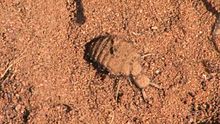
In the loose sand there are numerous funnels of the ant lion, the larva of the ant maiden (Myrmeleontidae), a family of insects from the order of the netwings . The insect of 2010, which is particularly protected in Germany by the Federal Species Protection Ordinance ( Annex 1 ) , was chosen to be the mascot of the Waltersberge inland dune. The insect leads an extremely psammophilic (sand-loving) way of life and buries itself completely in open, sun-exposed sand areas. The extreme case of this adaptation are the funnel-building species, which due to their physique are exclusively dependent on this method of catching prey. The approximately 1 cm large larva lurks in the bottom of the funnel for sliding ants and other insects, which it grabs with its powerful jaws and sucks. If it does not catch the prey immediately, the ant lion tries to prevent it from escaping by throwing up sand.
The funnel construction is a perfect adaptation to the hostile environment in two respects. On the one hand, it allows the larvae to expand their range of action when catching prey without having to change location. On the other hand, the funnel serves as heat protection: the funnel wall facing the sun is illuminated at a flatter angle than the flat floor and consequently does not heat up as much. It has been observed that the ant lion prefers to stay on the cooler side and thus escape the surface temperatures.
More insects

Another inhabitant of the inland dune adapted to sandy habitats is the heraldic animal of the Dahme-Heideseen Nature Park, the walker or Turkish cockchafer . Since it feeds on pine needles, the mixture of sandy areas and, despite the clearing, still rich pine stands is ideal for the beetle from the scarab beetle family . The walker is also particularly protected . The field tiger beetles , which are also protected in Germany, can also be observed . The hunter prefers open areas for his hunt for arachnids and small insects, where take-off and landing are easy on his short flights. Also ammophila that her brood with caterpillars of butterflies or after caterpillars feed, build their nests in the sand of the dune. Grasshoppers are represented, among other things, by the widespread large green hay horse , the extremely warmth-loving western biting insect , which is endangered according to the Red List in Germany, and the specially protected blue-winged wasteland insect , which prefers dry, warm bare and wasteland areas with very sparse vegetation such as on dry grass and in sand pits .
Reptiles, mollusks and birds
From the class of reptiles are lizards (after Annex IV of the Habitats Directive strictly protected ) and slow worms ( special protection ) before. The discovery of several empty shells suggests that Roman snails are represented in the dune area. The molluscs , which can sleep dry when it is very dry in summer and the associated lack of water - locked in their housing - are particularly protected in Germany . Around 20 bird species were recorded in June 2010, but most of them are native to the ruderal mixed deciduous forest . These included: cuckoo , black kite , buzzard , House Martin , Zilpzalp , Serin , Nuthatch , Blackcap , Spotted Flycatcher , wren , woodpecker , wood warbler , yellowhammer and allegedly also the Woodlark (in Germany strictly protected ). According to a later presentation (January 2011, also from the nature park), specialists for open sunbathing areas such as woodlark and wood pipit , who hide their nests on the ground, have not been detected since 1983. The remaining open spaces are too small for both species. The conservationists hope that these former residents will return due to the clearings and exemptions that have taken place.
Usage history
The effects of human activity on the Waltersberg include, in particular, viticulture, afforestation and considerable sand mining for a sand-lime brick plant.
Storkow vineyard

According to an information board on site, the dune was used for guarding for centuries . The old country sheep breeds of the nearby sheep farm in particular got along well with the meager forage on the dry sandy grassland. They ate away the thatch and allowed the weak, small, dry grass plants to grow. At the same time, the sheep, other Storkower domestic animals and wild animals transported seeds via droppings, fur and hooves to other places and contributed to the spread of the plants.
A winemaker was mentioned for the first time in records from 1493 and the vineyard in 1518 . On March 21, 1518 Ulrich von Biberstein sold in a document approved by King Ludwig of Hungary the Storkow-Beeskow estate including Storkow Castle for 45,000 Rhenish guilders , subject to the right of repurchase , to Dietrich von Bülow, the Bishop of Lebus . In another document dated June 15, 1518, the goods sold were specified: with all [...] Heyden, Vorwercken , Schefereyen, farms, vineyards, Jagten [...]. In the inheritance register of the Storkow estate on the same day it says:
"A vineyard in front of Storckow, even though it was once worn for XXX-XL and more quarters of wine, it is only used vff XXV quart of wine over the cost of a certain year and the quarter III fl., Does XXXVIII fl."
Around 1590, a vineyard with a size of 14 acres (around 3.6 hectares) is reported. It is said to have reached its greatest extent of 26 acres (around 6.6 hectares) in 1735. For the year 1750 a yield of 8 barrels of wine is given. With the decline in viticulture in the Mark Brandenburg , the area decreased in 1801 to 16 acres (around 4.1 hectares). In 1898 two remains of buildings on the summit and individual grapevines were evidence of the cultivation. The name Weinberg has remained for the highest elevation of the Waltersberg Mountains and for the “Alter Weinberg” inn at the foot of the dune.
Supplying Berlin with timber and afforestation

To supply Berlin with timber from the forests around Storkow, the Storkow waters were connected to the Dahme in the 1730s . The connection from the Storkower See to the Wolziger See was established by the so-called "Lower Connection" via the Storkower Canal . In addition, an “Upper Connection” was created , which as a rafting channel reached over the Rieplos Fliess and the Lebbiner See as far as the Kolpiner Forest north of the Waltersberg Mountains. The last section to Storkower See was never realized and failed, among other things, because of the adverse terrain, possibly because of the dune in the way. This water connection was given up after a short time.
In the course of the measures to rebuild and develop the country after the Seven Years' War (1756–1763), Frederick the Great set up forest management in 1768 . Since Berlin in particular continued to have a great need for construction timber, the decree was issued to sow the sandbells of the Mark Brandenburg with pine and birch seeds. The Stutgarten office was instructed to reforest the up to 53 meter high Turkish Mountains - located just two kilometers west of the Waltersberg. This sand bail ( over several thousand acres, 6000 paces long, partly towering, clear sand mountains ) is also said to be an inland dune. In the meantime, the Turkic Mountains, located on the northern edge of the Luchwiesen nature reserve in today's Storkower district of Philadelphia, above the Storkower Canal, form an extensive forest area.
The afforestation , which dragged on for decades, was largely carried out with the undemanding and quickly yielding Scots pine and also affected the Waltersberg Mountains. In 1775 the first mention of a horticultural house , the forerunner of the district forester's houses . An extensive forest was established near the Waltersberg , which in 1801 covered an area of 5419 acres (around 1400 hectares). At the same time as the decline in viticulture, large parts of the inland dune were planted with pines, so that only a small part remained free of woody plants.
Sand-lime brick plant in Storkow

The most lasting changes in the Waltersberge were caused by the sand-lime brick plant in Storkow, which existed from 1906 to 1944 and employed up to 250 workers. To a certain extent, the company was built into its main raw material supplier, the inland dune. From Reichenwalder Strasse, a bucket chain excavator systematically excavated the sand in the direction of the vineyard; around 75,000 cubic meters of sand were initially mined annually. The sand was brought to the plant by light rail along the road west of the Finkenberg vineyard. The limestone was obtained from the Rüdersdorf limestone quarry using the company's own barges . The company's shipping company had 3 steam tugs and 18 Finow Maß barges . The Lorenbahn went from the factory to the transshipment point on the north bank of the Storkower See. At the bulwark (today the sailing club Ciconia Storkow) stood a steel derrick crane whose boom could load and unload several barges lying next to each other. The plant also had its own wire drawing shop, which was converted into a sewing machine factory for the production of quilting machines for the shoe industry in 1929 as a further economic mainstay .
In the heyday of the plant, 250,000 white limestones were produced every day - a complete load layer for a Finow barge. In total, the plant is said to have produced almost a billion limestones, which were also used for the construction of Storkow houses, but mostly went to Berlin. In the capital, among other things, underground tunnels were built from the Storkower stones. Wood and stones from the area have contributed to the content of the winged phrase “Berlin is built out of the boat”. Almost the entire front part of the vineyard fell victim to the construction boom, and it is estimated that at least 300,000 cubic meters of sand were removed from the Waltersberge inland dune. What remains is the steep slope towards Reichenwalder Straße, which is now overgrown with pine trees. The map in the main information board of the nature trail shows the sand extraction areas for sand-lime brick production hatched ( see figure above ).
literature
- Gunnar Heyne: The inland dune Waltersberge. Relic of times past and the place where life began. In: Year Book 2011 . Ed .: NABU RV Dahmeland e. V. and Dahme-Heideseen Nature Park (State Office for Environment, Health and Consumer Protection Brandenburg), Prieros, p. 52f PDF .
-
Storkow (Mark). Insights into the history of an 800-year-old small town. Ed .: Mayor of the city of Storkow (Mark) in connection with the historical advisory board of the city. Complete production: Schlaubetal-Druck Kühl OHG, Müllrose 2009 ISBN 978-3-941085-72-5 . In this:
- Reinhard demand: From the forest and the Storkower Heide. A forest history excursion from the 13th century to the present. Pp. 221-231.
- Lutz Kühne: White stones from Storkow. On the history of the sand-lime brick factory. Pp. 111-118.
- Klaus Rattemeyer: The Storkow waters - from raftsman canal to tourist magnet. Pp. 54-65.
- Adolph Friedrich Riedel : Codex diplomaticus Brandenburgensis . First main part, Volume XX, Berlin 1861 Text on Google .
Web links
- Dahme-Heideseen nature park : GEO day of biodiversity . “We are exploring the inland dune Waltersberge near Storkow.” Results report of the excursion on June 12, 2010, compiled by Hans Sonnenberg PDF .
Individual evidence
- ↑ a b Gunnar Heyne: The inland dune Waltersberge. .... P. 52.
- ↑ Hirschluch evangelical youth education and meeting place.
- ↑ Land surveying and geographic base information Brandenburg : Brandenburg viewer, digital topographic maps 1: 10,000 (Menu - "More data" - click and select accordingly; switch to the district boundaries "Real estate cadastre" and there "districts".)
- ↑ Olaf Juschus: The young moraine land south of Berlin - Investigations into the young quaternary landscape development between Unterspreewald and Nuthe , p. 2. Dissertation, Humboldt University Berlin, 2001. See Figure 2 plates and glacial valleys in the young moraine land south of Berlin . online Also in: Berlin Geographical Works 95 , ISBN 3-9806807-2-X , Berlin 2003
- ↑ Brigitte Nixdorf, Mike Hemm u. a .: Documentation of the condition and development of the most important lakes in Germany, part 5, Brandenburg , environmental research plan of the Federal Ministry for the Environment, Nature Conservation and Nuclear Safety , final report R&D project FKZ 299 24 274, on behalf of the Federal Environment Agency at the Chair of Water Protection at the Brandenburg Technical University Cottbus , 2004 P. 155. PDF
- ^ Protected area map viewer Brandenburg
- ↑ Landtag Brandenburg. 5th electoral term. Printed matter 5/2339. Answer of the state government to Minor Question 881 by MP Dieter Dombrowski, printed matter 5/2148. November 22, 2010 (PDF; 362 kB)
- ↑ a b 3749-307 Waltersberge inland dune. (FFH area) Profiles of the Natura 2000 areas. Published by the Federal Agency for Nature Conservation . Retrieved November 25, 2017.
- ^ Protected area information in the state of Brandenburg
- ↑ See in addition to the publications referred to here in the NABU year book, for example: State Office for Environment, Health and Consumer Protection (LUGV): Dahme-Heideseen Nature Park. Current. Inland dune Waltersberge near Storkow is exempted. January 27, 2011. ( Memento of the original from December 20, 2010 in the Internet Archive ) Info: The archive link was inserted automatically and has not yet been checked. Please check the original and archive link according to the instructions and then remove this notice. or from the same office on the same topic in more detail, also assigned to the nature park below with logo and inscription: Light for the grass lily and tiger beetle. The inland dune Waltersberge is cleared and cleared. ( Memento of the original from January 5, 2012 in the Internet Archive ) Info: The archive link was inserted automatically and has not yet been checked. Please check the original and archive link according to the instructions and then remove this notice. (PDF; 350 kB)
- ^ Official journal for the city of Storkow (Mark). 14th year, No. 6, June 17, 2011. Resolutions of the city council meeting of June 1, 2011. Resolution no. 538/2011. ( Memento of the original from October 6, 2013 in the Internet Archive ) Info: The archive link was automatically inserted and not yet checked. Please check the original and archive link according to the instructions and then remove this notice. (PDF; 224 kB)
- ↑ Hans Sonnenberg: Report from nature. In memory of Martin Graef. In: Jahre Buch 2009 . Ed .: NABU RV Dahmeland e. V. and Dahme-Heideseen Nature Park (State Office for Environment, Health and Consumer Protection Brandenburg), Prieros, p. 95f PDF .
- ↑ Manfred Reschke: The 66 Lakes Hike To the natural beauties around Berlin . Trescher Verlag, Berlin 2009, ISBN 978-3-89794-154-0 , pp. 142, 148. Card attachment: Card 18 (after 3rd current and extended edition 2005).
- ↑ a b Dahme-Heideseen Nature Park: light for the grass lily and tiger beetle. The inland dune Waltersberge is cleared and cleared. ( Memento of the original from January 5, 2012 in the Internet Archive ) Info: The archive link was inserted automatically and has not yet been checked. Please check the original and archive link according to the instructions and then remove this notice. (PDF; 350 kB)
- ↑ a b c d e f Dahme-Heideseen Nature Park : GEO day of biodiversity . “We are exploring the Waltersberge inland dune near Storkow.” Report on the results of the excursion on June 12, 2010, compiled by Hans Sonnenberg PDF ( Memento of the original from February 21, 2015 in the Internet Archive ) Info: The archive link was automatically inserted and not yet checked. Please check the original and archive link according to the instructions and then remove this notice. .
- ↑ a b c d e Gunnar Heyne: The inland dune Waltersberge. .... P. 53.
- ↑ a b c d Information board for the nature trail “Binnendüne Waltersberge in Storkow (Mark)” on site. The panel does not have a title (topics include: dry sand grass, wet and marginal communities). The boards set up in 2011 bear the NATURA 2000 logo and do not contain any information about the creator. Due to the prehistory of the path and the measures in the protected area, the following institutions are close to being involved: City of Storkow, Dahme-Heideseen Nature Park, NABU Dahmeland, Heinz Sielmann Foundation, Brandenburg Nature Guard. According to the four-part main information board, the texts, drawings and graphics are from Lutz Kühne, based on the sources given there.
- ^ A b Rüdiger Prasse, Michael Ristow: List of wild growing vascular plants of the state of Berlin with red list. (PDF; 10.2 MB) The State Commissioner for Nature Conservation and Landscape Management / Senate Department for Urban Development (Ed.). Kulturbuch-Verlag, Berlin 2001, ISBN 3-88961-137-0 . Note: The Berlin list also contains the information for Brandenburg.
- ↑ Dragon root as a poisonous plant at botanikus.de. ( Memento of the original from October 6, 2013 in the Internet Archive ) Info: The archive link was automatically inserted and not yet checked. Please check the original and archive link according to the instructions and then remove this notice.
- ↑ a b c Information board for the nature trail "Binnendüne Waltersberge in Storkow (Mark)" on site. The panel does not have a title (topics include: ant lions, other insects, birds). The boards set up in 2011 bear the NATURA 2000 logo and do not contain any information about the creator. Due to the prehistory of the path and the measures in the protected area, the following institutions are close to being involved: City of Storkow, Dahme-Heideseen Nature Park, NABU Dahmeland, Heinz Sielmann Foundation, Brandenburg Nature Guard. According to the four-part main information board, the texts, drawings and graphics are from Lutz Kühne, based on the sources given there.
- ↑ a b c Information board "Dune Profiteurs - Living with and from the dune" of the nature trail "Binnendüne Waltersberge in Storkow (Mark)" on site. The boards set up in 2011 bear the NATURA 2000 logo and do not contain any information about the creator. Due to the prehistory of the path and the measures in the protected area, the following institutions are close to being involved: City of Storkow, Dahme-Heideseen Nature Park, NABU Dahmeland, Heinz Sielmann Foundation, Brandenburg Nature Guard. According to the four-part main information board, the texts, drawings and graphics are from Lutz Kühne, based on the sources given there.
- ^ Riedel: Codex diplomaticus Brandenburgensis . [...] p. 489f.
- ^ Riedel: Codex diplomaticus Brandenburgensis . [...] p. 491.
- ^ Riedel: Codex diplomaticus Brandenburgensis . [...] p. 510.
- ^ Heinrich Berghaus : Land book of the Mark Brandenburg and the Markgrafthum Niederlausitz in the middle of the 19th century; or geographical-historical-statistical description of the province of Brandenburg. Second volume. Printed and published by Adolf Müller, Brandenburg (an der Havel) 1855 p. 118 Online at Google Books .
- ^ Klaus Rattemeyer: The Storkower Waters ... , p. 56.
- ↑ Quoted from: Reinhard requirement: Vom Wald und der Storkower Heide. …, P. 226. The source of the request is: Albrecht Milnick: Sand floes - destroyed habitats. In: Archives for Forestry and Landscape Ecology. Deutscher Landwirtschaftsverlag , Issue 2, 2007, p. 94.
- ↑ Reinhard demand: From the forest and the Storkower Heide. ..., p. 226.
- ^ Lutz Kühne: White stones from Storkow. On the history of the sand-lime brick factory. Pp. 113, 116.
- ↑ Günter Pohlandt: Berlin is built out of a boat . Magazine Modellbau-heute 1/87, military publishing house of the GDR , Berlin 1987.
- ^ Lutz Kühne: White stones from Storkow. On the history of the sand-lime brick factory. Pp. 113, 116, 118.

Old Spree Estuary | Berry bush | Inland dune Waltersberge | Bush lock | Dammühlen River Low | Friedland Valley | Glieningmoor | Great Göhlenze and Fichtengrund | Great Fürstenwalder Stadtluch | Great Look Lake Chain | Wendisch Rietz canal meadows | Karauschsee | Kersdorfer See | Klautzkesee and forest moors with Kobbelke | Little Griesensee | Laie – Langes Luch | Linowsee-Dutzendsee | Löcknitztal | Luchwiesen | Mahlheide | Milasen | Medium or | Neubrück | Upper Demnitztal | Or – Neisse | Rehab | Reicherskreuzer Heide and Schwansee | Schlaubetal | Schwarzberge and Spree lowlands | Schwenower Forest | Spreebogen bei Briescht | Spreewiesen south of Beeskow | Storkower Canal | Swatzke and Skaby Mountains | Teufelssee | Trautzke lakes and moors | Triebschsee | Dry slopes Lawitz | Riverside meadows near Niewisch | Lower Schlaubetal | Urwald Fünfeichen | Wernsdorfer See
Coordinates: 52 ° 15 ′ 54 " N , 13 ° 57 ′ 26.5" E