Brunswik (Kiel)
|
Brunswik
City of Kiel
Coordinates: 54 ° 19 ′ 44 ″ N , 10 ° 8 ′ 15 ″ E
|
|
|---|---|
| Area : | 54 ha |
| Residents : | 6464 (December 31, 2014) |
| Population density : | 11,970 inhabitants / km² |
| Incorporation : | April 1, 1869 |
| Postal code : | 24105 |
| Area code : | 0431 |
|
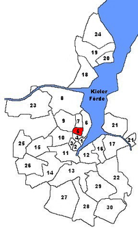
Location of Brunswik in Kiel
|
|
Brunswik is the name of a district in the central area of the city of Kiel . The district has 6,464 inhabitants (as of December 31, 2014). It includes the arcades on Holtenauer Straße , the Information Technology Office, the South Tax Office, the Kiel School of Academics with the St. Andrews Hall and, on the UKSH campus, the medical clinic, the dermatology clinic, part of the neurocenter and forensic medicine. Adjacent is the Ministry of School and Vocational Training. There are also numerous green areas in the southern part. The northern part is more dominated by urban residential developments. The State Vocational School Photo + Medien Kiel is located next to the grammar school.
history
The name Brunswik first appeared in 1350. It is assumed, however, that Brunswik is older than the city of Kiel itself. On April 1, 1869, the village was incorporated into Kiel. The Kiel city area grew by 277 hectares . The Brunswiker Flur was incorporated into the village at the same time . The total area roughly includes the current districts of Brunswik, Blücherplatz and Düsternbrook . The three small areas within the Brunswiker lands were added a short time later. On March 2, 1871, the approximately eight-hectare Kiel Castle including the castle grounds and on October 1, 1873 the approximately 32-hectare Düsternbrook and Düvelsbek enclosures were incorporated.
District boundaries
The Kiel-Brunswik district currently (2009) has the following border course - starting in the north and continuing clockwise: The border forms Waitzstraße in the north, it then runs in the east along the Forstweg, Niemannsweg, Schwesterngang and Feldstraße to Brunswiker Straße . In the south, the border runs along Brunswiker Strasse, Dreiecksplatz, Holtenauer Strasse and Lehmberg. In the west, the Knooper Weg forms the border. Holtenauer Strasse 2–104 and 19–85 belong to the Brunswik district.
See also
Web links
- Kiel district Brunswik in the Stadtwiki Kiel
Individual evidence
- ↑ a b The population in the Kiel districts in 2014 . (PDF) State capital Kiel
- ↑ City map of Kiel. Retrieved January 8, 2020 .
- ↑ Hans-G. Hilscher, Dietrich Bleihöfer: Brunswik. In: Kiel Street Lexicon. Continued since 2005 by the Office for Building Regulations, Surveying and Geoinformation of the State Capital Kiel, as of February 2017 ( kiel.de ).
- ↑ Max Leisner: The spot Brunswik . Vol. 58 of the series Communications of the Society for Kiel City History, Kiel 1968–1972.
- ↑ Vera Stoy: Kiel on the way to the big city. Kiel 2003
- ↑ City map of the city of Kiel published by the city of Kiel with detailed district boundaries
