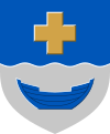
Kirkkonummi
| coat of arms | map |
|---|---|

|

|
| Basic data | |
| State : |
|
| Landscape : | Uusimaa |
| Administrative community : | Helsinki |
| Geographical location | 60 ° 7 ' N , 24 ° 26' E |
| Surface: | 1,016.01 km² |
| of which land area: | 366.08 km² |
| of which inland waterways: | 27.61 km² |
| of which sea area: | 622.32 km² |
| Residents : | 39,262 (Dec. 31, 2018) |
| Population density : | 107.2 inhabitants / km² |
| Municipality number : | 257 |
| Language (s) : | Finnish , Swedish |
| Website : | kirkkonummi.fi |
Kirkkonummi [ ˈkirkːoˌnumːi ] ( Finnish ; Swedish Kyrkslätt [ ˈtɕyrkslɛt ]) is a Finnish municipality in the Helsinki region . It is located west of Espoo , other neighboring communities are Ingå and Siuntio . The name of the place means "Kirchenheide". The Church of Kirkkonummi was built in 1500 and rebuilt in the 18th and 19th centuries to a cruciform church.
history
Finds of Stone Age artefacts in the north of Kirkkonummi suggest that the first settlement was around 9,000 years ago, when the south of today's municipal area was still below sea level. Ancient rock carvings have been preserved on the shores of Vitträsk and Juusjärvi lakes . With the post-glacial uplift , the coastline moved ever further south over the millennia; Barrows, especially on heights in the south of the municipality, indicate continuous settlement.
With the Christianization of Finland in the High Middle Ages, Swedish-speaking settlers settled on the coast; the coastal hinterland remained predominantly Finnish-speaking. The course of the language border can be traced in particular from the distribution of Finnish and Swedish place names. Some field names in Kirkkonummi are of Estonian origin, which can be attributed to the fact that the Estonian Cistercian monastery Padis Monastery owned some land here in the Middle Ages. The oldest walls of the stone church in Kirkkonummi possibly date back to the 13th century, the construction was completed in the 15th century. In the Middle Ages, the area benefited from its location on the King's Road , the trade route between Turku and Vyborg, and from trade across the Baltic Sea.
In the 19th century, Kirkkonummi benefited from its proximity to Helsinki , which was elevated to the capital of the now Russian Grand Duchy of Finland in 1812 and quickly grew into a major city. Local agriculture and fishing grew as food demand increased, and Kirkkonummi was soon known as the "pantry of the capital."
The municipal area includes the two strategically important peninsulas Porkkala and Upinniemi; one of the most important bases of the Finnish Navy is located on the latter . Porkkala and other areas of the municipalities of Kirkonnummi, Ingå and Siuntio were leased to the Soviet Union for 50 years after Finland's defeat in the Continuation War in 1945 , but the Soviet Union only used the base until 1956.
Development of the population (as of December 31) :
|
|
Sightseeing
Hvitträsk is an ensemble of villas that the architects Eliel Saarinen , Herman Gesellius and Armas Lindgren built in 1903 in the middle of nature above Lake Vitträsk. In the south wing of the main building there is now a museum on the history of the ensemble and a restaurant and café in the Black Villa.
Community partnerships
- Sundbyberg , Sweden
- Paldiski , Estonia
Sons and daughters of the church
- Amin Asikainen (* 1976), boxer and European champion
- Mårten Boström (* 1982), track and field athlete and orienteer
- Laura Österberg Kalmari (* 1979), soccer player
- Paradise Oskar (* 1990), singer-songwriter
- Eero Saarinen (1910–1961), architect and designer
- Johan Vilhelm Snellman (1806–1881), philosopher, journalist and statesman
- Thorvald Strömberg (1931–2010), canoeist and Olympic champion
- Pernilla Karlsson (* 1990), singer-songwriter
Web links
Individual evidence
- ↑ Maanmittauslaitos (Finnish land surveying office): Suomen pinta-alat kunnittain January 1, 2010 . (PDF; 199 kB)
- ↑ Statistical Office Finland: Table 11ra - Key figures on population by region, 1990-2018