Konibodom
|
Konibodom Конибодом |
||
| Basic data | ||
|---|---|---|
| State : |
|
|
| Province : | Sughd | |
| Coordinates : | 40 ° 17 ' N , 70 ° 26' E | |
| Height : | 409 m | |
| Area : | 828.9 km² | |
| Residents : | 47,000 (2003) | |
| Population density : | 57 inhabitants / km² | |
|
|
||
Konibodom ( Tajik Конибодом ; Russian Канибадам , Kanibadam ) is a city and the capital of the district of the same name in Sughd Province in northern Tajikistan . In the town, located in the fertile Ferghana Valley , there are Tajiks and minorities of Uzbeks , Russians and Kyrgyz people . The common languages are Tajik, Uzbek and Russian. In 2000 the Konibodom had 45,000 inhabitants. The city area is 828.9 km².
Location and climate
The city Konibodom lies in the southwestern part of the Ferghanatales at an altitude of around 400 meters, about ten kilometers from the eastern end of the Syrdarya fed Kairakkum Reservoir away, as well as the current flowing through the middle of the urban area Large Ferghanakanal used for irrigation. The border with Uzbekistan runs about ten kilometers east of the city . The border crossing on the A 376 expressway to Qo'qon (Kokand) is near the village of Patar. A good asphalt road connects Konibodom with the provincial capital Khujand, 79 kilometers to the west . After Isfara , a 28-kilometer direct road with good asphalt and a number of villages leads connecting long road at the border with Uzbekistan. The train station is six kilometers north of the city center. Trains run in both directions on this route twice a week.
The district ( Nohiya ) Konibodom borders in the north with the district Ascht, in the northeast with Uzbekistan, in the southeast with the district Isfara, in the south with Kyrgyzstan and in the west with the district Ghafurow .
The climate is a summer-dry continental climate ; the annual average temperature is 14.4 ° C. In summer it gets up to 45 ° C, in winter (beginning of November to the end of March) temperatures as low as −28 ° C are reached. The average temperature in January is −2 ° C and in July 28 ° C. In one year there is an average of 80 millimeters of precipitation.
history
The place has been known under its previous name, Kond ( Kend ), since the 9th century and belonged to the Samanid Empire at that time . It was on one of several routes on the Silk Road that ran east from Khujand via Marg'ilon to China. Konibodom was first mentioned in a document in 1463. The name means "city of almonds" and refers to the almond trees that used to grow in the area. In 1842 Kanibodom suffered from the skirmishes between Nasrullah Khan, the Emir of Bukhara (r. 1827-1860) and the invading Khan Madali of the Khanate of Kokand (r. 1821-1842), in which thousands died. Another battle occurred in 1875 in Mahram, west of the city on the road to Khujand, when 10,000 insurgent attackers from Kokand were defeated by the units of the Russian general Konstantin Petrovich von Kaufmann . Around 2000 Tajiks, Uzbeks and Kyrgyz lost their lives in this fight. Then the Russians captured Kanibodom that same year.
The city experienced a rapid economic boom as part of Russian Turkestan . In 1905 a Russian school was opened, soon after a train station. Since 1899 a railway line connected Samarkand with Osh through the Ferghana Valley . The Central Asian Oil Company ( Sredneaziatskoye Neftianoe Tovarischestvo, SANTO) set up a refinery to process the oil deposits that were extracted near Konibodom and Isfara . In 1917, 1,050 Russian workers and engineers were employed in the SANTA oil fields. From 1918 the Ferghana Valley belonged to the Autonomous Soviet Republic of Turkestan . In 1924, the Konibodom district was initially added to the Kokand Province of the Uzbek Soviet Socialist Republic . In April 1925, the Konibodom District was given a certain autonomy before it was incorporated into the Tajik Soviet Socialist Republic in 1929, along with other areas of the Ferghana Valley . The uprising movement of the Central Asian Basmachi , which had been directed against the Russian Bolsheviks during the October Revolution , was largely crushed in 1925. Agriculture, lying on the ground due to the unrest, was reorganized at the end of the 1920s with the introduction of collective farms for cotton and grain cultivation. In 1929, diesel generators began to produce electricity for Konibodom and the SANTO oil field. Konibodom has had city rights since 1937. In 1959 the Konibodom Technology Institute was opened, then in 1963 the Ura-Tyube ( Istaravshan ) Technical School . From 1970 there were performances in a newly built music and drama theater.
Cityscape

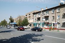
The largest part of the almost circular, but loosely built-up settlement area is formed by single-storey residential buildings with inner courtyards, which in Tajikistan are characteristic of the old town quarters of the cities ( Mahalla ) and for the villages ( Kishlak ). They are accessed by an irregular network of roads and paths. Larger residential and commercial buildings are lined up along the central Lenin Street, which runs from northwest to southeast. The A 376 road, which leads from Khujand to the Uzbek border, bypasses the southern outskirts of the city and makes an arc before it runs in a northerly direction as Aini Street ( ulitza Aini ) parallel to Lenin Street past the city center in the east. The stop for minibuses ( marshrutkas ) that go to the surrounding towns and villages is on the bypass about two kilometers south of the city center along Lenin Street. Here on the southern outskirts of the city there are some large Soviet apartment blocks in the open field, which clearly stand out from the otherwise carpet-like low construction.
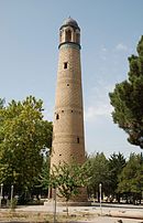
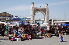
The city's business center is the market on Lenin Street, with a city park and several garden restaurants nearby. In the park there is a brick minaret from the beginning of the 20th century. There are one or two simple hotels on the main street, a theater used as a cinema and a teacher training facility.
Two madrasas are worth seeing . In 1914 there were eight madrasas in Konibodom and the surrounding villages, most of them dating from the 17th to 19th centuries. During the Soviet era, four of the eight madrasas and many mosques were destroyed by 1927 and the buildings that were not destroyed were used for other purposes. Only the oldest of them, the Madrasa Mir Radschab Dochdo (Mirradjab Dodho) from the 16th century, was largely preserved in its structural condition. It is located north of the market and now serves as a local museum. The Oim Madrasa is located in a village residential area about four kilometers north of the center on Saifuloew Street, which branches off from Aini Street. The madrasa, built in the 16th or 17th centuries, is one of the few Islamic schools in Central Asia that was founded by a woman. It contains separate areas for girls and boys with a number of individual rooms. During the Soviet era, the madrasa served as a prison from 1941, later as a warehouse for a farm and as a re-education center for boys. In 1996 the buildings were completely restored. The inner courtyard contains a well-tended garden. However, the facility is not used and is usually closed.
Economy and environment
The economy is focused on cotton processing, textile industry, livestock and food production. Crude oil production resumed near Konibodom and Isfara in 2011 amounted to 8,600 tons of oil and 4.3 million tons of natural gas in the first half of the year. The operating company is Somon Oil , 90 percent of which is owned by Swiss Manas Petroleum . Many of the other oil reserves in Tajikistan that have already been explored have not yet been developed.
Cotton cultivation, which was intensively carried out in monocultures during the Soviet era, led to environmental pollution with pesticides . Large quantities of pesticides that are no longer used and are now banned were stored between 1973 and 1999 without protective measures in a landfill five kilometers south of the urban area of Konibodom. The unguarded and unfenced pesticide storage near the household waste dump, which contains around 4,000 tons of DDT , lindane and other toxins, poses a potential environmental hazard because it is located a few kilometers from the Syr Darja and the Ferghana Canal. If the wind direction is unfavorable, toxic dust can reach the city.
sons and daughters of the town
- Kamil Jarmatow (1903-1978), director
literature
- Kamoludin Abdullaev, Shahram Akbarzadeh: Historical Dictionary of Tajikistan. Scarecrow Press, Lanham 2002, pp. 208 f.
- Robert Middleton, Huw Thomas: Tajikistan and the High Pamirs. Odyssey Books & Guides, Hong Kong 2012, p. 179 f.
- S. Frederick Starr (Ed.): Ferghana Valley: The Art of Central Asia. (Studies of Central Asia and the Caucasus) ME Sharpe, New York 2011, ISBN 978-0-7656-2998-2
Web links
Individual evidence
- ↑ Tadzhik Soviet Socialist Republic. Great Soviet Encyclopedia, 1979
- ↑ Kamoludin Abdullaev, Ravshan Nazarov: The Ferghana Valley Under Stalin, 1929–1953. In: S. Frederick Starr (Ed.), Pp. 129f
- ↑ Middleton, Thomas, 2002, p. 180
- ^ Oil and gas exploration has started at the Eastern Supetau deposit in Tajikistan . rusmininfo.com, August 25, 2011
- ↑ B. Frattini, A. Borroni (Ed.): Transboundary risk assessment on the hazardous waste sites of Kanibadam (Tajikistan), Khaidarken (Kyrgyzstan), Kadamjai (Kyrgyzstan) in the Fergana Valley. (PDF) Regional Synthesis Report, Italian Ministry for the Environment, Land and Sea, 2006, pp. 18–22


