Kotkino
| Village (selo)
Kotkino
Ко́ткино
|
||||||||||||||||||||||||||||
|
||||||||||||||||||||||||||||
|
||||||||||||||||||||||||||||
Kotkino ( Russian Ко́ткино ) is a village ( selo ) in the Nenets Autonomous Okrug in Russia with 372 inhabitants (as of October 14, 2010).
geography
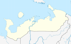
Kotkino is located in a swampy area on the left bank of the Sula , a tributary of the Pechora . The place is about 105 km southwest of Naryan-Mar , the capital of the Nenets Autonomous Okrug.
As to the administrative division, Kotkino belongs to the Sapolyarny rajon . It is also the administrative center and the only permanently inhabited place in the Kotkinski selsowet municipality .
history
According to tradition, the village was founded in the first half of the 19th century (according to other sources in the 1840s) by two brothers named Kotkin from Mesen who wanted to evade service in the Russian army. In the second half of the 19th century, the place began to be settled continuously. While there were two farms in the village in 1847, the number grew to nine up to 1919 and 13 up to 1923. At that time, Kotkino was on the post section from Arkhangelsk to Naryan Mar. In 1930, the place became the base of a fishing article , which became the most important employer in the place. The Artel was converted into a kolkhoz in the 1930s and celebrated its 80th anniversary as an agricultural production cooperative in 2010 .
In 1929, Kotkino became an administrative part of the newly created Nenezki nazionalny okrug (today's name Nenets Autonomous Okrug).
In 1995, Kotkino, which was previously categorized as derevnja (village), received the administrative status of selo (village with an administrative function). In 1996, the community was Kotkinski selsowet , a spin-off of the area from a year earlier formed selsowet Welikowissotschni , reformed. Since 2005, Kotkino has been part of the Sapoljarny rajon as the center of the Kotkinski selsowet .
Population development
| year | Residents |
|---|---|
| 1849 | 14th |
| 1918 | 49 |
| 1922 | 103 |
| 1928 | 96 |
| 2010 | 372 |
Note: 2010 census data
Infrastructure
The place has a kindergarten, a general education school, a cultural center and a Feldscher -Point ( Фельдшерско-акушерский пункт ), which ensures basic medical care. Electric power is generated with the help of diesel generators.
Economy and Transport
The most important employer in the area is the former fishing kolkhoz, which today is an agricultural production cooperative ( Сельскохозяйственный производственный кооператив ) and, in addition to fishing, is also active in the production of other agricultural products (cattle and dairy cattle).
There are no motorways to Kotkino. In the northeast of the town there is an airfield, which is used to transport passengers and cargo to Naryan-Mar with the help of helicopters ( Mil Mi-8 ) and small multi-purpose aircraft ( Antonov An-2 ). In the ice-free weeks in May and June, goods could also be transported by ship over the Sula and the Pechora.
Web links
- Kotkino website (Russian)
- Official website of the Kotkinski selsowet (Russian)
- The municipal administration's website on the official website of the Sapoljarny rajon (Russian)
Individual evidence
- ↑ a b Itogi Vserossijskoj perepisi naselenija 2010 goda. Tom 1. Čislennostʹ i razmeščenie naselenija (Results of the All-Russian Census 2010. Volume 1. Number and distribution of the population). Tables 5 , pp. 12-209; 11 , pp. 312–979 (download from the website of the Federal Service of State Statistics of the Russian Federation); Čislennost 'naselenija po municipal'nym obrazovanijam i naselennym punktam Archangel'skoj oblasti, vključaja Neneckij avtonomnyj okru Itogi Vserossijskoj perepisi naselenija 2010 Goda (population number of municipal structure and places the Arkhangelsk including the Autonomous circles Nenets results of the All-Russian census 2010.) Table (Download from the website of the Federal Service for State Statistics of Arkhangelsk Oblast)
- ↑ a b c d e f Kotkino on the official website of the Sapoljarny rajon (Russian); accessed on March 21, 2016
- ↑ a b c d e f History of Kotkinos on the official website of the Kotkinski selsowet (Russian); Reviewed on March 21, 2016
- ↑ a b c Alexei Rudnew: Slawny tradizijami Njarjana wynder, March 18, 2010 (Russian); Reviewed on March 21, 2016
- ↑ a b Kotkino on the regional portal of the Autonomous Okrug of the Nenets ( Memento of the original from March 25, 2016 in the Internet Archive ) Info: The archive link was inserted automatically and has not yet been checked. Please check the original and archive link according to the instructions and then remove this notice. (Russian); Reviewed on March 21, 2016

