Amderma
| settlement
Amderma
Амдерма
|
||||||||||||||||||||||||||||||||||||||
|
||||||||||||||||||||||||||||||||||||||
|
||||||||||||||||||||||||||||||||||||||
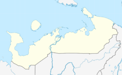
Amderma ( Russian А́мдерма ) is a settlement in the Nenets Autonomous Okrug in the northeast of the European part of Russia . The place has 541 inhabitants (as of October 14, 2010).
geography
Amderma is located on the north side of the Jugor Peninsula (Jugorski Peninsula) on the coast of the Kara Sea , about 40 kilometers east of the Jugor Strait (Jugorski Schar), a strait that separates the mainland from the island of Waigatsch . From the capital of the Naryan-Mar Autonomous Okrug , the place is a good 400 kilometers as the crow flies in a north-easterly direction, and from the city of Vorkuta in the neighboring Komi Republic about 270 kilometers in a north-westerly direction. At the village, the Amderma river of the same name first flows into an equally named lagoon and then into the sea.
Amderma belongs to the only district of the Autonomous Okrug, the Sapolyarny rajon .
The place is on the other side of the Arctic Circle : the polar day lasts from May 20th to July 30th, the polar night from November 27th to January 16th.
history

The settlement was established in July 1933 in connection with the development of a fluorspar deposit discovered there in 1932 , which secured the independence of the Soviet Union from imports of this raw material. The name of the place was derived from that of the river and the lagoon; in the Nenets language it means, for example, the resting place of walruses . In 1936 the place was given urban-type settlement status .
After the German-Soviet War and the discovery of other, more conveniently located fluorspar deposits, the mine was closed and Amderma developed as one of the logistical bases for the development of the Soviet Arctic. From 1940 it also became the administrative seat of a Rajon of the same name until the Rajon division of the Autonomous Okrug was given up in 1959.
In the 1980s, the production of fluorspar was resumed briefly, and in the 1990s, the promotion of building materials ( gravel ) was considered. After the collapse of the Soviet Union , however, the entire mining industry was given up due to unprofitability, due to the location of the place at a great distance from potential consumers and under harsh climatic conditions. In 1993 the air defense troops stationed in Amderma were withdrawn, in 1995 a local laboratory for researching permafrost was closed , in 1998 the supply base for shipping on the Northern Sea Route (Torgmortrans) , and in 2000 the local construction company (Amdermastroi) . As a result of this development, the population of the place fell by almost 90% between 1989 and 2002, and has continued to do so slowly since then.
In 2009, the status of an urban-type settlement was revoked as part of an administrative reform ; Amderma has been a rural settlement ever since. One perspective for the place is seen in the development of the previously unused oil and natural gas deposits in the northern part of the Timan - Pechora region.
Population development
| year | Residents |
|---|---|
| 1959 | 3598 |
| 1970 | 4516 |
| 1979 | 4221 |
| 1989 | 5495 |
| 2002 | 650 |
| 2010 | 541 |
Note: census data
Economy and Infrastructure
There is no fixed overland connection to Amderma. The seaport is under way in the summer navigation period of supply ships; Only in the frosty season can the place from Vorkuta, where the nearest railway station is located, be reached with all -terrain tracked vehicles (Russian wesdechod ).
Immediately to the west of the village, on the spit that closes the Amderma lagoon from the open sea, there is an airport ( IATA airport code AMV , ICAO code ULDD ) with a 2600 meter long runway that is also suitable for larger types of aircraft . Today, however, it is only served twice a month by Nordavia from Arkhangelsk .
An airport formerly known by the military code name Amderma-2 is not located near Amderma, but near the settlement of Beluschja Guba , which is 400 kilometers to the northwest on the west coast of the south island of Novaya Zemlya . The economy of the Amderma settlement today is limited to the maintenance of the transport facilities and the supply of the few inhabitants of the area.
Individual evidence
- ↑ a b Itogi Vserossijskoj perepisi naselenija 2010 goda. Tom 1. Čislennostʹ i razmeščenie naselenija (Results of the All-Russian Census 2010. Volume 1. Number and distribution of the population). Tables 5 , pp. 12-209; 11 , pp. 312–979 (download from the website of the Federal Service of State Statistics of the Russian Federation); Čislennost 'naselenija po municipal'nym obrazovanijam i naselennym punktam Archangel'skoj oblasti, vključaja Neneckij avtonomnyj okru Itogi Vserossijskoj perepisi naselenija 2010 Goda (population number of municipal structure and places the Arkhangelsk including the Autonomous circles Nenets results of the All-Russian census 2010.) Table (Download from the website of the Federal Service for State Statistics of Arkhangelsk Oblast)
- ↑ Article Amderma in the Great Soviet Encyclopedia (BSE) , 3rd edition 1969–1978 (Russian)
- ↑ Article on geography and history of the place on the website of the Northern Supraregional Administration of the Meteorological Service of the Russian Federation (Russian)
Web links
- Official website of the local government (Russian)
- Extensive photo collection (status 2009-2010)


