Charuta
| settlement
Charuta
Харута́
|
||||||||||||||||||||||||||||
|
||||||||||||||||||||||||||||
|
||||||||||||||||||||||||||||
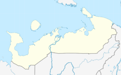
Charuta ( Russian Харута́ ) is a settlement ( possjolok ) in northern Russia with 538 inhabitants (as of October 14, 2010). From an administrative point of view, Charuta belongs to the Nenets Autonomous Okrug , but is surrounded by the territory of the Komi Republic as an exclave .
geography
Charuta is located about 290 km southeast of Naryan-Mar , the capital of the Nenets Autonomous Okrug. The place is located on the left bank of the Adswa , a tributary of the Ussa . Coming from the south, the eponymous river Charutaju flows into the Adswa a few hundred meters west of the village.
As to the administrative division, Charuta belongs to the Sapolyarny rajon . It is also the administrative center and the only permanently inhabited place in the municipality of Chosseda-Chardski selsowet .
history
The place was founded at the end of the 19th century by emigrants from today's Ischemski rajon of the Komi republic and first mentioned in documents about the census of 1897. The name of the place comes from the Nenets and is derived from the nearby river Charutaju (German: larch river ).
In 1995 the Chosseda-Chardski selsowet was reorganized as a municipality. Since 2006, Charuta has been part of the newly created Sapoljarny rajon as the center of Andegski selsowet .
Population development
| year | Residents |
|---|---|
| 2002 | 774 |
| 2010 | 538 |
Note: census data
Infrastructure
The place has basic educational facilities (kindergarten and middle school), a cultural center and an ambulance station. Electric power is generated with the help of diesel generators.
Economy and Transport
In Charuta there is an agricultural production cooperative that is mainly engaged in reindeer herding.
Charuta has two runways for Antonov-2 and a helicopter landing pad for Mi-8 , which means that people and goods can be transported all year round. There is a regular flight connection to Naryan-Mar and, depending on the occupancy, helicopter connections to Inta in the Komi Republic. In the winter months, the places Narjan-Mar, Inta and Ussinsk can be reached via ice roads .
Web links
- Official website of the Khosseda-Chardski selsowet (Russian)
- The municipal administration's website on the official website of the Sapoljarny rajon (Russian)
Individual evidence
- ↑ a b Itogi Vserossijskoj perepisi naselenija 2010 goda. Tom 1. Čislennostʹ i razmeščenie naselenija (Results of the All-Russian Census 2010. Volume 1. Number and distribution of the population). Tables 5 , pp. 12-209; 11 , pp. 312–979 (download from the website of the Federal Service of State Statistics of the Russian Federation); Čislennost 'naselenija po municipal'nym obrazovanijam i naselennym punktam Archangel'skoj oblasti, vključaja Neneckij avtonomnyj okru Itogi Vserossijskoj perepisi naselenija 2010 Goda (population number of municipal structure and places the Arkhangelsk including the Autonomous circles Nenets results of the All-Russian census 2010.) Table (Download from the website of the Federal Service for State Statistics of Arkhangelsk Oblast)
- ↑ a b c d e f Charuta on the official website of the Sapoljarny rajon (Russian); Reviewed on December 18, 2016.
- ↑ Charuta on the regional portal of the Nenets Autonomous Okrug (Russian); Reviewed on December 18, 2016.


