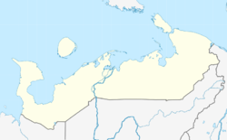
Naryan-Mar
| city
Narjan-Mar
Нарьян-Мар Няръяна мар
|
||||||||||||||||||||||||||||||||||||||||||
|
||||||||||||||||||||||||||||||||||||||||||
|
||||||||||||||||||||||||||||||||||||||||||
| List of cities in Russia | ||||||||||||||||||||||||||||||||||||||||||
Naryan-Mar ( Russian Нарьян-Мар , Nenets мар Няръяна, "Red City") is the capital of the Autonomous Okrug Nenets in the northwest of Russia with 21,658 inhabitants (14 October 2010).
geography
The city is located north of the Arctic Circle on the right bank of the Lower Pechora in its river delta, around 90 km south of its confluence with the Barents Sea . The distance to Moscow is a good 1,540 kilometers and to the city of Arkhangelsk around 660 km. The closest city is Ussinsk in the Komi Republic , around 270 km southeast of Naryan-Mar. Narjan Mar has a polar climate.
history
The place emerged from 1929, simultaneously with the establishment of the Nenets Autonomous Okrug within the Russian SFSR . Initially it was an urban-type settlement , which was built on the site of the Beloschtschelje village with the construction of a sawmill. In the early days the place was called " Felix Dzerzhinsky workers' settlement ". In 1931 the settlement was declared the capital of the Autonomous Okrug, and two years later it was given the name Narjan-Mar , which means “Red City” in Nenet (meaning “City of Communism ”). In the spring of 1935 Narjan-Mar received city status.
Population development
The following overview shows the development of the population of Naryan-Mar.
| year | Residents |
|---|---|
| 1939 | 13,670 |
| 1959 | 13,222 |
| 1970 | 16,864 |
| 1979 | 23,435 |
| 1989 | 20.182 |
| 2002 | 18,611 |
| 2010 | 21,658 |
Note: census data
Economy and Transport
| Naryan-Mar | ||||||||||||||||||||||||||||||||||||||||||||||||
|---|---|---|---|---|---|---|---|---|---|---|---|---|---|---|---|---|---|---|---|---|---|---|---|---|---|---|---|---|---|---|---|---|---|---|---|---|---|---|---|---|---|---|---|---|---|---|---|---|
| Climate diagram | ||||||||||||||||||||||||||||||||||||||||||||||||
| ||||||||||||||||||||||||||||||||||||||||||||||||
In addition to the sawmill Naryan-Mar has a large fish processing industrial complex and other companies in the food industry . The oil and gas industries also play an important role in the Autonomous Okrug .
Narjan-Mar has a river and sea port on the Pechora and a small airport about 3 km east of the city, which is connected via the A-381 . Road connections with the rest of Russia do not exist. The nearest railway connection is in Pechora in the Komi Republic.
sons and daughters of the town
- Antonina Ordina (* 1962), cross-country skier
- Vladislav Borissow (* 1978), racing cyclist
Web links
- Official website of the city administration (Russian)
- Narjan-Mar on mojgorod.ru (Russian)
Individual evidence
- ↑ a b Itogi Vserossijskoj perepisi naselenija 2010 goda. Tom 1. Čislennostʹ i razmeščenie naselenija (Results of the All-Russian Census 2010. Volume 1. Number and distribution of the population). Tables 5 , pp. 12-209; 11 , pp. 312–979 (download from the website of the Federal Service of State Statistics of the Russian Federation); Čislennost 'naselenija po municipal'nym obrazovanijam i naselennym punktam Archangel'skoj oblasti, vključaja Neneckij avtonomnyj okru Itogi Vserossijskoj perepisi naselenija 2010 Goda (population number of municipal structure and places the Arkhangelsk including the Autonomous circles Nenets results of the All-Russian census 2010.) Table (Download from the website of the Federal Service for State Statistics of Arkhangelsk Oblast)


