Bugrino (Arkhangelsk)
| settlement
Bugrino
Бугрино
|
||||||||||||||||||||||||||||||
|
||||||||||||||||||||||||||||||
|
||||||||||||||||||||||||||||||
Bugrino ( Russian Бугрино́ ) is a settlement on the Russian island of Kolgujew in the Nenets Autonomous Okrug with 424 inhabitants (as of October 14, 2010). Like the entire island of Kolgujew, the place is in a restricted area and may only be entered with the permission of the FSB .
geography
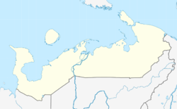
Bugrino is located in the south of the island of Kolgujew, on the Pomorsky Strait ( Поморский пролив ) of the eastern Barents Sea . To the east of the village, the Bugrjanka river flows into the Barents Sea. The capital of the Nenets Autonomous Okrug, Narjan-Mar, is about 200 km as the crow flies southeast of Bugrino.
As to the administrative division, Bugrino belongs to the Sapoljarny rajon . It is also the administrative center and the only permanently inhabited place in the Kolgujewski selsowet municipality .
history
The island of Kolguev was already inhabited by pomors before the Russian conquest by the Grand Duchy of Moscow in the 15th century . However, there were no permanent settlements here. In 1776 a sailing ship belonging to the Mesen Old Believer, Kotkin, reached the island with the first Russian families. However, the camp only existed for one year, as all 70 settlers except four people died of scurvy . Bugrino, the name of the camp, was derived from the word bugrana ( буграна ), which is used to describe simple dwellings in northern Russia.
The first Nenets arrived on the island at the beginning of the 19th century . The first settlers made their living from reindeer herding, hunting land animals and marine mammals, and fishing. In 1858 Kolguiev was already inhabited by more than 100 people. The administrative center of the island has been Bugrino since then. Due to the nomadic way of life of the Nenets, only a few people lived in Bugrino until the 20th century. Of the 104 residents of Kolguiev in 1926, only six lived in the settlement.
In 1924 the Kolgujewski ostrownoi Sowet ( Kolgujewer Island Soviet ) was established with its seat in Bugrino. In 1936 a few houses, a boarding school, a bakery and a shop were built in the village. From this time the island population began to settle increasingly in Burgino.
Due to the Soviet nuclear weapons tests on Novaya Zemlya in the mid-1950s , most of the Nenets living there, as well as their reindeer, were evacuated and moved to Kolguyev.
In 1995 the Kolgujewski selsowet was reorganized as the municipality of the same name. Since 2005, Bugrino has been part of the Sapoljarny rajon as the center of the Kolgujewski selsowet .
Population development
| year | Residents |
|---|---|
| 1926 | 6th |
| 2002 | 400 |
| 2010 | 424 |
Note: 2002 and 2010 census data
Infrastructure
The place has a kindergarten, a primary school, a library, a cultural center, a post office, a diesel power station, a weather station and a shop. There is also a Feldscher point ( Фельдшерско-акушерский пункт ), which ensures basic medical care.
Economy and Transport
There is no industry in Bugrino. The population is mainly active in reindeer herding.
There is a small airport close to the town, from which regular connections via Antonov An-2 and Mi-8 to Naryan-Mar exist. A road leads from Bugrino to the Pestschanka oil workers' settlement, which has existed since 1987, at the Pestschanoosjorskoye oil deposit . Pestschanka has its own airport with regular connections to Murmansk .
Restricted area
Bugrino belongs, like large parts of the Sapoljarny rajon, to the so-called border zone ( Пограничная зона ) of the Russian Federation. In these areas, access is regulated for both Russians and foreigners. Permits to enter these areas are issued by the FSB.
Web links
Individual evidence
- ↑ a b Itogi Vserossijskoj perepisi naselenija 2010 goda. Tom 1. Čislennostʹ i razmeščenie naselenija (Results of the All-Russian Census 2010. Volume 1. Number and distribution of the population). Tables 5 , pp. 12-209; 11 , pp. 312–979 (download from the website of the Federal Service of State Statistics of the Russian Federation); Čislennost 'naselenija po municipal'nym obrazovanijam i naselennym punktam Archangel'skoj oblasti, vključaja Neneckij avtonomnyj okru Itogi Vserossijskoj perepisi naselenija 2010 Goda (population number of municipal structure and places the Arkhangelsk including the Autonomous circles Nenets results of the All-Russian census 2010.) Table (Download from the website of the Federal Service for State Statistics of Arkhangelsk Oblast)
- ↑ a b Prikas Federalnoi sluschby besopasnosti Rossijskoi Federazii ot 10 maja 2007, N 229, gorod Moskwa (Russian); accessed on October 23, 2015
- ↑ a b c d e f g h Bugrino on the official website of the Sapoljarny rajon ( page no longer available , search in web archives ) Info: The link was automatically marked as defective. Please check the link according to the instructions and then remove this notice. (Russian); accessed on October 23, 2015
- ↑ a b c d e story of Bugrino on the official website of the local government (Russian); accessed on October 23, 2015
- ↑ a b c d e f g h General information and history of Bugrino on the official website of the municipal administration (Russian); accessed on October 23, 2015
- ↑ Characteristics Bugrinos on the official website of the Kolgujewski selsowet (in Russian); accessed on October 21, 2015


