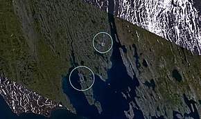
Beluschja Guba
|
Urban-type settlement
Beluschja Guba
Белушья Губа
|
||||||||||||||||||||||||||||||||
|
||||||||||||||||||||||||||||||||
|
||||||||||||||||||||||||||||||||
Beluschja Guba ( Russian Белу́шья Губа́ ) is an urban-type settlement in the Novaya Zemlya archipelago . It is subordinated to the Nenets Autonomous Okrug, which is part of Arkhangelsk Oblast . The settlement has 1972 inhabitants (as of October 14, 2010). Most of the inhabitants belong to the indigenous population, the Nenets .
geography
Beluschja Guba is located on the bay of the same name in the west of the south island of Novaya Zemlya, on the Gussinaja Zemlya peninsula . The Rogachovo military air base is located nine kilometers northeast of the settlement .
The bay is surrounded by warm ocean currents all year round. Entry into the bay is 30 to 50 meters and the bay itself is 10 to 30 meters deep. Due to these conditions, it is navigable all year round with ships of all classes with only minimal use of icebreakers . In hard winters, the frozen ice extends a maximum of 1 km from the bay and is only a maximum of one meter thick. The bay is well protected from floating ice masses by natural conditions.
history
In 1894, during a visit by the then governor of the Arkhangelsk governorate AP Engelgard, it was decided that Beluschja Guba would become a settlement. In 1896 an expedition on the ship Samoyed ( Самоед ) explored the western shore of the island of Novaya Zemlya. Some of the expedition participants gave their names to geographical objects on the island. The capes Lilje ( Лилье ) and Morosow ( Морозов ), the Gulf of Gavrilow ( Гаврилов ) and the bays of Nasimow ( Назимов ) were named after members of the expedition. The settlement of Beluschja Guba was built on the banks of Samoyed Bay in 1897.
On September 17, 1954, the Novaya Zemlya Nuclear Test Site was established on Novaya Zemlya . In the years that followed, numerous nuclear weapon tests took place on Novaya Zemlya. Beluschja Guba became the central residential and scientific center of Novaya Zemlya during this time. On February 27, 1992, the President of the Russian Federation Boris Yeltsin signed Decree No. 194. This made the test site the Central Test Site of the Russian Federation ( Центральный полигон Российской Федерации ; ZPRF).
economy
Beluschja Guba is now the capital of the Central Polygon of the Russian Federation, a nuclear weapons test area . On October 30, 1961, the so-called Tsar bomb, the atomic explosive device with the most powerful explosive force to date (over 50 megatons of TNT equivalent ) was detonated there.
The settlement has 17 residential buildings, a school for 560 students, a kindergarten with 80 places, three hotels, the Orbita television and radio station ( Russian Орбита ), a military hospital , an officers' house and an Orthodox church .
A role of the fishing and fur hunting , especially in the Arctic fox .
In the near future, Beluschja Guba should become an important transport center. There is a project for a large oil port in Beluschja Guba, from which oil from Western Siberia and gas from the Yamal Peninsula are to be transported. In the vicinity of the settlement there are precious metal (including silver ) and non-ferrous metal deposits ( manganese , lead , zinc ). When the nearby ore deposits are exploited, the ores are to be transported further by sea from the port. The construction of an oil port in Beluschja Guba would reduce the cost of exporting oil compared to transporting it with a pipeline .
Individual evidence
- ↑ a b Itogi Vserossijskoj perepisi naselenija 2010 goda. Tom 1. Čislennostʹ i razmeščenie naselenija (Results of the All-Russian Census 2010. Volume 1. Number and distribution of the population). Tables 5 , pp. 12-209; 11 , pp. 312–979 (download from the website of the Federal Service of State Statistics of the Russian Federation); Čislennost 'naselenija po municipal'nym obrazovanijam i naselennym punktam Archangel'skoj oblasti, vključaja Neneckij avtonomnyj okru Itogi Vserossijskoj perepisi naselenija 2010 Goda (population number of municipal structure and places the Arkhangelsk including the Autonomous circles Nenets results of the All-Russian census 2010.) Table (Download from the website of the Federal Service for State Statistics of Arkhangelsk Oblast)
- ↑ a b Alexander Parfenow: How should a seaport be? In: Journal "Sewer Promyschlenny". April 2006, accessed March 21, 2010 (source in Russian).
- ↑ History of the settlement on belushka.narod.ru ( Memento from March 4, 2016 in the Internet Archive ), (Russian)
- ↑ a b History of the Poligon Beluschja Guba on belushka.narod.ru (Russian)
- ↑ a b The path of saving leads via Novaya Zemlya ( Memento of July 24, 2011 in the Internet Archive ), Oil & Gas Eurasia, May 2009, Russian


