Beresnik
| Urban-type settlement
bereznik
Березник
|
||||||||||||||||||||||||||||||||
|
||||||||||||||||||||||||||||||||
|
||||||||||||||||||||||||||||||||
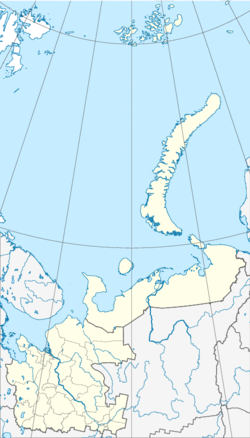
Beresnik ( Russian Бере́зник ) is an urban-type settlement in northwestern Russia . It belongs to the Arkhangelsk Oblast and has 6018 inhabitants (as of October 14, 2010).
geography
Beresnik is located about 215 km southeast of the Oblast capital Arkhangelsk . It is located on the left bank of the Northern Dvina about 6 km north of the mouth of the Waga in the same. The nearest cities are Schenkursk , about 90 km to the south , Mirny , 115 km to the west, and Plesetsk, 120 km to the west.
history
Beresnik was first mentioned in 1676. From the 19th century to 1960 the place was called Semyonovskoye. In 1962 it received urban-type settlement status. Bereznik is the administrative center of the Rajons Winogradowski .
Population development
The following overview shows the development of the population of Bereznik.
| year | Residents |
|---|---|
| 1939 | 575 |
| 1959 | 3,179 |
| 1970 | 5.118 |
| 1979 | 6,071 |
| 1989 | 7.006 |
| 2002 | 6,464 |
| 2010 | 6,018 |
Note: census data
Economy and Transport
The economy of the settlement is mainly based on agriculture (milk and vegetable production) and on the forest industry.
The M8 highway from Moscow to Severodvinsk runs right through the settlement . Beresnik does not have a railway connection. The nearest train stations are the Cholmogorskaya station , 148 km north-west , and the Welsk station, which can be reached via the M8, 200 km south of Bereznik.
Individual evidence
- ↑ a b Itogi Vserossijskoj perepisi naselenija 2010 goda. Tom 1. Čislennostʹ i razmeščenie naselenija (Results of the All-Russian Census 2010. Volume 1. Number and distribution of the population). Tables 5 , pp. 12-209; 11 , pp. 312–979 (download from the website of the Federal Service of State Statistics of the Russian Federation); Čislennost 'naselenija po municipal'nym obrazovanijam i naselennym punktam Archangel'skoj oblasti, vključaja Neneckij avtonomnyj okru Itogi Vserossijskoj perepisi naselenija 2010 Goda (population number of municipal structure and places the Arkhangelsk including the Autonomous circles Nenets results of the All-Russian census 2010.) Table (Download from the website of the Federal Service for State Statistics of Arkhangelsk Oblast)
Web links
- Beresnik article in the Great Soviet Encyclopedia (BSE) , 3rd edition 1969–1978 (Russian)

