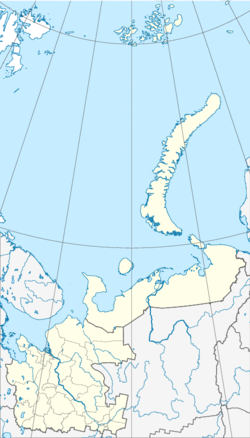
Jemza
| Urban-type settlement
Jemza
Емца
|
||||||||||||||||||||||||||||||||
|
||||||||||||||||||||||||||||||||
|
||||||||||||||||||||||||||||||||
Jemza ( Russian Емца ) is an urban-type settlement in northwestern Russia . The place belongs to the Arkhangelsk Oblast and has 1067 inhabitants (as of October 14, 2010). It is located in Rajon Plesetsk .
geography
Jemza is located about 163 kilometers south of the Oblast capital Arkhangelsk . The closest town is Mirny , about 34 kilometers south of Jemza. Plesetsk, the administrative center of the Rajon, is 40 kilometers south of the settlement. The river Jemza , after which the settlement is named, also runs south of Jemza .
history
In 1943 Jemza received urban-type settlement status.
Population development
The following overview shows the development of the population of Jemza.
| year | Residents |
|---|---|
| 1959 | 8,807 |
| 1970 | 6,881 |
| 1979 | 4,900 |
| 1989 | 2,266 |
| 2002 | 1,498 |
| 2010 | 1,067 |
Note: census data
Economy and Infrastructure
Jemza is a station of the Northern Railway on the Plesetsk - Obozersky line . Until the beginning of the 1990s there was a railway line between Jemza and the forestry settlement Verkhovsky ( Верховский ), which is about 23 kilometers northwest of the settlement, which was mainly used for timber transport. In addition to forestry, rail transport is an important industry.
Individual evidence
- ↑ a b Itogi Vserossijskoj perepisi naselenija 2010 goda. Tom 1. Čislennostʹ i razmeščenie naselenija (Results of the All-Russian Census 2010. Volume 1. Number and distribution of the population). Tables 5 , pp. 12-209; 11 , pp. 312–979 (download from the website of the Federal Service of State Statistics of the Russian Federation); Čislennost 'naselenija po municipal'nym obrazovanijam i naselennym punktam Archangel'skoj oblasti, vključaja Neneckij avtonomnyj okru Itogi Vserossijskoj perepisi naselenija 2010 Goda (population number of municipal structure and places the Arkhangelsk including the Autonomous circles Nenets results of the All-Russian census 2010.) Table (Download from the website of the Federal Service for State Statistics of Arkhangelsk Oblast)
- ↑ http://infojd.ru/22/emtsa-verhovsky.html
Web links
- Entry on terrus.ru (Russian)
- Article Jemza in the Great Soviet Encyclopedia (BSE) , 3rd edition 1969–1978 (Russian)

