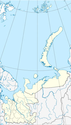
Plesetsk (place)
| Urban-type settlement
Plesetsk
Плесецк
|
||||||||||||||||||||||||||||
|
||||||||||||||||||||||||||||
|
||||||||||||||||||||||||||||
| List of large settlements in Russia | ||||||||||||||||||||||||||||
Plesetsk ( Russian Плесе́цк ) is an urban-type settlement in the northwestern Russian Arkhangelsk Oblast . It has 11,037 inhabitants (as of October 14, 2010).
geography
Plesetsk is located about 800 km northeast of Moscow and 180 km south of the Oblast capital Arkhangelsk . The settlement is the administrative center of the same name Rajons Plesetsk and also the center of Plessezkoje gorodskoje posselenije , in addition Plesetsk the settlement Puksa includes.
A few kilometers northeast of the city are the Plesetsk Cosmodrome and the associated city of Mirny . Although this is located on the territory of the Plesetsk Raion, it is under the direct administration of the Oblast. The area of the Plesetsk Cosmodrome also includes the Pleszy Airport , which is located near Plesetsk .
history
With the construction of the railway line Vologda - Arkhangelsk , was established in 1897, the railway station Plessezkaja to which was a small settlement for the people working there railwaymen. The railway station was named after an existing place about five kilometers away, near Lake Pleszy . The station Plessezkaja belonged at the time of its establishment Nawolozkaja volost of Oneschski Ujesd within the provinces of Arkhangelsk . The first school was built in the settlement in 1914 and the first church in 1916.
During the Russian Civil War , the place was fiercely contested and was captured by the British and White Guards in September 1919. After the liberation of the place on February 12, 1920, the settlement was largely destroyed and had to be rebuilt. At the beginning of the 1920s, the wood industry settled in the area. There were other small work settlements on the railway lines around Plesezkaya, which were combined in 1924 to form the Plessezkaya wolost administrative unit with the Navolok administrative center. Two years later the Plessezkaja wolost was placed under the administration of the Arkhangelski ujesd as Plessezkaja ukrupnennaja wolost . The administrative center of the Volost became the Plesetskaya settlement. In 1926 a sawmill was built in the settlement, which has also exported wood since 1932. A hospital was also built in the early 1930s.
In the course of an administrative reform in 1929, the Plesezkaya ukrupnennaja wolost was united with the Samoded labor settlement and the Plesezk Raion was founded with the Plesezkaya settlement as the administrative center. In 1932 the settlement was named a work settlement (Russian рабочий посёлок , corresponds to an urban-type settlement) and was named Plesetsk.
Since 2006 Plesetsk has been the administrative center of Plesetskoye gorodskoje posselenije .
Plesetskaya station of the Northern Railway
Population development
The following overview shows the development of the population of Plesetsk.
| year | Residents |
|---|---|
| 1939 | 11,754 |
| 1959 | 13,316 |
| 1970 | 13,330 |
| 1979 | 13,267 |
| 1989 | 14,027 |
| 2002 | 11,300 |
| 2010 | 11,037 |
Note: census data
economy
The wood industry is an important branch of the economy in the settlement. Plesezk also has a dairy and a meat processing plant.
Individual evidence
- ↑ a b Itogi Vserossijskoj perepisi naselenija 2010 goda. Tom 1. Čislennostʹ i razmeščenie naselenija (Results of the All-Russian Census 2010. Volume 1. Number and distribution of the population). Tables 5 , pp. 12-209; 11 , pp. 312–979 (download from the website of the Federal Service of State Statistics of the Russian Federation); Čislennost 'naselenija po municipal'nym obrazovanijam i naselennym punktam Archangel'skoj oblasti, vključaja Neneckij avtonomnyj okru Itogi Vserossijskoj perepisi naselenija 2010 Goda (population number of municipal structure and places the Arkhangelsk including the Autonomous circles Nenets results of the All-Russian census 2010.) Table (Download from the website of the Federal Service for State Statistics of Arkhangelsk Oblast)
- ↑ Law “On the Status of Boundaries and Territories of Municipal Forms of Arkhangelsk Oblast” of September 23, 2004, updated version of July 2, 2012 (Russian); checked on September 2, 2012
- ↑ a b c О. Балакина: Центр земли Плесецкой , Плесецкие новости, September 26, 2006 (Russian); checked on September 2, 2012
Web links
- Article Plesetsk in the Great Soviet Encyclopedia (BSE) , 3rd edition 1969–1978 (Russian)


