Katunino (Arkhangelsk)
| settlement
Katunino
Катунино
|
||||||||||||||||||||||||
|
||||||||||||||||||||||||
|
||||||||||||||||||||||||
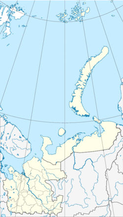
Katunino ( Russian Катунино ) is a settlement in northwestern Russia with 3443 inhabitants (as of October 14, 2010). It belongs to Arkhangelsk Oblast .
geography
Katunino is located about 22 kilometers south of the Oblast capital Arkhangelsk . In the west of the settlement runs the small river Lesnaja , which rises from the lake Lachta of the same name, which borders on Katunino in the south and flows into the Northern Dvina after about 15 kilometers . In the southwest of the settlement, the village of Lachta connects to Katunino, which is named after the river of the same name that flows through the village. To the east of Katunino is the Lachta military air base.
history
Katunino was originally called Lachta and was renamed Katunino in 1967 in honor of the Soviet fighter pilot and war hero Ilya Borisovich Katunin (1908-1944). Because of the nearby Lachta air base, the place also had the code name Arkhangelsk-27 ( Архангельск-27 ) during the Soviet Union and was not shown on maps.
Since 2006 Katunino administrative center of Katuninskoje selskoje poselenije ( Катунинское сельское поселение ) which has an 4,299 inhabitants and beside the settlements and Katunino Belomorje ( Беломорье ), the villages Lachta ( Лахта ) and Chelm ( Холм included).
traffic
Katunino is connected to Arkhangelsk by bus routes 115 and 125. The Russian M8 highway runs west of the settlement . Furthermore, the regional and long-distance train station Issakogorka is about 4 kilometers north of Katunino .
Individual evidence
- ↑ a b Itogi Vserossijskoj perepisi naselenija 2010 goda. Tom 1. Čislennostʹ i razmeščenie naselenija (Results of the All-Russian Census 2010. Volume 1. Number and distribution of the population). Tables 5 , pp. 12-209; 11 , pp. 312–979 (download from the website of the Federal Service of State Statistics of the Russian Federation); Čislennost 'naselenija po municipal'nym obrazovanijam i naselennym punktam Archangel'skoj oblasti, vključaja Neneckij avtonomnyj okru Itogi Vserossijskoj perepisi naselenija 2010 Goda (population number of municipal structure and places the Arkhangelsk including the Autonomous circles Nenets results of the All-Russian census 2010.) Table (Download from the website of the Federal Service for State Statistics of Arkhangelsk Oblast)
- ↑ a b Katuninskoje selskoje poselenije on the official website of Primorsk Raion (Russian); Reviewed January 8, 2012
- ↑ Law "О статусе и границах территорий муниципальных образований в Архангельской области" Retrieved October 17, 2016
- ↑ Population figures of Arkhangelsk Oblast as of January 1, 2011 ( Memento of the original from March 13, 2013 in the Internet Archive ) Info: The archive link was inserted automatically and has not yet been checked. Please check the original and archive link according to the instructions and then remove this notice. (Russian); Reviewed January 8, 2012

