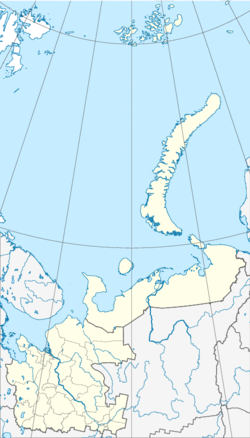
Konjowo (Arkhangelsk)
| Village
Konjowo
Конёво
|
||||||||||||||||||||||||
|
||||||||||||||||||||||||
|
||||||||||||||||||||||||
Konjowo ( Russian Конёво ) is a village (Selo) in northwestern Russia . It belongs to the Arkhangelsk Oblast and has 2838 inhabitants (as of October 14, 2010).
geography
Konjowo located in Rajon Plesetsk , about 276 km south of the Oblasthauptstadt Arkhangelsk . It lies on the right bank of the Onega around 82 km from the Rajonzentrum Plesetsk removed. The river Ektysha ( Эктыша ) flows through the village . Konjowo is the administrative center of the rural municipality Konjowo ( Коневское сельское поселение ), in which there are 42 other villages ( деревня ) in addition to the settlement Most . The rural community has 4,268 inhabitants (as of 2010).
history
Konjowo emerged as a combination of several, situated on the Onega, villages (u. A. Proimatschewskaja , Ektyscha , Mischkowskaja and Lukjanowskaja ). Since 1765, the settlement served as a post office on the postal tract from Saint Petersburg to Arkhangelsk. The name of the place is derived from this function as a post office, where, among other things, the horses were changed (Russian конь, kon , German: horse).
Konjowo was the administrative seat of the Volost of the same name from 1919 to 1929 and the administrative seat of Priosjorsk Raion from 1929 until its dissolution in 1963. With the dissolution of the Priosjorsk Rajon Konjowo became part of the Kargopol Rajon. It has been part of the Plesetsk Rajon since 1965.
Population development
The following overview shows the development of the population of Konjowo.
|
Note: census data
Infrastructure and traffic
There is no industry to speak of in Konjowo. Most of the employed work in the nearest larger cities such as Mirny and Plesetsk. Sights of the place are the Orthodox chapel built in the 18th century and the Church of the Holy Protection ( Храм Святого Покрова ) built from 1880 to 1882 . The village has a culture house, a middle school, a kindergarten and two libraries.
Konjowo is located on the regional road R1 (Р1), which runs from the trunk road M8 in Brin-Nawolok via Konjowo to Kargopol .
Individual evidence
- ↑ a b Itogi Vserossijskoj perepisi naselenija 2010 goda. Tom 1. Čislennostʹ i razmeščenie naselenija (Results of the All-Russian Census 2010. Volume 1. Number and distribution of the population). Tables 5 , pp. 12-209; 11 , pp. 312–979 (download from the website of the Federal Service of State Statistics of the Russian Federation); Čislennost 'naselenija po municipal'nym obrazovanijam i naselennym punktam Archangel'skoj oblasti, vključaja Neneckij avtonomnyj okru Itogi Vserossijskoj perepisi naselenija 2010 Goda (population number of municipal structure and places the Arkhangelsk including the Autonomous circles Nenets results of the All-Russian census 2010.) Table (Download from the website of the Federal Service for State Statistics of Arkhangelsk Oblast)
- ↑ Law “On the Status and Limits of Territories of Municipal Formations of Arkhangelsk Oblast”. Retrieved October 17, 2016
- ↑ a b Konjowo rural community on the Plesetsk Raion official website.Retrieved August 12, 2011
- ↑ a b Нина Семьина: Сжет и тени Конёвушка , Pravda Severa December 23, 2004 Retrieved August 12, 2011
- ↑ Konjowo's story on pleseck.com. Retrieved on August 12, 2011

