
Hefferthorn-Fellhorn-Sonnenberg landscape protection area
|
Hefferthorn-Fellhorn-Sonnenberg landscape protection area
|
||
 Auenland at the Seiwaldhof in the Hagertal - the Brunnbach winds through the Almgrund |
||
| location | Kitzbühel District , Tyrol , Austria | |
| surface | 69.64 km² | |
| WDPA ID | 32541 | |
| Geographical location | 47 ° 37 ' N , 12 ° 31' E | |
|
||
| Sea level | from 605 m to 1869 m | |
| Setup date | 1983 | |

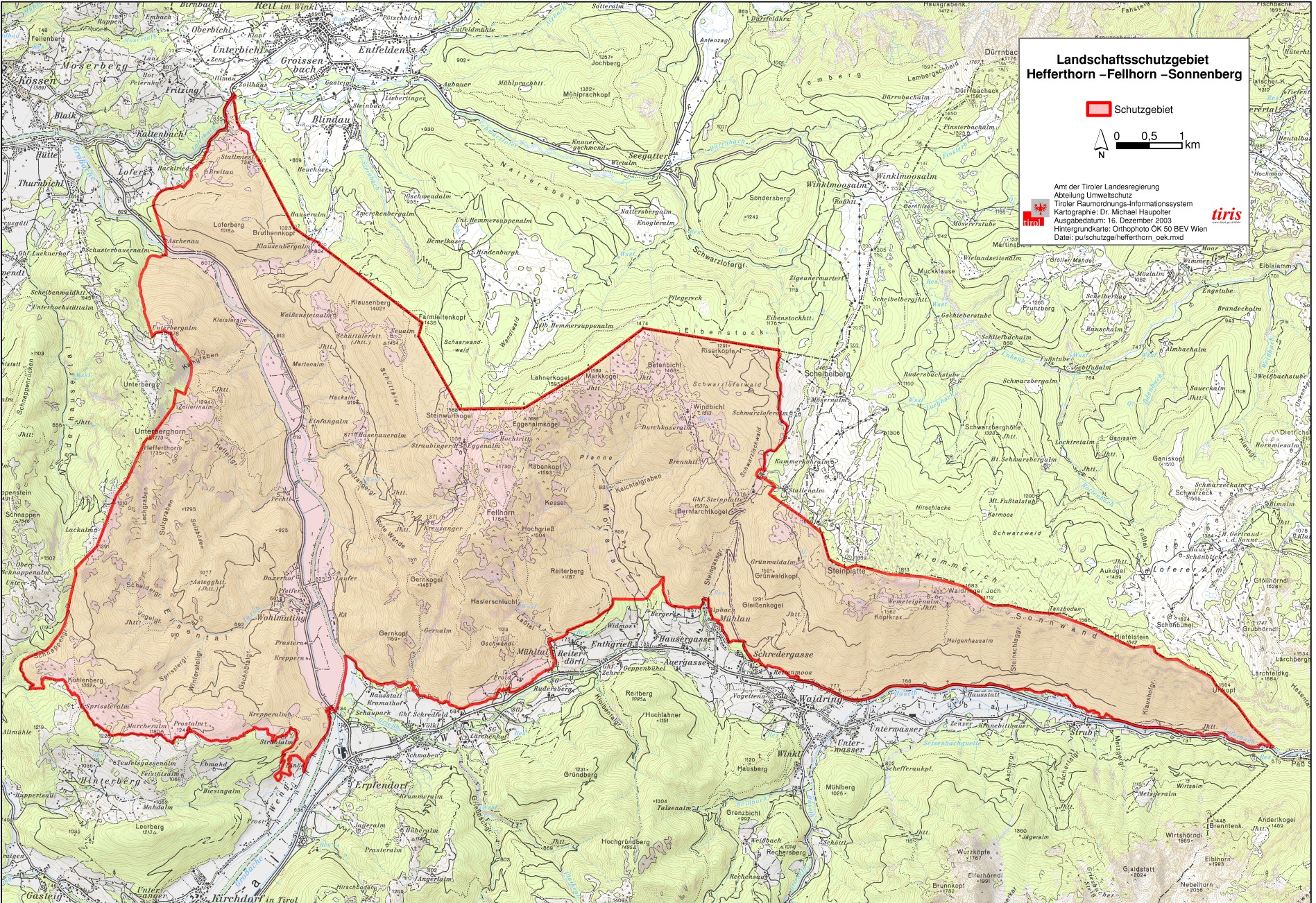
The landscape protection area Hefferthorn - Fellhorn - Sonnenberg was placed under protection in 1983 in order to preserve the special nature and beauty of the landscape and the resulting recreational value.
location and size
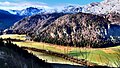
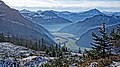
The protected landscape area has a size of 6,963.97 hectares and extends from the Hefferthorn mountain over the Hagertal in an easterly direction to the German border. In the southeast the area near Lofer borders on the state of Salzburg . The protected area lies in the area of the municipalities of Waidring , Kirchdorf in Tirol and Kössen in the Kitzbühel district at an altitude of 605 m (Hagertal) to 1869 m (Steinplatte). As the largest body of water, the area in the Hagertal is traversed by the Großache . The most important surveys in the landscape protection area are:
- Hefferthorn ( 1735 m above sea level )
- Unterberghorn ( 1773 m above sea level )
- Fellhorn ( 1765 m above sea level )
- Steinwurfkogel ( 1587 m above sea level )
- Eggenalmkogel ( 1686 m above sea level )
- Sonnenberg (southern slope of the Steinplatte , 1869 m above sea level )
Landscape image
Management
The peculiarity of the landscape lies in its originality. On small-scale pastures, some of which are also in the valley area, alpine pastures (mountain pastures) have been cultivated in the traditional way for centuries. As a result of this rural use, the settlements Wohlmuting and Taxerau have formed around the former farmsteads.
Rock formation and drainage
The landscape formations here are more lovely than in the foothills of the Alps and thus clearly distinguish themselves from the massifs of the Kaiser Mountains and the Loferer Steinberge . In densely wooded and fissured mountain ranges with narrow gorges and waterfalls , there are also many springs and moors . In the entire area between Erpfendorf and Kössen , many waterfalls plunge down into the valley floor and feed the Großache . The Taxabach, the Grießbach and the Brunnbach are particularly worth mentioning here. The Brunnbach flows as a natural, unregulated body of water for several kilometers through the Hagertal before it flows into the Großache. The course of the river Brunnbach shapes the Auenland in the Hagertal with its meanders and the original vegetation on the banks in a way that is particularly typical for this area. In the area of Fellhorn and Steinplatte , the texture of the limestone led to the formation of karst phenomena . Pronounced sinkholes , funnels and caves can be found here. The northernmost and also one of the largest reefs of the Northern Limestone Alps are located in the nature reserve . The formation around the Fellhorn and Unterberghorn was created by Ice Age glaciers , which are evidenced by glacier cuts and glacier mills as well as remnants of moraines .
Woods
The forests in the landscape protection area differ significantly from the usual image in the region. The spruce - Book - mixed forest reaches up to an altitude of 1,500 m up. In addition, there are pine , larch , mountain ash , sycamore and cotoneaster and in the understory Alpine wild rose , daphne and Steinröschen .

Alm in the valley floor of the Hagertal

View from the Eiblkogel

Hefferthorn
Taxerau in the Hagertal

Hefferthorn
Hagertal

Fellhorn and Hefferthorn


See also
Web links
Individual evidence
- ↑ Map: LSG Hefferthorn-Fellhorn-Sonnenberg (ÖK50) , tirol.gv.at (jpg 1.2 MB)
- ↑ tirisMaps
- ↑ a b c Tyrolean protected areas: Hefferthorn-Fellhorn-Sonnenberg landscape protection area ( Memento of the original from January 4, 2015 in the Internet Archive ) Info: The archive link was automatically inserted and not yet checked. Please check the original and archive link according to the instructions and then remove this notice.
- ↑ File: Anich 1765.jpg
- ^ Municipality of Kirchdorf in Tirol: districts / fractions