Le Sueur (Minnesota)
| Le Sueur | |
|---|---|
|
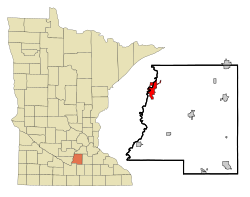
Location in Minnesota
|
|
| Basic data | |
| State : | United States |
| State : | Minnesota |
| Counties : |
Le Sueur County Sibley County |
| Coordinates : | 44 ° 28 ′ N , 93 ° 55 ′ W |
| Time zone : | Central ( UTC − 6 / −5 ) |
| Residents : | 4,058 (as of 2010) |
| Population density : | 291.7 inhabitants per km 2 |
| Area : | 14.56 km 2 (approx. 6 mi 2 ) of which 13.91 km 2 (approx. 5 mi 2 ) is land |
| Height : | 236 m |
| Postal code : | 56058 |
| Area code : | +1 507 |
| FIPS : | 27-36746 |
| GNIS ID : | 654787 |
| Website : | www.cityoflesueur.com |
| Mayor : | Robert "Bob" Broeder |
 The Dr. William W. Mayo House , listed on the NRHP since 1969 |
|
Le Sueur is a small town (with the status " City "), most of which in Le Sueur County , and to a lesser extent in Sibley County in the US -amerikanischen State Minnesota is. In 2010 , Le Sueur had 4058 inhabitants.
geography
Le Sueur is located in central southeast Minnesota on the Minnesota River at 44 ° 27'57 "north latitude and 93 ° 54'32" west longitude. The city extends over 14.56 km², which is spread over 13.91 km² of land and 0.65 km² of water.
Neighboring places to Le Sueur are Henderson (10.1 km north), Belle Plaine (14.9 km northeast), Le Center (22 km southeast) and Ottawa (10.3 km south-southwest).
The nearest major cities are Minneapolis (92 km northeast), Minnesota's capital Saint Paul (102 km in the same direction), Rochester (153 km southeast), Iowa's capital Des Moines (351 km south), Omaha , Nebraska (490 km southwest) , Sioux Falls , South Dakota (287 km west southwest) and Fargo , North Dakota (420 km northwest).
traffic
The US Highway runs through the north of Le Sueur. The Minnesota State Route 112 runs from their northwestern end point as the main road through town and exits to the south. West of the Minnesota River at the confluence with US 169 is the southern end point of Minnesota State Route 93 . In addition to the US 169 bridge in the north of the city, there is another crossing of the Minnesota River near the center of Le Sueur. All other roads within Le Sueur are subordinate roads or inner-city connecting roads.
A railway line of the Union Pacific Railroad , the largest railroad company in the country, runs parallel to the Minnesota River .
By Le Sueur Municipal Airport , a small airfield located south of the city. The nearest major airport is Minneapolis-Saint Paul International Airport (87.2 km northeast).
Demographic data
| Population development | |||
|---|---|---|---|
| Census | Residents | ± in% | |
| 1880 | 1414 | - | |
| 1890 | 1763 | 24.7% | |
| 1900 | 1937 | 9.9% | |
| 1910 | 1755 | -9.4% | |
| 1920 | 1795 | 2.3% | |
| 1930 | 1897 | 5.7% | |
| 1940 | 2302 | 21.3% | |
| 1950 | 2713 | 17.9% | |
| 1960 | 3310 | 22% | |
| 1970 | 3745 | 13.1% | |
| 1980 | 3763 | 0.5% | |
| 1990 | 3714 | -1.3% | |
| 2000 | 3922 | 5.6% | |
| 2010 | 4058 | 3.5% | |
| 1880-2000 2010 | |||
According to the 2010 census , Le Sueur had 4058 people in 1640 households. The population density was 291.7 people per square kilometer. In the 1640 households there were statistically 2.41 people each.
The racial the population was composed of 90.6 percent white, 0.8 percent African American, 0.3 percent Native American, 0.8 percent Asian and 5.9 percent from other ethnic groups; 1.5 percent were descended from two or more races. Hispanic or Latino of any race was 11.9 percent of the population regardless of ethnicity.
25.0 percent of the population were under 18 years old, 58.4 percent were between 18 and 64 and 16.6 percent were 65 years or older. 51.6 percent of the population was female.
The average annual income for a household was 50,906 USD . The per capita income was $ 24,101. 11.3 percent of the population lived below the poverty line.
Individual evidence
- ↑ Extract from the National Register of Historic Places - No. 69000074.Retrieved May 14, 2013
- ↑ a b c American Fact Finder. Retrieved May 14, 2013
- ↑ Distance information according to Google Maps. Accessed on May 14, 2013
- ^ US Decennial Census. Retrieved May 14, 2013
