Leybucht


The Leybucht is the second largest bay in East Friesland after the Dollart , whereas the Jade Bay is historically part of Oldenburg .
location
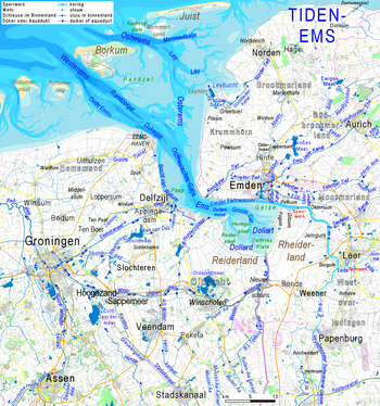
The Leybucht is located in the west of East Friesland between Greetsiel and Westermarsch , about eight kilometers southwest of the city north and about 18 kilometers north of Emden . It has a size of about 19 square kilometers. It forms the border between the Norderland in the east and the Krummhörn peninsula in the south. In the southwest, the artificial Leyhörn peninsula protrudes into the sea, mostly filled by the reservoir of the Leysiel barrage .
history
The Leybucht formed after the first reliably mentioned storm surge on the Dutch coast on December 26th, 838. Around 2500 people fell victim to the forces of nature in the entire coastal area affected by it. After the storm surges of 1374 and 1376, the bay reached its greatest extent with an area of a good 129 km² and reached from Greetsiel in the west to Marienhafe in the east and from the edge of the city in the north to Canhusen (municipality of Hinte ) in the south. In the centuries that followed, polders were repeatedly diked, so that the bay was reduced to its present size by 1950. The last land reclamation took place in the years 1947–1950 with the construction of the Störtebeker dike , which diked the Leybuchtpolder and straightened the coastline. In the following years there were plans to dike the entire bay in order to significantly shorten the dyke line and improve coastal protection. In the end, however, this measure was rejected for nature conservation reasons . Only minor coastal protection measures were implemented (such as the dike in 1991 of the Leyhörn, which has been under nature protection since the end of 1994 ).
To strengthen the dyke systems, the first preparations began in 1985 for the construction of the new Störtebeker dyke, which was completed in 2000 and which is located in front of the old dike, but largely spared the salt marshes .
View from the eastern edge of the Leybucht to the artificial Leyhörn peninsula
Salt marshes "Buscher Heller" on the east bank of the Leybucht. Above the left group of trees behind the dike, the historic Norddeich Radio transmission mast
Todays situation
The Leybucht is located in the Lower Saxony Wadden Sea National Park and belongs to Zone I (quiet zone). It therefore enjoys special protection, not least because of the fauna and flora of the salt marshes .
The Leybuchtpolder was settled in the 1950s and is a district of the city north . The Norder Tief as well as the Old and New Greetsieler Sieltief drain into the Leybucht .
The most important tourist spot on the Leybucht is the Sielort Greetsiel .
See also
Web links
- Site of the Greetsiel National Park House
- Lower Saxony State Office for Water Management, Coastal Protection and Nature Conservation - Coastal Protection Project Leybucht
- The Leybucht - changes due to coastal protection measures
Individual evidence
- ^ Fehntjer Kurier of February 23, 1989 De nich will dieken, de mutt wieken. Retrieved December 25, 2011 .
- ↑ Gerd Ganteför: Climate - The end of the world does not take place (= science experience ). 1st edition. Wiley, Weinheim 2010, ISBN 978-3-527-32671-6 , pp. 225 ( limited preview in Google Book Search).
Coordinates: 53 ° 32 ' N , 7 ° 6' E


