Lichtenmoor
Coordinates: 52 ° 42 ′ 28 " N , 9 ° 21 ′ 28" E
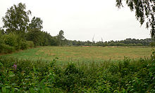
The Lichtenmoor is an originally 50 km² large degenerated raised bog in Lower Saxony . It is located northeast of Nienburg / Weser in the districts of Nienburg and Heidekreis . The peat bog areas are mostly used for agriculture and have been partially reforested. Several areas of the Lichtenmoors are designated as nature conservation or FFH areas.
location
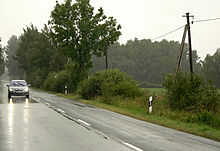
The Lichtenmoor lies northeast of Nienburg / Weser between the rivers Weser and Aller . It is located around 30 km north of the Steinhuder Meer . Two streets run through the Lichtenmoor, running in west-east and north-south direction and intersecting in the center of the area in Lichtenhorst. The places Rethem-Moor, Steimbke , Sonnenborstel, Anderten and Lichtenmoor lie on the edges of the former moor . The Lichtenhorst settlement, which is centrally located in the moor, was only founded in 1919.
history
The Lichtenmoor is named after the fact that it is tree-free, i.e. light . Until the beginning of the 19th century, the moor was largely natural, only on the edge was there peat extraction by the residents of the surrounding villages. In 1765 the first surveying work took place in the moor. In 1792 the Wölpe office sold the first bog land to farmers. The reclamation of the moor began after the regulation of the alp in 1848 , which flows past the moor. During the land consolidation in 1855, the Lichtenmoor was divided. In 1899 the first attempts at cultivation in the moor began from the surrounding villages, which were discontinued in 1905. During the First World War , a prisoner-of-war camp was set up in the moor in 1914 , which was not closed until 1924. After the decision of 1912 in Neustadt am Rübenberge to settle the moor, the first settlers came in 1919. It was landless farmers who founded the Lichtenmoor and Lichtenhorst settlements. In 1934 an oil well was found in the Lichtenmoor.
Flora and fauna
The Lichtenmoor formed several thousand years ago as a raised bog in the rim of an underground salt dome . Today it is a degenerate bog . The peat of the former raised bog was extracted by hand over the centuries by the inhabitants of the surrounding villages. The industrial peat removal of the bog began in 1938, extensively after the Second World War , and is still in operation today. Large parts of the peat high moor landscape today consists of cultivated areas such as grassland , arable land or forest afforestation, but also uncultivated areas.
In 1970, an area of 236 ha was designated as a nature reserve " Lichtenmoor " in the northwest of the Lichtenmoor for the regeneration of the moor. 243 hectares of it, including the entire nature reserve, are designated as FFH area . After the Lower Saxony moor protection program was drawn up in 1981, further parts of the nature reserves “ Steimbker Kuhlen ”, “ Rodewalder Lichtenheide ”, “ Rodewalder Wiehbuschwiesen ” and “ Holtorfer Moor ” were placed under protection, withdrawn from use and rewetted in 1984 and 1985 . The " Weißer Graben " nature reserve followed in 1995 and the " Lichtenmoor peripheral areas " nature reserve in 2016 . The rewetting and dekusselung has partly led to the growth of the raised bog vegetation. Typical plant populations are whistle and cotton grass and heathland. There are also birch, pine and bog forests. The moist grassland of the Lichtenmoors serves as an important breeding and resting area for numerous bird species. It is an important gathering and sleeping place , especially for cranes .
Planned nuclear waste storage facility
In 1976 plans to build an underground nuclear waste repository in the salt dome under the Lichtenmoor became known. Above ground, one should reprocessing plant for nuclear fuel produced. Residents of the surrounding towns founded citizens 'initiatives against the project , including the citizens' initiative against the Lichtenmoor nuclear waste storage facility . On July 16, 1976 about 20 people prevented a planned and approved exploratory drilling. They then occupied the designated drilling site for months. On July 30, 1976, around 600 people gathered in Lichtenmoor to protest against a nuclear waste park. In addition to the Lichtenmoor, locations in the Emsland and in the Südheide as the location of a storage facility were also discussed. In early 1977, the Lower Saxony state government under Prime Minister Ernst Albrecht decided to explore the Gorleben salt dome .
Others
From 1968, a 11-hectare military facility that was inside the Lichtenmoor Bundeswehr with mobile Hawk - aircraft missiles . It was about a kilometer east of the town of Lichtenmoor . After the end of the Cold War , the position was given up and the Bundeswehr unit withdrew in 1993. After that, the complex was used for agriculture and as private property.
See also
Web links
- Landscape profile at the Federal Agency for Nature Conservation
- Photo and description of the air defense position in the Lichtenmoor
- Resistance in 1976 against the nuclear waste dump in Lichtenmoor
Individual evidence
- ↑ Prison camp near the Lichtenhorst community
- ^ Online portal "Lower Saxony Cultural Heritage": poster "Atomic waste - No thanks". In: Lower Saxony Ministry for Science and Culture. Gorleben Archive eV, accessed on July 14, 2019 .


