
List of architectural monuments in Füssen
The monuments of the Swabian city of Füssen are compiled on this page . This table is a partial list of the list of architectural monuments in Bavaria . The basis is the Bavarian Monument List , which was first drawn up on the basis of the Bavarian Monument Protection Act of October 1, 1973 and has since been managed by the Bavarian State Office for Monument Preservation . The following information does not replace the legally binding information from the monument protection authority.

Historical core ensemble
File number: E-7-77-129-1


The ensemble encompasses the historical core of the city of Füssen , which essentially documents the urban development up to the beginning of the 19th century. In addition to the old town, which curves around the Schlossberg and the St. Mang monastery to the north and east, this historical urban space also includes the Baumgarten to the west and the bridgehead at the foot of the Huttersberg, the outer Lech suburb, to the south of the Lech . The boundary is marked by the course of the former city fortifications from 1500, which are still partially preserved, and by the Lech.
The outer Lechvorstadt forms the road system that closes in the east at the former Büchelestor (demolished in 1812), and in the west includes the Church of Our Lady on the Mountain. The political and economic importance of the city since the Middle Ages, but also its historical prerequisites in Roman and early medieval times, have found expression in the floor plan and the building fabric and are largely still clear.
Determining the location of the city is the Lech exit from the Alps, where the high mountains drop particularly suddenly towards the flat land; an elevation on this side of the Lech offered itself as a favorable military checkpoint. With the construction of the Via Claudia (45/46 AD), the Romans further expanded an older Alpine crossing from the Adige Valley to southern Bavaria and strategically used the Schlossberg with the construction of the “Foetibus” fort. The course of the Via Claudia is preserved in the cut between St. Mang-Kloster and Hohem Schloss as well as in Reichenstrasse and has retained its importance as a trade route until 1975 (establishment of a pedestrian zone). A Carolingian royal court and the establishment of a cell by St. Magnus (around 746) formed the actual core of the medieval urban development: The Reichshof itself was probably on the high bank of the Lech - "Auf dem Stein" - on the site of the Lechhalde 2 estate, which later became the official seat of the ministerials of the Welfs and Staufers and the Location within the old city wall, directly at the former Lechtor, indicated (Dr. Georg Guggemoos); this included the early medieval Reichshofkirche St. Stephan - the predecessor of the Franciscan monastery church - and the Reichshofmühle, probably on the site of the former rear mill, at the foot of the castle hill.

The structure of the floor plan and the main structural features of the old town in the Middle Ages were based on these prerequisites and, in the centuries that followed, underwent changes in the external appearance, which in most cases did not impair the historical informative value, but made it clear. The development into a town took place in the 12th century under imperial rule and was promoted and strengthened in the 13th century by the construction of the High Castle, the expansion of the St. Mang monastery and the construction of a city wall. The arch that circumscribes the oldest city wall begins at the former Lech Gate, leads to the peak of the cap and describes a curve along Drehergasse which - comparable to the Wegbach settlement in Memmingen - suggests a former Reichshof settlement; it leads to the Augsburger Tor, along the Hinteren Gasse and ends at the foot of the Schlossberg at the former Knight's Gate.
Within this oldest enclosure there is an alternation of curved narrow streets, irregular, square-like extensions and regular, obviously well-planned parts in a narrow space. Lechhalde, Klosterplatz, Brotmarkt and Schrannenplatz are likely to be in the 12th / 13th centuries. Century the most important squares with a similar ground plan shape; the Reichenstrasse as the main axis of the entire city complex, along the Via Claudia, can be referred to as a planned complex from the Hohenstaufen era due to its spindle-shaped bulge, as well as the development to the west of it, with the Jesuitergasse and the straight Hinteren Gasse on the city wall - the older parts except in the area of Ritterstrasse. At about the same time as the city's first economic boom, it was pledged to the Augsburg bishopric in 1313 by King Henry VII. On the one hand, this brought about the expansion into an episcopal country town and historically confirmed Augsburg's old relationships with St. Mang and the Füssener Land, on the other hand it prevented Füssen from becoming an imperial city. This fact, but also other reasons, such as strict building regulations (1391), contributed to the preservation of the originally medieval scale.
The former function of the city as a stacking and transshipment point for the Italian trade was reflected in a variety of buildings. On the main traffic axes, Lechhalde, St. Mangplatz and the entrance to Reichenstraße, where the road to Kempten branches off (Ritterstraße), weekly and annual markets have always taken place, and wealthy merchants built residential and commercial buildings; Here the development in stately three- to four-storey pitched roof gabled houses achieves imperial urban format. In side streets, such as Hutergasse or Drehergasse, the core of the development is also late Gothic, but smaller in scale. In the 15th century the city gained greater freedom from the bishop, and in 1477 a town hall was built on the corner of Reichenstrasse and Ritterstrasse (demolished in the 19th century).
Around 1503, the Lechvorstadt with the hospital and the rafters' settlement as well as St. Stephan were included in an extension of the city wall; the High Castle was essentially given its current shape, which has made it one of the most beautiful complexes of its kind in Bavarian Swabia. The economic boom in the last decades of the 15th century and at the beginning of the 16th century led to brisk construction activity; many of the houses in the old town essentially date from this period. In addition to trade, handicrafts experienced a significant boom; Craftsmen's houses from the 16th and 17th centuries, often renovated in the 18th century, characterize the face of the city's remote alleys. The canopy houses of the Spitalvorstadt (Flößersiedlung) and the gable-independent, mostly three-storey flat-roof houses on Tirolerstrasse and Schwangauer Strasse - in the type of suburban development of the Alpine foothills - form independent areas within the overall ensemble.
The structural changes made in the 17th century remained within the scope of the traditional layout. The Jesuits chose Reichenstrasse as the location for the Nativity Church (1611) and related the facade to the Kornmarkt, which was of particular importance due to the brisk grain trade in Füssen. After their departure in 1627, the Franciscans founded a monastery near St. Stephen and rebuilt the church. It forms a counterbalance to St. Mang when viewed from the Lech side, its choir is a high-altitude destination in the line of sight of Spitalstrasse.
In the 18th century, the generous new construction of the monastery and the St. Mang monastery church with its richly structured roof area and the characteristic Herkomer thermal baths gave the city view from the south its final, memorable shape.
The 19th century hardly affected the historical building fabric of the old town. Although at the beginning of the 19th century the walls of the city, gates and towers were partially torn down, the moat was abandoned and partially built on (e.g. on Luitpoldstrasse), the basic historical shape and appearance of the old town remained largely intact. New buildings were mainly built outside the walls, the former tree garden of the Pröbste was redesigned into a park with a pavilion and trees. Far-reaching changes took place as a result of the new economic development from the middle of the 19th century. The Hanfwerke (later HFI) started building the Lechgriess opposite St. Mang and the High Castle in 1862 and initiated the planned expansion of the 19th and 20th centuries with the construction of a large workers' settlement in the north of the city in the last quarter of the century.
City fortifications
The first wall, probably built with the High Castle in the late 13th century, was renewed around 1338 under Bishop Friedrich. Around 1502 the wall was expanded to include St. Stephen's Church and the Spitalvorstadt. Large parts were demolished in the 19th century. In the oldest areas, the wall was built in quarry stone, in more recent brick masonry. The following sections have been preserved:
- Preserved remains of the wall from the 14th century in the west, directly adjoining the High Castle, sloping down like stairs towards Ritterstraße with loopholes
- a small section immediately behind the Nativity Church
- Remains of the former Knight's Gate on the Ritterstrasse building
- Behind the property at Hintere Gasse 13, 27: Remnants of the wall
- Luitpoldstrasse 1: Remnants of the wall
- At the rear building of Reichenstrasse 33: Remnants of the wall
- Behind Augsburger-Tor-Platz 2, 4, 6, Schrannengasse 7 and then
- Seiler or Hirschwirtsturm, semicircular tower from the 14th century with pinnacles from the 19th century
- Drehergasse 20, 40, 42
- Parts of the city wall of the 13th / 14th centuries Century between Drehergasse 4 and Spitalgasse 1, low wall, interrupted several times (on the city wall)
- City wall of the 15th century from the Sebastianstor (bevelled pointed arch gate) along the old cemetery to the Bleichertörle, wall partially with battlements, four round towers with conical roofs, Bleichertörle at Franziskanerplatz 5½
- Wall sections on Faulenbachgäßchen below the St. Mang monastery to the outer gate of the castle in the west
File number: D-7-77-129-1.
City wall at Rittergasse 25

Sebastianstraße 2, Seiler or Hirschwirtsturm

Gate Drehergasse 6

Sebastianstor

Wall tower northwest of Klosterstrasse 3

Wall tower south of Franziskanerplatz 3


The only surviving city gate has its own file number.
| location | object | description | File no. | image |
|---|---|---|---|---|
| Franziskanerplatz 5 1/2 ( location ) |
City gate | So-called Bleichertörle, 1770–1817 apartment of a hermit, therefore also called Franziskanertor or Klause, rectangular tower with western stepped gable and pointed arched passage, above it a relief with double coat of arms of Augsburg Bishop Friedrich II. Von Zollern and inscription with "1503", built 1499–1503, as well as with the following section of the city fortifications, 15th century | D-7-77-129-80 |

|
Architectural monuments according to districts
Feet
| location | object | description | File no. | image |
|---|---|---|---|---|
| Augsburger Strasse 3½ ( location ) |
Residential building | Two-storey hipped roof building, around 1860/70 | D-7-77-129-6 |

|
| Augsburger Strasse 11 ( location ) |
Hip roof house | Two-storey hipped roof building with late Classicist wall structure and central projection, around 1870/80 | D-7-77-129-7 |

|
| Augsburger Strasse 16 ( location ) |
Residential building | Two-storey hipped roof building with a dwelling, flat bay window and corner bay window tower in clinker brickwork with ashlar elements, around 1860 | D-7-77-129-8 |

|
| Augsburger Straße 19 ( location ) |
villa | So-called Villa Luitpold, two-storey hipped mansard roof building with a tower with a tent roof and lantern in clinker brickwork with stone corner blocks, around 1895 | D-7-77-129-9 |

|
| Augsburger Strasse 49 ( location ) |
Catholic branch church ("field church") St. Ulrich and Afra | Hall construction with a gable roof, western octagonal ridge turret with a curved tent roof over the choir and wall structure, probably built in 1725 by Johann Georg Fischer; with equipment |
D-7-77-129-3 |
 more pictures |
| Augsburger Straße 62 ( location ) |
Morgue | Hipped roof construction with central turret with tent roof, side arms with gable roofs and arcade vestibule, 1925 to 1929 by Hans Grässel ; with equipment |
D-7-77-129-4 |
.jpg) more pictures |
| Augustenstrasse 10 ( location ) |
villa | Two-storey hipped roof building with a dwarf house, balconies and bay windows, built in 1911 | D-7-77-129-217 |

|
| Bahnhofstrasse 3 ( location ) |
hotel | Three-storey hipped roof building with a dwelling and neo-baroque facade decoration, marked 1902 | D-7-77-129-13 |
 more pictures |
| Bahnhofstrasse 6 ( location ) |
Residential building | Three-storey saddle roof building with round corner and flat bay windows and a dwelling and facing gables, historicistic, around 1905 | D-7-77-129-121 |
 more pictures |
| Baumgarten ( location ) |
Fountain house | Artificial ruin with a well grotto, labeled "1897" | D-7-77-129-15 |
.jpg) more pictures |
| Brotmarkt 1 ( location ) |
Residential and commercial building | Three-storey corner house with a mansard roof, mid-house, gable crowns and wall structure, essentially the second half of the 17th century, redesigned around 1870/80 | D-7-77-129-17 |
 more pictures |
| Brotmarkt 2 ( location ) |
Residential and commercial building | Two-storey corner building with a gable roof, beveled pointed arch entrance, late Gothic core | D-7-77-129-18 |
 more pictures |
| Brotmarkt 3 ( location ) |
Residential and commercial building | Three-storey gable building with a gable roof, late Gothic beamed ceiling and baroque medallion fresco of Our Lady | D-7-77-129-19 |
 more pictures |
| Brotmarkt 4 ( location ) |
Inn | Two-storey saddle roof building with a late Gothic stepped gable with pointed arches and tracery-like plaster decorations from the 19th century | D-7-77-129-20 |
 more pictures |
| Brotmarkt 6 ( location ) |
Residential and commercial building | Three-storey eaves side house with a steep gable roof, the core is probably late Gothic | D-7-77-129-21 |
 more pictures |
| Brotmarkt 7, 7 1/2 ( location ) |
Residential and commercial building | Three-storey gabled house with a gable roof and wide basket arch frieze, probably the second half of the 16th century | D-7-77-129-22 |
 more pictures |
| Brotmarkt 8 ( location ) |
Residential and commercial building | Three-storey eaves-sided house with a steep gable roof, broken facade, pointed arched entrance with fluted on the back as part of the former city fortifications, late Gothic in the core, as well as window frames from the 19th century | D-7-77-129-23 |
 more pictures |
| Brotmarkt 9, Hutergasse 8 ( location ) |
Inn | Three-storey corner house with a pitched roof, partly recessed gable facade, late Gothic in the core, as well as a stone lion head in the shape of a gargoyle at the back, probably from the 13th century | D-7-77-129-24 |
 more pictures |
| Brotmarkt 10 ( location ) |
Residential and commercial building | Four-storey corner building with a flat gable roof and drawn-in eaves-side facade, in the core probably 17th / 18th. Century, 19th century remodeling, as well as with a classicist front door, around 1800 | D-7-77-129-25 |
 more pictures |
| Brunnengasse 3 ( location ) |
Residential and commercial building | Four-storey eaves side building with saddle roof, 17th century core, and plaster cuboid strips, first half 19th century | D-7-77-129-26 |
 more pictures |
| Brunnengasse 4 ( location ) |
Residential and commercial building | Four-storey gable building with flat gable roof, segmented arched entrances and smooth plaster strips around the windows, in the core 18th century, remodeling in the 19th century | D-7-77-129-27 |
 more pictures |
| Brunnengasse 5 ( location ) |
Residential and commercial building | Four-storey eaves side building with saddle roof and rectangular entrance in sandstone setting, marked "1783" | D-7-77-129-28 |
 more pictures |
| Brunnengasse 6 ( location ) |
Residential and commercial building | Four-storey gable building with flat gable roof, two flat cores and segmental arch openings, in the core probably 16./17. Century, renewed at the beginning of the 20th century, and with a house figure, third quarter of the 18th century | D-7-77-129-29 |
 more pictures |
| Brunnengasse 7 ( location ) |
Residential and commercial building | Four-storey gable building with a gable roof, beveled arched openings and ridge attachment, in the core 17th / 18th century. Century, mid-19th century remodeling | D-7-77-129-30 |
 more pictures |
| Brunnengasse 12 ( location ) |
Residential and commercial building | Four-storey gable building with flat gable roof, the core probably 16th century, arched entrance with relief, above entrance marked with "1752", as well as with facade stucco from 1901 | D-7-77-129-31 |
 more pictures |
| Brunnengasse 14 ( location ) |
Residential and commercial building | Four-storey gable building with flat gable roof, 18th century | D-7-77-129-32 |
 more pictures |
| Brunnengasse 15 ( location ) |
Residential and commercial building | Four-storey gable building with flat gable roof, knee-height, loading hatch, plaster grooves on the ground floor and basket arched door with fighters and apex, second quarter of the 18th century | D-7-77-129-33 |
 more pictures |
| Brunnengasse 16 ( location ) |
Residential and commercial building | Four-storey gable building with pitched roof and ridge attachment, in the core 17th / 18th. century | D-7-77-129-34 |
 more pictures |
| Brunnengasse 18 ( location ) |
Residential and commercial building | Former home of the sculptor Anton Sturm, three-storey gable building with a gable roof, arched entrance, rear arbor with balusters, probably 17th century in the core, and sandstone relief by the artist, inscribed "1724" Rear building, farm building and former workshop of Anton Strum, in the core probably 16./17. Century, mansard roof probably 18th century |
D-7-77-129-35 |
 more pictures |
| Brunnengasse 19 ( location ) |
Former inn, now residential and commercial building | Three-storey eaves side building with saddle roof, "Ohrwaschl" and basket arch entrance, in the core the second half of the 17th century | D-7-77-129-36 |
 more pictures |
| Brunnengasse 20 ( location ) |
Residential and commercial building | Three-storey gable building with flat gable roof, high knee, ridge pinnacle and rear extension, the core around 1600, inner door marked “1612”, rebuilt in the 19th century, the interior partially renewed Rear building, barn with pitched roof, marked "1767", the core is late medieval |
D-7-77-129-37 |
 more pictures |
| Drehergasse 1 ( location ) |
Residential building | Four-storey gable building with flat gable roof, pent roof extension, loading hatch and eaves bower, 19th century, as well as with wooden keel arch lintel inset on the gable side, marked "1709" | D-7-77-129-38 |
 more pictures |
| Drehergasse 4, 4½ ( location ) |
Residential building | Gable-independent semi-detached house with protruding flat gable roof, loading hatch, boarded frame construction on the north upper floor, 16th century, and part of the city fortifications, 13th / 14th centuries. century | D-7-77-129-39 |
 more pictures |
| Drehergasse (between No. 4 and 6) ( location ) |
City wall gate | Round arched passage, above round arch niche with oil painting and mount of olives scene and window opening, early 18th century | D-7-77-129-40 |
.jpg) more pictures |
| Drehergasse 8 ( location ) |
Residential building | Three-storey gable building with a pitched roof and segment-arched loading hatch, the core of the 18th century | D-7-77-129-41 |
 more pictures |
| Drehergasse 12 ( location ) |
Residential building | Three-storey gable building with a pitched roof and arched loading hatches, the core of the 18th century | D-7-77-129-42 |
 more pictures |
| Drehergasse 15 ( location ) |
Residential building | Three-storey gable building with a pitched roof, arched loading hatch and profiled light openings, the core of the 16th century | D-7-77-129-43 |
 more pictures |
| Drehergasse 17 ( location ) |
Residential building | Four-storey gable building with flat gable roof, protruding canopy and profiled arches; first half of the 18th century | D-7-77-129-44 |
 more pictures |
| Drehergasse 18 ( location ) |
Residential building | Three-storey gable building with a two-storey extension and saddle roofs, in the core around 1500, as well as two flat, round extensions of the former city fortifications, 14th century | D-7-77-129-45 |
 more pictures |
| Drehergasse 22 ( location ) |
Residential building | three-storey gable building with pitched roof and arched loading hatch, in the core 17th / 18th century century | D-7-77-129-46 |
 more pictures |
| Drehergasse 24 ( location ) |
Residential building | Three-storey gable building with a protruding flat gable roof, the core of the 18th century | D-7-77-129-47 |
more pictures |
| Drehergasse 30 ( location ) |
Residential building | three-storey eaves side house with pitched roof and elevator dormer, in the core 17./18. century | D-7-77-129-48 |
 more pictures |
| Drehergasse 36 ( location ) |
Residential building | three-storey gable building with protruding flat gable roof and elevator openings, 2nd half of the 18th century | D-7-77-129-49 |
 more pictures |
| Drehergasse 38 ( location ) |
Residential and commercial building | three-storey gable building with a protruding flat gable roof, the core of the 18th century | D-7-77-129-50 |
 more pictures |
| Drehergasse 44 ( location ) |
Residential and commercial building | Four-storey eaves side house with saddle roof and split cornice from the middle of the 19th century, older in the core | D-7-77-129-53 |
 more pictures |
| Drehergasse 46/48 ( location ) |
Residential and commercial building | Three-storey semi-detached house with a pitched gable roof, retracted gable, segment arch openings and loading hatches, in the core 16./17. century | D-7-77-129-54 |
 more pictures |
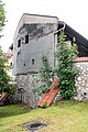
| Faulenbachgäßchen 3, 5, 7 ( location ) |
Former rear mill | Short row of houses in eaves position, two-storey pitched roof buildings, in the core 1582, renovated at the end of the 19th century | D-7-77-129-55 |

|
| Floßergasse 1 ( location ) |
Residential building | Three-storey gable building with an extended flat gable roof with grooved rough plaster on the ground floor, in the core 18th century | D-7-77-129-58 |

|
| Floßergasse 2 ( location ) |
Residential building | Two-storey gable building with a flat gable roof, arched frieze over the entrance on the gable side, fresco and post construction with gazebo covered on the back, the core of the 16th century, as well as the eaves side with carved double-wing door, around 1800 | D-7-77-129-59 |
 more pictures |
| Floßergasse 3 ( location ) |
Residential building | Three-storey gable building with a pitched roof and segmental arched entrance, the core of the 16th century | D-7-77-129-122 |

|
| Floßergasse 5 ( location ) |
Residential building | Three-storey gable building with a gable roof, tail gable and smooth plaster decoration from the 19th century, in the core 17th / 18th. century | D-7-77-129-60 |

|
| Floßergasse 7 ( location ) |
Residential building | Two-storey corner building with a protruding flat gable roof and a high knee stick, the core of the 18th century | D-7-77-129-61 |

|
| Floßergasse 9 ( location ) |
Residential building | Three-storey gable building with protruding flat gable roof and smooth plaster strips, the core of the 18th century | D-7-77-129-62 |

|
| Floßergasse 17 ( location ) |
Residential building | Three-storey gable building with protruding flat gable roof, boarded gable and protruding part of the house, in the core 16./17. century | D-7-77-129-63 |

|
| Floßergasse 18 ( location ) |
Residential building | Three-storey eaves side building with flat gable roof, cantilevered upper storey and double front door in a bevelled niche, the core of the 16th century | D-7-77-129-64 |

|
| Floßergasse 19 ( location ) |
Residential building | Three-storey gable building with a protruding flat gable roof, marked "1663" on the ridge beam | D-7-77-129-65 |

|
| Floßergasse 21 ( location ) |
Residential building | Three-storey gable building with a flat gable roof and the upper storey protruding on the gable side on strong, fluted beam heads, in the core 16./17. century | D-7-77-129-66 |

|
| Floßergasse 23 ( location ) |
Residential house, semi-detached house | Three-storey flat gable roof building with blown gable, in the core 17th / 18th century. century Barn extension, boarded post construction with flat saddle roof, 18th century |
D-7-77-129-67 |

|
| Floßergasse 27 ( location ) |
Residential building | Three-storey gable building with flat gable roof, boarded gable field, short, profiled arches and fresco, there marked with "1706" | D-7-77-129-68 |

|
| Franziskanergasse 1 ( location ) |
Residential and commercial building | Three-storey gable building with pitched roof, arched openings and loading hatch, essentially the second half of the 17th century, relief on the gable side marked with "1790" | D-7-77-129-69 |
 more pictures |
| Franziskanergasse 3 ( location ) |
Residential building | Three-storey eaves side building with flat gable roof, elevator hatch and transverse oval windows, in the core 17th / 18th. century | D-7-77-129-70 |
 more pictures |
| Franziskanergasse 4 ( location ) |
Residential building | Three-storey corner building with a pitched roof, segmented arched door and smooth plastered window frame, second third of the 19th century | D-7-77-129-71 |
 more pictures |
| Franziskanergasse 5 ( location ) |
Residential and commercial building | Three-storey gable building with protruding flat gable roof, in the core 17th / 18th century. century | D-7-77-129-72 |
 more pictures |
| Franziskanergasse 7 ( location ) |
Old rectory | Three-storey eaves construction with pitched roof, segmental arch openings and stucco facade, in the core of the 16th century, since 1632 rectory | D-7-77-129-73 |
 more pictures |
| Franziskanergasse 14 ( location ) |
Residential building | Four-storey gable building with a pitched roof, the core of the 16th century, shop facade in the second half of the 19th century | D-7-77-129-74 |
 more pictures |
| Franziskanergasse 16 ( location ) |
Residential building | Three-storey gable building with loading hatch and segment arched door, probably 16th century core, and wooden door on the eaves side, 19th century | D-7-77-129-76 |
 more pictures |
| Franziskanerplatz 1 ( location ) |
Franciscan monastery in structural connection with the Franciscan church | Two-storey two-wing complex with hipped gable roofs, west wing built 1629–31 by Georg Schmuzer , south wing with the former brewery supplemented by Johann Jakob Herkommer from 1711–14 , house chapel in the west wing; with fittings, |
D-7-77-129-77 |

|
| Franziskanerplatz 3 ( location ) |
Catholic Franciscan Church of St. Stephan, monastery church since 1628, convent since 1913 | Hall building with saddle roof, easterly turret with onion dome and retracted choir, 1763/64 new building based on plans by Franz Karl Fischer , consecrated in 1767; with equipment |
D-7-77-129-78 |
 more pictures |
| Franziskanerplatz 5 ( location ) |
Residential building | Two- and three-story semi-detached house, structurally connected to the Bleichertor, with pitched roofs and three stepped gables, neo-Gothic, built around 1830 | D-7-77-129-79 |
 more pictures |
| Glückstrasse 2 ( location ) |
villa | Two-storey mansard roof building with balconies and neoclassical wall structure, around 1870 | D-7-77-129-81 |

|
| Hintere Gasse 13 ( location ) |
Residential building | Three-storey gable building with a protruding flat gable roof, 18th century, as well as part of the former city fortifications, 14th century | D-7-77-129-83 |

|
| Hintere Gasse 15 ( location ) |
Residential building | Three-storey eaves side building with a gable roof, basket arch gate and plaster structures from the 19th century, older in the core | D-7-77-129-84 |
 more pictures |
| Hintere Gasse 17 ( location ) |
Residential building | Two-storey side eaves building with saddle roof, gable, chiselled panel door with skylight grille, in the Biedermeier appearance, around 1835/40, in essence older | D-7-77-129-85 |
 more pictures |
| Jesuitergasse 7 ( location ) |
Residential building | Residential building, narrow three-storey side eaves building with saddle roof and late classicist front door, the core around 1481 (dendro.dat.) With conversions in the 17th century and 1759/60 (dendro.dat.). | D-7-77-129-88 |

|
| Jesuitergasse 9 ( location ) |
Corner house | Flat roof building, the core of the 1st half of the 18th century | D-7-77-129-89 |

|
| Kaiser-Maximilian-Platz 1 ( location ) |
Residential building | Now partly tourist information, corner building, three-storey two-wing building with a flat hipped roof, flat gables and neo-classical facade structure, around 1860/75 | D-7-77-129-10 |

|
| Kaiser-Maximilian-Platz 6 ( location ) |
villa | Two-storey hipped roof building with a semicircular corner bay window with tent roof, dwarf house, balcony, arched openings and fresco, neo-baroque, after 1900, as well as with part of the former city fortifications, 14th century | D-7-77-129-12 |

|
| Kalvarienberg ( location ) |
Calvary | The Hutlerberg has been designed since 1837 with the erection of a summit cross by Pastor Johann Baptist Graf, consecrated in 1842 Chapel, integrated into the three-
eighteenth- century branch of the Catholic branch church of Our Lady on the Mountain, mid-19th century |
D-7-77-129-190 |
 more pictures |
| Karlstrasse 1-12 ( location ) |
Part of the workers' housing estate of the Hanfwerke Füssen-Immenstadt | Three-storey solid buildings with saddle and hipped mansard roofs with cornices and partly with gables and risalits, historical, built from 1878, see also Marienstraße 6/7/8, 6 1/2, 10/11/12, 10 1/2, 12 1 / 2, 14/15/16, 14 1/2, 16 1/2 and Theresienstraße 1, 3, 5, 7, 9, 11 and 13 | D-7-77-129-90 |
_ehem_Hanfwerke-Arbeitersiedlung.JPG)
|
| Kemptener Straße 2 ( location ) |
villa | Three-storey hipped mansard roof building with a dwelling with a ridge top, gable, bay window, balcony and neo-baroque wall structure, 1901 | D-7-77-129-91 |

|
| Kemptener Straße 9/11 ( location ) |
Two oil paintings | Two oil paintings, on sheet metal, around 1870/80. | D-7-77-129-92 | |
| Klosterstrasse 3; Near Blutanger; |
Catholic cemetery church of St. Sebastian | Predecessor building erected as a chapel in 1507, cemetery church, sacristy, added in 1683 by Johann Schmuzer , hall building with saddle roof, rounded pointed arch, high oval and wide semicircular windows as well as north tower with pitched roof, 1700 plan of a new building by Johann Jakob Herkommer , but only from 1721 renewal the nave by Mang Schuster based on designs by Johann Georg Fischer while preserving the original choir, consecrated in 1725; with equipment |
D-7-77-129-93 |
.jpg) more pictures |
| Klosterstrasse 6 ( location ) |
Former garden pavilion | Now integrated into the southern corner of a 19th century house, with a mansard hood and weather vane with the Füssen coat of arms, labeled "1740" | D-7-77-129-94 |

|
| Klosterstrasse 10 ( location ) |
villa | Three-storey hipped roof building with balconies and Art Nouveau ornaments, around 1905 | D-7-77-129-95 |

|
| Ländeweg ( location ) |
Boundary marking | Above is a coat of arms carved into the rock with the year 1773, which shows the Austrian shield on the left and the coat of arms of the Abbey of Augsburg on the "hanging wall" on the right. The lower rock marking refers to the border treaty between the Kingdom of Bavaria and Austria from 1844. On the left of the Lech, southwest of Bad Faulenbach |
D-7-77-129-96 |

|
| Lechhalde 2 and 2½ ( location ) |
Residential and commercial building | Three-storey gable building with flat gable roof, loading hatch and irregular openings and niches on the southern eaves side, early 16th century | D-7-77-129-97 |
 more pictures |
| Lechhalde 3, Magnusplatz 1 ( location ) |
Former Benedictine monastery of St. Mang, town hall and museum since 1909 | Extensive, partly irregular four-wing system with three inner courtyards of different sizes, hipped roofs, different numbers and heights of floors, as well as round and flat cores, some with hoods One- and two-storey north wing, three-storey east wing with arched entrance with overlying Frssko, 1732 probably by Johann Heel 9, and dormer with curved gable elongate three- and four-story south wing as a shop facade with three transverse buildings, for arched and oval windows, mid century |
D-7-77-129-98 |
 more pictures |
| Lechhalde 4 ( location ) |
Residential and commercial building | Three-storey gable building with a pitched roof, basket arch and round arch openings, in the core probably first half of the 16th century | D-7-77-129-99 |
 more pictures |
| Lechhalde 6 ( location ) |
Residential and commercial building | Three-storey gable building with pitched roof, late Gothic gable field with round arches and three keel arch openings, beginning of the 16th century, roof structure marked "1603", as well as frescoes of the Mother of God and window frames, mid-19th century | D-7-77-129-100 |
 more pictures |
| Lechhalde 8 ( location ) |
Residential and commercial building | Previously rectory, former monastery high school, three-storey eaves side building with saddle roof, flat bay window, wall structure and segmental arch opening, late Gothic core, historicized in 1914 | D-7-77-129-101 |
 more pictures |
| Lechhalde 10 ( location ) |
Residential and commercial building | Four-storey gable building with a gable roof, ridge attachment, 17th century core, and carved front door, around 1800 | D-7-77-129-102 |
 more pictures |
| Prinzregentenplatz ( location ) |
Luitpold monument | Monument to the Prince Regent Luitpold, bronze figure with base reliefs cast by Hans Clement according to a design by Alois Mayer , inscribed "1902" | D-7-77-129-103 |
 more pictures |
| Magnusplatz 2 ( location ) |
Residential and commercial building | Four-storey gable building with pitched roof and ridge attachment, 16./17. century | D-7-77-129-106 |
 more pictures |
| Magnusplatz 4 ( location ) |
Residential and commercial building | Four-storey gable building with saddle roof, ridge attachment and weather vane, 16./17. century | D-7-77-129-107 |
 more pictures |
| Magnusplatz 6 ( location ) |
Residential and commercial building | Four-storey gable building with a pitched roof and gable divided by rising clover-leaf arches, two elevator openings and two windows, end of the 15th century | D-7-77-129-108 |
 more pictures |
| Magnusplatz 10 ( location ) |
High castle | Three-wing complex around an elongated courtyard on a plateau sloping steeply to the north, south and west, construction 1269–92, expanded in 1322 and included in the city fortifications in 1363, in 1486–1505 extensive renovations under Bishop Friedrich II of Zollern , in 1499 probably by Fidelis Eichele illusionistic Wall paintings executed on the courtyard facades West wing, in the center five-storey prison tower with a tented roof as a semicircular jutting-out keep to the west with a straight line to the courtyard side, probably built in 1291, with three- and four-storey connecting wings on both sides with gable roofs, individual floors from different construction phases as well as small oriels on corbels with conical roof and on the north-west corner Storchenturm, originally called Hohes Haus, built until 1292, with a saddle roof and stepped gable with branches, raised in 1322–63, |
D-7-77-129-109 |
 more pictures |
| Magnus kick, Near Lech; |
"Magnus kick" | So-called Magnus step, two shoe-shaped depressions on the Lechfall, labeled "1726" Iron cross, marked "1730", with accompanying figures |
D-7-77-129-193 |
_IMG_6797.JPG)
|
| Marienstraße 6-8, Marienstraße 10-12, |
Parts of the former workers' housing estate of the Füssen-Immenstadt hemp works | Three-storey solid buildings with saddle and hipped mansard roofs with cornices and some with gables and risalits, historical, built from 1878, see also Karlstrasse 1-12 and Theresienstrasse 1, 3, 5, 7, 9, 11 and 13 | D-7-77-129-123 |

|
| Mühlbachgasse 3, Mühlbachgasse 4 |
Head of the central wing of the Füssen-Immenstadt hemp works | Two-story administration building with a tent roof, dormers, arched windows and cornice, Heimatschutz style, built in 1916 | D-7-77-129-124 |

|
| Ottostraße 1 ( location ) |
villa | Two-storey solid construction with a protruding gable roof, bay tower with tent roof, wooden arcades and balconies on the ground floor bay window, neo-Renaissance, around 1900 Enclosure, brick pillars with wrought iron fence, at the same time |
D-7-77-129-126 |

|
| Reichenstrasse 1 and 1a ( location ) |
Residential and commercial building | Three-storey eaves corner house with saddle roof, probably 17th century core, and bay window on half-column, around 1930 | D-7-77-129-127 |

|
| Reichenstrasse 3 ( location ) |
Residential and commercial building | Four-storey gable building with flat gable roof and cornice strips, renewed over the older core in the middle of the 19th century | D-7-77-129-110 |

|
| Reichenstrasse 5 ( location ) |
Residential and commercial building | Four-storey gable building with pitched roof, ridge top, in the core 16./17. Century, and cornice structure of the 19th century | D-7-77-129-111 |

|
| Reichenstrasse 7 ( location ) |
Residential and commercial building | Narrow four-storey gable building with a pitched roof and late Gothic stepped gable with keyhole-shaped openings and large tracery panels, around 1500 | D-7-77-129-112 |

|
| Reichenstrasse 8 ( location ) |
Residential and commercial building | Three-storey eaves side building with pitched roof, arched entrance and corner cuboid, in the core 16./17. century | D-7-77-129-113 |
 more pictures |
| Reichenstrasse 10 ( location ) |
Residential and commercial building | Three-storey eaves side building with a saddle roof, in the core of the 16th century, and historicist wall structure, renewed in 1830/40 | D-7-77-129-114 |
 more pictures |
| Reichenstrasse 16 ( location ) |
Residential and commercial building | Three-storey eaves side building with pitched roof, the core of the 16th century | D-7-77-129-115 |
 more pictures |
| Reichenstrasse 18 ( location ) |
Residential and commercial building | Three-storey eaves side building with saddle roof, gable and neo-classical wall structure, around 1870/90, probably older in the core | D-7-77-129-117 |
 more pictures |
| Reichenstrasse 20/22 ( location ) |
Residential and commercial building | Three-storey eaves side building with saddle roof, arched gate entrance, core around 1700, and with a house figure, attributed to Anton Sturm, inscribed in a cartouche with "1716" | D-7-77-129-128 |
 more pictures |
| Reichenstrasse 21 ( location ) |
Residential and commercial building | Three-storey side eaves building with saddle roof and neo-Renaissance structure, second half of the 19th century | D-7-77-129-118 |
 more pictures |
| Reichenstrasse 23 ( location ) |
Residential and commercial building | Three-storey eaves side building with saddle roof, in the core 16./17. Century, as well as with rosette frieze and tooth frieze, facade third quarter of the 19th century | D-7-77-129-129 |
 more pictures |
| Reichenstrasse 29 ( location ) |
Sandstone relief | Our Lady, around 1500 | D-7-77-129-130 |
 more pictures |
| Reichenstrasse 31 ( location ) |
Catholic Nativity Church of St. Nicholas | Hall building with saddle roof with ridge turret, curved volute gable, high oval and round arched windows as well as central axis as a basket arched niche, previous building erected in 1611, new building by Johann Jakob Herkommer in 1717 , completed by Johann Georg Fischer by 1718 ; with equipment |
D-7-77-129-119 |
 more pictures |
| Ritterstrasse 1 ( location ) |
Gabled house | House with ridge attachment, probably 16./17. Century, front door around 1800. | D-7-77-129-131 |
 more pictures |
| Ritterstrasse 2 ( location ) |
Eaves side house | Eaves side house, with arched passage, wall approach of the town hall, demolished in 1837/39; in the Flachdachstadel courtyard, 18./19. century |
D-7-77-129-132 |
 more pictures |
| Ritterstrasse 3 ( location ) |
Gabled house | Gable house, ridge attachment, in the core 16./17. century | D-7-77-129-133 |
more pictures |
| Ritterstrasse 5 ( location ) |
Gabled house | Gable house, ridge attachment, in the core 16./17. century | D-7-77-129-134 |

|
| Ritterstrasse 7 ( location ) |
Gabled house | Gable house, ridge attachment, in the core 16./17. century | D-7-77-129-135 |

|
| Ritterstrasse 9 ( location ) |
Gabled house | Gabled house, in the core 17./18. Century, renewed. | D-7-77-129-136 |

|
| Ritterstrasse 10 ( location ) |
Gable-free flat roof house | Gabled flat roof house, dye arbor under the ridge, in the core of the 2nd half of the 17th century | D-7-77-129-137 |

|
| Ritterstrasse 11 ( location ) |
Gabled house | Slightly protruding facade part, 17th century | D-7-77-129-138 |

|
| Ritterstrasse 13 ( location ) |
Gabled house | Projecting part of the facade, 17th century | D-7-77-129-139 | |
| Ritterstrasse 14 ( location ) |
Former front paint | Corner house with half-hipped roof, 17th century and first third of the 19th century | D-7-77-129-140 |
 more pictures |
| Ritterstrasse 15 ( location ) |
Eaves side house | Gable, around 1840/50, in the core probably 1569. | D-7-77-129-141 |

|
| Ritterstrasse 17 ( location ) |
Eaves side house | Slightly protruding window strip, the core of the 16th century | D-7-77-129-142 |
 more pictures |
| Ritterstrasse 25 ( location ) |
Outbuildings | Former dye works, supposedly built in 1812, flat roof, drying scaffolding under the eaves and remains of the wall of the knight's gate, which was demolished in 1812; see city fortifications. |
D-7-77-129-143 |
.jpg)
|
| Rupprechtstrasse 1 ( location ) |
Tax office | Mansard roof house with rich facade structure, neo-baroque, around 1900. | D-7-77-129-144 |

|
| Schrannengasse 5 ( location ) |
Gabled house | Profiled arched opening on the ground floor, mid-16th century; Extension of the former “Rose” inn, reworked. |
D-7-77-129-145 |
 more pictures |
| Schrannengasse 7 ( location ) |
Former Episcopal Augsburg City Bailiwick | Now a Catholic journeyman's house, gabled house, with a round arched entrance under recessed window axes, Renaissance arcades on the courtyard side, first half of the 16th century; with equipment; |
D-7-77-129-146 |
 more pictures |
| Schrannengasse 8 ( location ) |
Eaves side house | House with a late Gothic beamed ceiling. | D-7-77-129-147 |
 more pictures |
| Schrannengasse 9 ( location ) |
Eaves side house | Eaves side house, mid-16th century | D-7-77-129-148 |
 more pictures |
| Schrannengasse 10 ( location ) |
Wheat brewery | Wheat brewery, gabled house, 16th century | D-7-77-129-149 |
 more pictures |
| Schrannengasse 11 ( location ) |
Gabled house | Steep gable roof, beveled Korbgogene entrance, shop dormer and half gable, 16./17. century | D-7-77-129-150 |
 more pictures |
| Schrannengasse 12 ( location ) |
Former granary | Former granary (fire house), built in 1483, with a pent roof staircase and clock tower, built around 1570. | D-7-77-129-151 |
 more pictures |
| Schrannengasse 13 ( location ) |
Biedermeier house | Biedermeier house, gable facing eaves, around 1835/50. | D-7-77-129-152 |
 more pictures |
| Schrannengasse 15 ( location ) |
Steep gabled house | In the core second half of the 16th century, gable frieze in the second half of the 19th century | D-7-77-129-153 |
 more pictures |
| Schrannengasse 17 ( location ) |
Inn | Stately gabled house with round arch access, in the core 16./17. century | D-7-77-129-154 |
 more pictures |
| Schwangauer Str., South ( location ) |
Wayside shrine | Renewed in the 19th century; south on Schwangauer Strasse. |
D-7-77-129-191 | |
| Schwangauer Strasse, south ( location ) |
Landmark | Border stone with two coats of arms, marked 1785; east of the city, south on Schwangauer Strasse. not re-qualified |
D-7-77-129-192 | |
| Schwangauer Straße 1 ( location ) |
Former inn | Stately corner house on the Lechbrücke, with a steep gable roof and basket arch entrance, in the core 17th / 18th century. century | D-7-77-129-155 |
 more pictures |
| Schwangauer Straße 2 ( location ) |
Gabled house | Neo-Renaissance structure, older in essence | D-7-77-129-156 |
 more pictures |
| Schwangauer Straße 4 ( location ) |
Gabled house | Flat roof and bevelled basket arch gate, in the core 17./18. century | D-7-77-129-157 |

|
| Schwangauer Straße 15 ( location ) |
Residential building | Hipped roof building with blown, flat mansard gable, first quarter of the 19th century | D-7-77-129-158 |

|
| Klosterstraße 2, Sebastianstraße 6, 8, 10, 12 ( location ) |
Workers' residential complex of the Hanfwerke Füssen-Immenstadt | picturesque Art Nouveau, 1905 by Johannes Schobloch (Munich). | D-7-77-129-214 |
 more pictures |
| Spitalgasse ( location ) |
Section of the city wall | 13./14. Century; between No. 5 and Drehergasse 4. |
D-7-77-129-159 | |
| Spitalgasse 2 ( location ) |
Catholic Hospital Church of the Holy Spirit | Centralizing building with painted north facade, built in 1748/49 by Franz Karl Fischer ; with equipment |
D-7-77-129-160 |
.jpg) more pictures |
| Spitalgasse 4 ( location ) |
Former town mill | New hospital, three-storey hipped roof house, built in 1774 over the older core, added upper floor in 1854 | D-7-77-129-161 |
 more pictures |
| Spitalgasse 6 ( location ) |
Old hospital | Donated in 1465, eaves house with gable roof, built over the old core in 1630, rebuilt in 1735 after a fire | D-7-77-129-162 |
 more pictures |
| Spitalgasse 7 ( location ) |
Courtyard door | Classicist courtyard door on the back, around 1800. | D-7-77-129-163 | |
| Spitalgasse 9 ( location ) |
Gabled house | Flat roof building, mainly 18th century, painted with Art Nouveau elements. | D-7-77-129-164 |

|
| Spitalgasse 11 ( location ) |
Gabled house | Flat roof and head frames, essentially 18th century | D-7-77-129-165 |

|
| Spitalgasse 13 ( location ) |
Gabled house | Flat roof, essentially 18th century, renewed. | D-7-77-129-166 |

|
| Spitalgasse 14 ( location ) |
Gabled house | Flat roof construction over a late Gothic core. | D-7-77-129-167 |

|
| Spitalgasse 16 ( location ) |
Gabled house | Flat roof and carved front door, around 1800, in the core 17th / 18th century. century | D-7-77-129-169 |

|
| Spitalgasse 17 ( location ) |
Gabled house | Flat roof and chiselled panel door, the core of the 18th century | D-7-77-129-170 |

|
| Spitalgasse 21/23 ( location ) |
Duplex | Flat roof and profiled head bow, still 17th century in core | D-7-77-129-171 |

|
| Spitalgasse 24 ( location ) |
Gabled house | Flat roof, hatch and crane beam, in the core 17./18. century | D-7-77-129-172 |

|
| Spitalgasse 25 ( location ) |
Gabled house | Stately flat roof building with a fore, three arched doors and a loading hatch, in the core 18th century | D-7-77-129-173 |

|
| Spitalgasse 27 ( location ) |
Doctor House | So-called doctor's house, the core of which is probably late Gothic, renovated in 1787. | D-7-77-129-175 |

|
| Spitalgasse 28 ( location ) |
Gabled house | Flat roof, with profiled beam heads, in the middle of the 18th century, renewed. | D-7-77-129-176 |

|
| Stadtbleiche ( location ) |
Former guard house | Now the Catholic Chapel of St. Antonius, built in 1795. | D-7-77-129-87 | |
| Theresienstraße 1, 3, 5, 7, 9, 11, 13 ( location ) |
Part of the workers' housing estate of the Hanfwerke Füssen-Immenstadt | Part of the workers' housing estate of the Hanfwerke Füssen-Immenstadt, see Marienstraße 6 ff. | D-7-77-129-177 |

|
| Tiroler Strasse ( location ) |
Rocks with painting | Origin not researched; west of the Church of Our Lady on the Mountain |
D-7-77-129-185 | |
| Tiroler Straße 1 ( location ) |
Inn | Eaves side building with curved gable and late classical vase, first third of the 19th century | D-7-77-129-178 |
 more pictures |
| Tiroler Straße 7 ( location ) |
Gabled house | Pitched roof with facade structure, second half of the 18th century | D-7-77-129-179 |

|
| Tiroler Straße 9 ( location ) |
Residential building | three-storey gabled house, western half of the facade pulled forward, the core of the 18th century | D-7-77-129-180 |

|
| Tiroler Straße 11 ( location ) |
Gabled house | four storeys, the core of the 19th century | D-7-77-129-181 |

|
| Tiroler Straße 15 ( location ) |
Gabled house | Flat roof construction, mainly 18th century | D-7-77-129-182 |

|
| Tiroler Straße 23 ( location ) |
Catholic branch church of Our Lady on the Mountain | New building in 1682/83 by Johann Schmuzer ; with equipment | D-7-77-129-183 |
 more pictures |
| Tiroler Straße 39 ( location ) |
Villa Alpenblick | House with hipped mansard roof, porch with gable and decor, neo-baroque, early 20th century | D-7-77-129-184 |

|
| Von-Freyberg-Strasse 2 ( location ) |
Former home of the Freyberg-Eisenberg family | Hipped roof house, probably 18th century | D-7-77-129-186 |

|
| Von-Freyberg-Strasse 5 ( location ) |
villa | Flat hipped roof house with Bellevue, late Classicist window frames, around 1870. | D-7-77-129-187 |

|
| Von-Freyberg-Strasse 9 ( location ) |
Residential building | Corner building with a mansard hipped roof, around 1900. | D-7-77-129-188 |

|
| ( Location ) | Water drive system | Water drive system for the power supply of the former mills and the factory on the Lechgries: underground water channel through the Lechfall rock, 1784–87; Trap houses to regulate the water supply and to remove gravel at the beginning and end of the tunnel, 1864, partially expanded in 1901; |
D-7-77-129-216 | |
| Ziegelbergweg 22 ( location ) |
Post truck hall | Three-wing system differentiated in storey heights and roof design, paneled wooden construction, partly with steel lattice support structure, at the southeast corner grid-shaped glazed staircase porch with a semicircular end, core structure (motor vehicle hall) 1912, complete system 1931 based on a design by Robert Vorhoelzer | D-7-77-129-189 |

|
Bad Faulenbach
| location | object | description | File no. | image |
|---|---|---|---|---|
| Alatseestraße 3 ( location ) |
Catholic branch church St. Max | Hall building with west tower and saddle roofs, neo-Romanesque, built in 1915; with equipment |
D-7-77-129-194 |

|
| Wayside shrine ( location ) |
Wayside shrine | Round arch niche between pilasters, second half of the 18th century; with equipment; |
D-7-77-129-196 |

|
| Fischhausweg 7 ( location ) |
Former fish house | Flat roof house with a partially boarded gable, including an ornamental collar, first half of the 18th century | D-7-77-129-195 |
Benken
| location | object | description | File no. | image |
|---|---|---|---|---|
| Benkener Weg ( location ) |
Barn | Economic part of an abandoned small farmhouse, second half of the 18th century; at house number 5. |
D-7-77-129-197 |

|
Eschach
| location | object | description | File no. | image |
|---|---|---|---|---|
| House number 13 ( location ) |
Former monastery property | stately hipped roof building, probably built by Franz Karl Fischer , 1757. | D-7-77-129-200 |

|
| House number 26 ( location ) |
Catholic chapel | Renewed over the older core in 1755; with equipment. |
D-7-77-129-198 |

|
| House number 27 ( location ) |
Farmhouse | Residential part plastered post construction with profiled bows, in the core first half of the 18th century | D-7-77-129-199 |

|
Hops on the lake
| location | object | description | File no. | image |
|---|---|---|---|---|
| Höhenstraße 10 ( location ) |
Catholic parish church of St. Peter and Paul | Choir 1434, nave in the core late Gothic, west tower Romanesque, around 1690 baroque; Cemetery wall, quarry stone masonry, 17th / 18th centuries century |
D-7-77-129-201 |

|
| Riedener Straße 1 ( location ) |
Rectory | Gable roof house, in the core 1434; economic section to the east; |
D-7-77-129-202 |

|
Hubmannsegg
| location | object | description | File no. | image |
|---|---|---|---|---|
| Former plague cemetery ( location ) |
Former plague cemetery in Weißensee | Originally walled; west of the wasteland. |
D-7-77-129-204 |
 more pictures |
| House number 1 ( location ) |
Farmhouse | Longitudinal crest, double front door and hook crest, the core of the early 19th century | D-7-77-129-203 |

|
Oberdeusch
| location | object | description | File no. | image |
|---|---|---|---|---|
| House number 3 ( location ) |
Farmhouse | With painted chip carving and colored dragon heads, knee stick with St. Andrew's crosses in a row, remarkable late forms around 1860/70. | D-7-77-129-205 |

|
Oberkirch
| location | object | description | File no. | image |
|---|---|---|---|---|
| Kapellenweg 9 ( location ) |
Catholic branch church of St. Nicholas | In the second half of the 15th century, redesigned in 1617; with equipment. |
D-7-77-129-206 |
 more pictures |
lake
| location | object | description | File no. | image |
|---|---|---|---|---|
| Pfrontener Straße 36 ( location ) |
House figure | Crucifix, with arma sacra, 19th century | D-7-77-129-207 |

|
Mocking
| location | object | description | File no. | image |
|---|---|---|---|---|
| House number 2 ( location ) |
Farmhouse | Stately flat roof building with hooked head, modern designation 1657, old front door, first quarter of the 19th century; Grain box, one-story block construction, first half of the 17th century |
D-7-77-129-208 |

|
Weissensee
| location | object | description | File no. | image |
|---|---|---|---|---|
| Am Pfarrhof 1 ( location ) |
Rectory | Originally the Fischhaus of the Füssen Abbots, a square two-storey building with a hip roof, renovated in 1766 by Franz Karl Fischer over the older core | D-7-77-129-209 |

|
| Am Pfarrhof 2 ( location ) |
Former sacristan's house | Two-storey flat saddle roof building with eaves-sided framework on the upper floor and wide nose bows with stencil painting, in the core 1624 | D-7-77-129-210 |

|
| Am Pfarrhof 3 ( location ) |
Catholic parish church of St. Walburga | Hall building with gable roof and square north tower with folding roof, Romanesque building probably built around 1200, expanded around 1350 and 1463, redesigned in Baroque style in 1668–78, renewed in 1720; with equipment |
D-7-77-129-211 |
 more pictures |
Wiedmar
| location | object | description | File no. | image |
|---|---|---|---|---|
| Wiedmar 16 ( location ) |
Farmhouse | Residential part of the farmhouse, two-storey flat saddle roof building with plastered posts on the upper floor, strong headbands and sloping beams, first half of the 18th century | D-7-77-129-212 |

|
Wies
| location | object | description | File no. | image |
|---|---|---|---|---|
| Wies 3 ( location ) |
Catholic Chapel of St. Joseph | Saddle roof construction with arched niches and bell cage, built in 1697; with equipment. |
D-7-77-129-213 |

|
Former architectural monuments
This section lists objects that were previously entered in the list of monuments.
| location | object | description | File no. | image |
|---|---|---|---|---|
| Füssen Bahnhofstrasse 10 ( location ) |
Tombstone | Marked with "1676"; On the southwest corner |
D-7-77-129-14 |

|
| Füssen Baumgarten ( location ) |
Wooden pavilion | renewed; Tree moving, around 1800. |
D-7-77-129-16 |

|
| Füssen Drehergasse 40, 40 1/2 ( location ) |
Duplex | Flat roof over boarded gable field, 1st half of the 18th century | D-7-77-129-51 |

|
| Füssen Reichenstrasse 17 ( location ) |
House figure | Our Lady, 19th century | D-7-77-129-116 |

|
See also
Remarks
- ↑ This list may not correspond to the current status of the official list of monuments. The latter can be viewed on the Internet as a PDF using the link given under web links and is also mapped in the Bavarian Monument Atlas . Even these representations, although they are updated daily by the Bavarian State Office for Monument Preservation , do not always and everywhere reflect the current status. Therefore, the presence or absence of an object in this list or in the Bavarian Monument Atlas does not guarantee that it is currently a registered monument or not. The Bavarian List of Monuments is also an information directory. The monument property - and thus the legal protection - is defined in Art. 1 of the Bavarian Monument Protection Act (BayDSchG) and does not depend on the mapping in the monument atlas or the entry in the Bavarian monument list. Objects that are not listed in the Bavarian Monument List can also be monuments if they meet the criteria according to Art. 1 BayDSchG. Early involvement of the Bavarian State Office for Monument Preservation according to Art. 6 BayDSchG is therefore necessary in all projects.
literature
- Michael Petzet: City and District of Füssen. German art publisher, Munich 1960.
- Bernd-Peter Schaul: Swabia . Ed .: Michael Petzet , Bavarian State Office for the Preservation of Monuments (= Monuments in Bavaria . Volume VII ). Oldenbourg, Munich 1986, ISBN 3-486-52398-8 , pp. 350-356 .
Web links
- Bavarian Monument Atlas (cartographic representation of the Bavarian architectural and ground monuments by the Bavarian State Office for Monument Preservation (BLfD) )
- List of monuments for Füssen (PDF) at the Bavarian State Office for Monument Preservation

Aitrang | Baisweil | Bidingen | Biessenhofen | Buchloe | Eggenthal | Eisenberg | Friesenried | Feet | Germaringen | Görisried | Günzach | Halbch | Hopferau | Irsee | Jengen | Kaltental | Kraftisried | Lamerdingen | Lechbruck am See | Lengenwang | Marktoberdorf | Mauerstetten | Nesselwang | Obergünzburg | Oberostendorf | Osterzell | Pforzen | Pfronten | Rettenbach am Auerberg | Vineyards | Vineyards on the Forggensee | Ronsberg | Roßhaupten | Backwood | Ruderatshofen | Schwangau | Seeg | Stötten am Auerberg | Stöttwang | Unterthingau | Untrasried | Waal | Forest | Westendorf