
List of artificial trenches and florets of the Freiberg Revierwasserlaufanstalt
The artificial trenches and roses of the Freiberg Revierwasserlaufanstalt comprised a system over 80 km long at times. This was created between the middle of the 16th century and the second half of the 19th century in order to provide impact water for mining in the southern Freiberg district . The system is still largely in operation today as part of the state dam administration of Saxony and supplies the Chemnitz, Dresden and Freiberg areas with service and drinking water .
Lower water supply
The lower water supply supplied the southeastern area around Zug, in particular the old murder pit, bestowing luck, young tall birch and God's blessing.
| Surname | construction time | Length (km) | Height (m above sea level) | source | muzzle | Remarks |
|---|---|---|---|---|---|---|
|
Zethauer Kunstgraben with street roses and church roses |
1564 to circa 1570 | 8.7 | 530-490 |
Zethaubach 50 ° 46 ′ 12 ″ N , 13 ° 22 ′ 4 ″ E |
Lower Großhartmannsdorfer pond 50 ° 48 ′ 21 ″ N , 13 ° 20 ′ 39 ″ E |
|
|
Müdisdorfer Kunstgraben with Mendenrösche and Müdisdorfer Rösche |
1562-1568, 1590 | 6.2 | 485-480 | 50 ° 48 ′ 46 " N , 13 ° 20 ′ 26" E | above Rothbächer pond in the Münzbach 50 ° 51 '20 " N , 13 ° 20' 33" E and in the Hohbirker Kunstgraben 50 ° 51 '30 " N , 13 ° 20' 44" E |
|
| Hohbirker Kunstgraben | 1589-1590 | 4.8 | 480-470 | 50 ° 51 '30 " N , 13 ° 20' 44" E |
Münzbach 50 ° 53 ′ 10 ″ N , 13 ° 21 ′ 15 ″ E |
Upper water supply
The upper water supply supplied the southwestern area around Brand-Erbisdorf , in particular the Himmelsfürst , Reicher Bergsegen, Lower House of Saxony, Sun and God's Gift pits .
Hollow water supply
The ditches of the Muldenwasserversorgung supplied mining facilities in the eastern and northern parts of the Freiberg mining area . They were not related to each other and are no longer used today for water management purposes.
| Surname | construction time | Length (km) | Height (m above sea level) | source | muzzle | Remarks |
|---|---|---|---|---|---|---|
| Red moat | around 1613 | 7,830 | 323-294 | Branch ditch of Freiberg Mulde 50 ° 55 ′ 39 ″ N , 13 ° 22 ′ 23 ″ E |
Oberer Graben at Münzbach 50 ° 57 ′ 29 ″ N , 13 ° 19 ′ 48 ″ E |
supplied u. a. the pits Oberneugeschrei, Beihilfe, Kurprinz and the Halsbrücker smelter |
| Wernergraben with Wernerstolln and Röschen | 1827-1860 | 4,467 | 364-360 | Freiberg Mulde 50 ° 52 ′ 38 ″ N , 13 ° 23 ′ 58 ″ E |
supplied the Morgenstern mine, the Muldenhütten and the Revier powder factory |
gallery
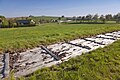
Müdisdorfer Kunstgraben north of Müdisdorf

Mouth hole II. Purschensteiner Rösche

Mouth hole of the Martelbacher Rösche at the Dittmannsdorfer artificial pond


literature
- Otfried Wagenbreth : The Freiberg mining . Technical monuments and history. Ed .: Eberhard Wächtler . 2nd Edition. German publishing house for basic industry, Leipzig 1988, ISBN 3-342-00117-8 , p. 62-71, 248-250 .
- Mining Association of Freiberg (Ed.): Freiberg's mining and smelting system . A brief description of the orographic, geological, historical, technical and administrative conditions. 1st edition. Craz & Gerlach, Freiberg 1883, p. 97-105 ( Text Archive - Internet Archive ).
- Konrad Voppel: The landscape of the Ore Mountains under the influence of ore mining . In: Scientific publications of the Deutsches Museum für Länderkunde. New episode. No. 9 , 1941, pp. 33-36 .
- August Breithaupt : The mining town of Freiberg in the Kingdom of Saxony, in terms of history, statistics, culture and trade, especially mining and metallurgy . Craz & Gerlach, Freiberg 1847, p. 146-153 ( digitized version ).
- Yearbook for the miner and smelter. 1856-1873.
Web links
- Freiberg Reservoir Revierwasserlaufanstalt , accessed on March 24, 2013
- Wernergraben and Wernerstolln , accessed on March 24, 2013
- Flöha-Rösche discharge tunnel (Deutsche Fotothek) , accessed on March 24, 2013