List of the objects of the II. Vienna High Spring Pipeline
The list of objects of the Second Vienna High Spring Pipeline contains the individual structures of the Second Viennese High Spring Pipeline visible above ground in their course from the springs to the water reservoirs in Vienna. A large part of the buildings is under monument protection , the objects can therefore also be found in the monument lists of the communities along the mountain spring pipeline. In contrast to the monument lists, which, following the object definition of the Federal Monuments Office, often describe sections of the water pipeline at the level of a cadastral community as only one listed object and combine several individual structures, and describe individual structures across commune and cadastral municipality boundaries twice, the individual structures are in this list listed separately and each cross-border structure is regarded as one structure.
The second Viennese spring water pipeline is a 183 km long drinking water supply pipeline for the city of Vienna . It was built at the instigation of Karl Lueger and, after a ten-year construction period, opened on December 2, 1910 as the 2nd Kaiser-Franz-Josef Spring Pipeline . It was built to reinforce the first Viennese spring pipeline and brings drinking water from the Hochschwab area in Styria to Vienna .
| photo | Building | km | Location | description | Metadata |
|---|---|---|---|---|---|

|
Chamber B ObjectID : 129441 |
Mariazell location |
This section describes the versions of the Brunngraben springs above Gleißnerhof (Salza left). The well-ditch springs form the beginning of the aqueduct, they are contained in three chambers |
ObjectID : 129441 Name: Chamber B GstNr .: 240/3; 1940/4; 1947/1; 1947/2; 1764/1; 1570/1 |
|

|
Chamber A ObjectID : 129441 |
Mariazell location |
ObjectID : 129441 Name: Chamber A GstNr .: 240/3; 1940/4; 1947/1; 1947/2; 1764/1; 1570/1 |
||
|
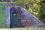
Chamber T ObjectID : 129441 |
Mariazell location |
ObjectID : 129441 Name: Chamber T GstNr .: 240/3; 1940/4; 1947/1; 1947/2; 1764/1; 1570/1 |
||
| Entry tower 1 ObjectID : 129441 |
Mariazell location |
shortly afterwards the first entry tower follows |
ObjectID : 129441 Name: Entry tower 1 GstNr .: 240/3; 1940/4; 1947/1; 1947/2; 1764/1; 1570/1 |
||

|
1. Access to ObjectID : 129441 |
Mariazell location |
possibly another access (unclear) |
ObjectID : 129441 Name: 1st access GstNr .: 240/3; 1940/4; 1947/1; 1947/2; 1764/1; 1570/1 |
|

|
Entry tower 2 ObjectID : 129441 |
Mariazell location |
entry tower 2 in Waldsiedel |
ObjectID : 129441 Name: Entry tower 2 GstNr .: 240/3; 1940/4; 1947/1; 1947/2; 1764/1; 1570/1 |
|
|
2. Access to ObjectID : 129441 |
Mariazell location |
possibly another entrance in Gschödringergraben (unclear) |
ObjectID : 129441 Name: 2nd access GstNr .: 240/3; 1940/4; 1947/1; 1947/2; 1764/1; 1570/1 |
||

|
Premises Kläfferquelle Object ID: 129443 |
Mariazell location |
at the Kläfferbrücke |
ObjectID : 129443 Name: Company building Kläfferquelle GstNr .: .168 Kläfferquelle |
|

|
Chamber C ObjectID : 129442 |
Mariazell location |
Versions Kläfferquelle and Höllbachquellen ( position Höllbachquelle 1 , 2 and 3 ), above Kläfferbrücke (both sides of salt), Prescenyklause (left) and Barbarakapelle ( position Höllgraben right). The individual structures are spread over a spacious area of around 14 km on both sides of the Salza. Chamber C ( Lage ) connects the Höllbachstrang with the strand coming from the Brunngraben springs at the outlet of the Vorderen Höll in Weichselboden . |
ObjectID : 129442 Name: 1 chamber (C) GstNr .: 138/1 |
|
| 9 Entries ObjectID : 129442 |
Mariazell location see description |
Versions Kläfferquelle and Höllbachquellen ( position Höllbachquelle 1 , 2 and 3 ), above Kläfferbrücke (both sides of salt), Prescenyklause (left) and Barbarakapelle ( position Höllgraben right). The individual structures are spread over a spacious area of around 14 km on both sides of the Salza. Chamber C ( Lage ) connects the Höllbachstrang with the strand coming from the Brunngraben springs at the outlet of the Vorderen Höll in Weichselboden . |
ObjectID : 129442 Name: 9 accesses GstNr .: 138/1; 438/3; 174/4; 191/3; 191/5; 256/1; 288/2 |
||

|
Bärnbach aqueduct ObjectID : 129444 |
Wildalpen location |
The Bärnbachaqueduct across the stream of the same name north of the Salza connects the communities of Mariazell and Wildalpen. |
ObjectID : 129444 Name: Bärnbachaqueduct GstNr .: 291/1 |
|

|
Crabapple aqueduct (Aqueduct II) ObjectID : 129449 |
Wildalpen location |
Aqueduct over the Holzäpfeltal |
ObjectID : 129449 Name : Crabapple aqueduct (Aqueduct II) GstNr .: 464/1; 463; 291/1; 1189; 1150; 505 crab apples tala aqueduct |
|

|
11 chambers, 1 pump house, 3 entrances, Hartlsee ObjektID : 129446 |
Winterhöh Wildalpen location |
Branch Siebenseequellen at Winterhöh |
ObjectID : 129446 Name: 11 chambers, 1 pump house, 3 entrances, Hartlsee GstNr .: .632; 739; 740; 764; 784/10; 793/12; 1173/2; 291/43; 1108/25; 793/3; 23/2; 291/1; 1164; 408 |
|

|
E-Werk ObjektID : 98503 |
Schreiereng 28 Wildalpen location |
ObjectID : 98503 Name: E-Werk GstNr .: 793/3 |
||

|
Office building of Wiener Wasser ObjectID : 129447 |
Wildalpen 24 Wildalpen location |
Office building of MA 49 (Vienna Water) |
ObjectID : 129447 Name: Office building of Wiener Wasser GstNr .: .597 |
|

|
Salza aqueduct (Aqueduct I) ObjectID : 129452 |
Wildalpen location |
Aqueduct over the Salza |
ObjectID : 129452 Name: Salza aqueduct (Aqueduct I) GstNr .: 1177/2; 32/2; 34/1 |
|

|
Hopfgarten aqueduct (Aqueduct III) ObjectID : 129450 |
Wildalpen location |
Aqueduct over the Hopfgartenbach |
ObjectID : 129450 Name: Hopfgartenaqedukt (Aqueduct III) GstNr .: 400/1; 400/4; 291/51; 1153/13; 1190/2 Hopfgarten aqueduct |
|

|
Imbachaqueduct (Aqueduct IV) ObjectID : 129451 |
Wildalpen location |
Aqueduct over the Schneckengraben |
ObjectID : 129451 Name: Imbachaqueduct (Aqueduct IV) GstNr .: 360/1 |
|
| Canal bridge Lahnbach ObjectID : 129466 |
Göstling at the Ybbs location |
ObjectID : 129466 Name: Canal Bridge Lahnbach GstNr .: 320/1; 339/1; 366/1; 367; 316; 317/1; 95; 339/2 |
|||
| Canal bridges Windischbach ObjektID : 129466 |
Göstling at the Ybbs location |
ObjectID : 129466 Name: Canal bridges Windischbach GstNr .: 320/1; 339/1; 366/1; 367; 316; 317/1; 95; 339/2 |
|||
| Hundsaubach Canal Bridge ObjectID : 129466 |
Göstling at the Ybbs location |
ObjectID : 129466 Name: Hundsaubach Canal Bridge GstNr .: 320/1; 339/1; 366/1; 367; 316; 317/1; 95; 339/2 |
|||
| Almwaldbach Canal Bridge ObjectID : 129466 |
Göstling at the Ybbs location |
ObjectID : 129466 Name: Almwaldbach Canal Bridge GstNr .: 320/1; 339/1; 366/1; 367; 316; 317/1; 95; 339/2 |
|||
| Schreierbach Canal Bridge ObjectID : 129466 |
Göstling at the Ybbs location |
ObjectID : 129466 Name: Schreierbach Canal Bridge GstNr .: 320/1; 339/1; 366/1; 367; 316; 317/1; 95; 339/2 |
|||
| Access tunnel 25 ObjektID : 129466 |
Göstling an der Ybbs |
ObjectID : 129466 Name: Access tunnel 25 GstNr .: 320/1; 339/1; 366/1; 367; 316; 317/1; 95; 339/2 |
|||
| Access tunnel 28 ObjectID : 129466 |
Göstling an der Ybbs |
ObjectID : 129466 Name: Access tunnel 28 GstNr .: 320/1; 339/1; 366/1; 367; 316; 317/1; 95; 339/2 |
|||
| Access tunnel 29 ObjectID : 129466 |
Göstling at the Ybbs location |
ObjectID : 129466 Name: Access tunnel 29 GstNr .: 320/1; 339/1; 366/1; 367; 316; 317/1; 95; 339/2 |
|||
| Access tunnel 30 ObjectID : 129466 |
Göstling an der Ybbs |
ObjectID : 129466 Name: Access tunnel 30 GstNr .: 320/1; 339/1; 366/1; 367; 316; 317/1; 95; 339/2 |
|||
| Access tunnel 31 ObjektID : 129466 |
Göstling at the Ybbs location |
ObjectID : 129466 Name: Access tunnel 31 GstNr .: 320/1; 339/1; 366/1; 367; 316; 317/1; 95; 339/2 |
|||

|
Hagenbach aqueduct ObjectID : 129467 |
Göstling at the Ybbs location |
ObjectID : 129467 Name: Hagenbach aqueduct GstNr .: 317/7; 368/1; 288; 381; 122 |
||
| Large excavation aqueduct ObjectID : 129487 |
Lunz am See location |
Note: Coordinates must be verified |
ObjectID : 129487 Name: Large excavation aqueduct GstNr .: 232
|
||
| Access tunnel 32 ObjectID : 129488 |
Lunz am See location |
ObjectID : 129488 Name: Access tunnel 32 GstNr .: 227; 210; 132; 41/1 |
|||
| Lechnergrabendüker inlet chamber (EK 33) ObjectID : 129488 |
Lunz am See location |
ObjectID : 129488 Name: Lechnergrabendüker inlet chamber (EK 33) GstNr .: 227; 210; 132; 41/1 |
|||

|
Lechnergrabenüker outlet chamber (AK34) ObjectID : 129488 |
Lunz am See location |
ObjectID : 129488 Name: Lechnergrabendüker discharge chamber (AK34) GstNr .: 227; 210; 132; 41/1 |
||
| Access tunnel 35 ObjectID : 129488 |
Lunz am See location |
ObjectID : 129488 Name: Access tunnel 35 GstNr .: 227; 210; 132; 41/1 |
|||

|
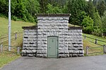
Inlet chamber Lunzdüker (EK 36) ObjectID : 129489 |
Lunz am See location |
The Lunzdüker passes under the municipality of Lunz with a horizontal distance of around 610 m between the inlet chamber EK 36 and the outlet chamber AK 37 . Note: Coordinates must be verified |
ObjectID : 129489 Name: Inlet chamber Lunzdüker (EK 36) GstNr .: 9/1 |
|
|
Lunzdüker discharge chamber (AK 37) ObjectID : 129490 |
Elisabeth Hummel-Straße Lunz am See location |
The Lunzdüker passes under the municipality of Lunz with a horizontal distance of around 610 m between the inlet chamber EK 36 and the outlet chamber AK 37. |
ObjectID : 129490 Name: Lunzdüker discharge chamber (AK 37) GstNr .: .108 |
|

|
Mitterau aqueduct (WAG tunnel) ObjectID : 129492 |
Gaming location |
ObjectID : 129492 Name: Mitterau aqueduct (WAG tunnel) GstNr .: 1015/1; 4232/1; 4140/6; 1018/1 |
||
| Access tunnel 38 ObjectID : 129491 |
Gaming location |
ObjectID : 129491 Name: Access tunnel 38 GstNr .: 1015/1; 1526/18; 1133/1; 1177/3; 1180; 1281/1; 1262 |
|||
| Access tunnel 39 ObjectID : 129491 |
Gaming location |
ObjectID : 129491 Name: Access tunnel 39 GstNr .: 1015/1; 1526/18; 1133/1; 1177/3; 1180; 1281/1; 1262 |
|||

|
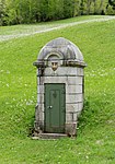
Access tunnel 40 ObjectID : 129491 |
Gaming location |
ObjectID : 129491 Name: Access tunnel 40 GstNr .: 1015/1; 1526/18; 1133/1; 1177/3; 1180; 1281/1; 1262 |
||
|
Entry tower 41 ObjectID : 129491 |
Gaming location |
ObjectID : 129491 Name: Entry tower 41 GstNr .: 1015/1; 1526/18; 1133/1; 1177/3; 1180; 1281/1; 1262 |
||

|
Entry tower 41a ObjectID : 129491 |
Gaming location |
ObjectID : 129491 Name: Entrance tower 41a GstNr .: 1015/1; 1526/18; 1133/1; 1177/3; 1180; 1281/1; 1262 |
||
| Access tunnel ObjectID : 129491 |
Gaming |
ObjectID : 129491 Name: Access tunnel GstNr .: 1015/1; 1526/18; 1133/1; 1177/3; 1180; 1281/1; 1262 |
|||
| Access tunnel ObjectID : 129491 |
Gaming |
ObjectID : 129491 Name: Access tunnel GstNr .: 1015/1; 1526/18; 1133/1; 1177/3; 1180; 1281/1; 1262 |
|||
| 1 chamber (raid chamber WAG tunnel) ObjektID : 129491 |
Gaming |
ObjectID : 129491 Name: 1 chamber (raid chamber WAG tunnel) GstNr .: 1015/1; 1526/18; 1133/1; 1177/3; 1180; 1281/1; 1262 |
|||

|
Entry tower 43 ObjectID : 129510 |
Gaming location |
ObjectID : 129510 Name: Entry tower 43 GstNr .: 229 |
||

|
Umberg Canal Bridge I ObjectID : 129510 |
Gaming location |
ObjectID : 129510 Name: Umberg I canal bridge GstNr .: 229 |
||

|
Access tunnel 44 ObjectID : 129511 |
Gaming location |
ObjectID : 129511 Name: Access tunnel 44 GstNr .: 3027/1; 2943 |
||
| 1 chamber (water lock / WAG tunnel) ObjektID : 129511 |
Gaming location |
ObjectID : 129511 Name: 1 chamber (water lock / WAG tunnel) GstNr .: 3027/1; 2943 |
|||

|
Kraftwerk I (Wienstrom), water pipeline power station Gaming ObjektID : 129512 |
at Pockau 19 gaming location |
The power plant was built between 1923 and 1926 by the Viennese electricity company and uses the gradient of the spring water pipeline. |
ObjectID : 129512 Name: Kraftwerk I (Wienstrom), water line power station Gaming GstNr .: .336; .337; .338; .339; 2959/2 water pipeline power plant Gaming |
|

|
Aqueduct Umberg II ObjectID : 129509 |
Gaming location |
ObjectID : 129509 Name: Aqueduct Umberg II GstNr .: 240/3 |
||

|
Gamingbach aqueduct ObjectID : 20647 |
Gaming location |
ObjectID : 20647 Name: Gamingbach aqueduct GstNr .: 262/2; 4235/1; 4206/1; 267/1; 269/1; 270 |
||

|
Inlet chamber Pockaudüker (EK 45) ObjectID : 129513 |
Gaming location |
The Pockaudüker crosses under the village of Pockau with a horizontal distance of 150 m from the inlet chamber EK 45 to the outlet chamber AK 46. |
ObjectID : 129513 Name: Pockaudüker inlet chamber (EK 45) GstNr .: 2975/1; 3047/6 |
|

|
Outlet chamber Pokaudüker (AK 46) ObjektID : 129517 |
Gaming location |
The Pockaudüker crosses under the Pockau village with a horizontal distance of around 150 m from the inlet chamber EK 45 to the outlet chamber AK 46. |
ObjectID : 129517 Name: Outlet chamber Pokaudüker (AK 46) GstNr .: 3393/24; 3444/1; 3668/2; 3560 |
|
| Inlet chamber Erlaufdüker (EK 48) ObjektID : 129517 |
107.39 km |
Gaming location |
The Erlauf culvert crosses under the Erlauf from the inlet chamber EK 48 to the outlet chamber AK 49 with a horizontal distance of around 165 m . |
ObjectID : 129517 Name: Inlet chamber Erlaufdüker (EK 48) GstNr .: 3393/24; 3444/1; 3668/2; 3560 |
|

|
Outlet chamber Erlaufdüker (AK 49) ObjectID : 129517 |
107.23 km |
Gaming location |
ObjectID : 129517 Name: outlet chamber Erlaufdüker (AK 49) GstNr .: 3393/24; 3444/1; 3668/2; 3560 |
|
| Access tunnel 50 ObjectID : 129517 |
Gaming location |
ObjectID : 129517 Name: Access tunnel 50 GstNr .: 3393/24; 3444/1; 3668/2; 3560 |
|||

|
Access tunnel 50a |
Gaming location |
In KG Kienberg you can still find the not listed access tunnel 50a which is visibly more recent construction date. | Name: Access Gallery 50a GstNr .: 3393/24; 3444/1; 3668/2; 3560 |
|
| Entry tower 51 ObjectID : 129524 |
St. Anton an der Jeßnitz location |
ObjectID : 129524 Name: Entry tower 51 GstNr .: 2166/1; 2519 |
|||

|
Sulzgraben canal bridge ObjectID : 129524 |
St. Anton an der Jeßnitz location |
ObjectID : 129524 Name: Sulzgraben canal bridge GstNr .: 2166/1; 2519 |
||

|
Access tunnel 52 ObjectID : 129525 |
Scheibbs location |
ObjectID : 129525 Name: Access tunnel 52 GstNr .: 844/1 |
||

|
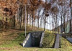
Lueger aqueduct ObjectID : 129532 |
Scheibbs and St. Anton an der Jeßnitz location |
The Lueger aqueduct bridges the valley of the Jessnitz . With a length of 271 meters and a height of 22 meters, it is the longest aqueduct of Vienna's second high spring water pipeline. The 14 arch positions have a span of 10 to 30 m. The aqueduct is located in the municipality of Scheibbs and the cadastral municipalities of St. Anton an der Jeßnitz and Gärtenberg in the municipality of St. Anton an der Jeßnitz. |
ObjectID : 129532 Name: Lueger aqueduct GstNr .: 3239; 3220/2; 3221/1; 3226/2; 3226/1; 3251/1; 861; 804; 866 |
|
|
Entry chamber 53 ObjectID : 129533 |
St. Anton an der Jeßnitz location |
ObjectID : 129533 Name: Entry chamber 53 GstNr .: 3251/1 |
||

|
Hochbruckaqueduct ObjectID : 129539 |
Scheibbs location |
ObjectID : 129539 Name: Hochbruckaquedukt GstNr .: 17/1 |
||
| Entry tower 54 ObjectID : 129540 |
Scheibbs location |
ObjectID : 129540 Name: Entry tower 54 GstNr .: 1771 |
|||

|
Canal bridge Lehenhof ObjectID : 129540 |
Scheibbs location |
ObjectID : 129540 Name: Lehenhof Canal Bridge GstNr .: 1771 |
||

|
Entry tower 55 ObjectID : 129544 |
Scheibbs location |
ObjectID : 129544 Name: Entry tower 55 GstNr .: 60/6
|
||

|
Ginningbach aqueduct ObjectID : 129543 |
Scheibbs location |
The Ginningbach aqueduct connects the cadastral communities of Ginning and Scheibbs. |
ObjectID : 129543 Name: Ginningbach aqueduct GstNr .: 60/6; 28/1 |
|

|
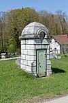
Schöllgraben canal bridge ObjectID : 129541 |
Scheibbs location |
ObjectID : 129541 Name: Schöllgraben Canal Bridge GstNr .: 1/15; 1/16; 5/11 |
||
|
Entry tower 56 ObjectID : 129545 |
Scheibbs location |
ObjectID : 129545 Name: Entry tower 56 GstNr .: 955 |
||

|
Leysbach aqueduct ObjectID : 129548 |
Scheibbs and St. Georgen at the Leys location |
The Leysbach aqueduct connects the communities of Scheibbs and St. Georgen an der Leys. |
ObjectID : 129548 Name: Leysbach aqueduct GstNr .: 1332/2; 1111; 528/1; 1841 |
|

|
Discharge chamber Object ID: 129546 |
St. Georgen an der Leys location |
ObjectID : 129546 Name: Drain Chamber GstNr .: 528/1 |
||
| Stücklehen aqueduct ObjectID : 129549 |
St. Georgen an der Leys location |
ObjectID : 129549 Name: Stücklehenaqueduct GstNr .: 520/4; 530; 531 |
|||
| Feldbauer canal bridge ObjectID : 129550 |
St. Georgen an der Leys location |
ObjectID : 129550 Name: Feldbauer Canal Bridge GstNr .: 495/2; 472; 461; 366/1 |
|||

|
Inlet chamber Melkdüker (EK 57) ObjectID : 129550 |
St. Georgen an der Leys location |
Inlet chamber of the around 430 meter long milking culvert |
ObjectID : 129550 Name: Melkdüker inlet chamber (EK 57) GstNr .: 495/2; 472; 461; 366/1 |
|
| Outlet chamber Melkdüker (AK 58) ObjectID : 129550 |
St. Georgen an der Leys location |
Outlet chamber of the around 430 meters long milking culvert as the crow flies |
ObjectID : 129550 Name: Melkdüker discharge chamber (AK 58) GstNr .: 495/2; 472; 461; 366/1 |
||
| Canal bridge Pfoisau ObjektID : 129554 |
Oberndorf an der Melk location |
ObjectID : 129554 Name: Pfoisau Canal Bridge GstNr .: 815/2; 637 |
|||

|
Entry tower 59 ObjectID : 129554 |
Oberndorf an der Melk location |
ObjectID : 129554 Name: Entry tower 59 GstNr .: 815/2; 637 |
||

|
Koppendorf aqueduct ObjectID : 129555 |
Oberndorf an der Melk location |
ObjectID : 129555 Name: Koppendorf aqueduct GstNr .: 694/1; 694/2; 700 |
||

|
Aqueduct Oberndorf 1 ObjektID : 129557 |
Oberndorf an der Melk location |
ObjectID : 129557 Name: Aqueduct Oberndorf 1 GstNr .: 43/1 Aqueduct Oberndorf 1 |
||

|
Canal bridge Oberndorf 2 ObjektID : 129556 |
Oberndorf an der Melk location |
ObjectID : 129556 Name: Canal bridge Oberndorf 2 GstNr .: 43/1 |
||

|
Canal bridge Oberndorf 3 ObjektID : 129556 |
Oberndorf an der Melk location |
ObjectID : 129556 Name: Canal bridge Oberndorf 3 GstNr .: 43/1 |
||

|
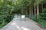
Aqueduct Oberndorf 4 ObjektID : 129558 |
Oberndorf an der Melk location |
ObjectID : 129558 Name: Aqueduct Oberndorf 4 GstNr .: 184/1; 184/2; 175; 176 |
||
|
Aqueduct Oberndorf 5 ObjektID : 129559 |
Oberndorf an der Melk location |
ObjectID : 129559 Name: Aqueduct Oberndorf 5 GstNr .: 208; 209 |
||
| Canal bridge Oberndorf 6 ObjektID : 129556 |
Oberndorf an der Melk location |
ObjectID : 129556 Name: Canal bridge Oberndorf 6 GstNr .: 209; 210 |
|||

|
Ganzbachaqeduct ObjectID : 129560 |
Oberndorf an der Melk location |
ObjectID : 129560 Name: Ganzbachaqedukt GstNr .: 329 |
||

|
Entry tower 60 ObjectID : 129556 |
Oberndorf an der Melk location |
ObjectID : 129556 Name: Entry tower 60 GstNr .: 444/3 |
||

|
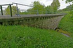
2 canal bridges (Sonnleiten, Fellner) ObjectID : 129556 |
Oberndorf an der Melk location see description |
The canal bridge Sonnleiten and Fellner ( location or location ) are the objects summarized under this entry. Note: assignment unclear |
ObjectID : 129556 Name: 2 canal bridges (Sonnleiten, Fellner) GstNr .: 624; 616/2; 1145; 879; 933/2; 1156 |
|
|
Schuhmaieraqedukt ObjektID : 129561 |
Oberndorf an der Melk location |
ObjectID : 129561 Name: Schuhmaieraqedukt GstNr .: 1065; 1123 |
||
| Entry tower 61 ObjectID : 129596 |
Kirnberg at the Mank location |
ObjectID : 129596 Name: Entry tower 61 GstNr .: 610 |
|||
| Canal bridge Sigritsberg 1 ObjektID : 129596 |
Kirnberg at the Mank location |
ObjectID : 129596 Name: Canal Bridge Sigritsberg 1 GstNr .: 549/2; 593/1 |
|||

|
Aqueduct Sigritsberg 2 ObjectID : 129597 |
Kirnberg at the Mank location |
ObjectID : 129597 Name: Aqueduct Sigritsberg 2 GstNr .: 549/3; 550/1; 507/3 |
||

|
Schonaberg Canal Bridge ObjectID : 129596 |
Kirnberg at the Mank location |
ObjectID : 129596 Name: Schonaberg Canal Bridge GstNr .: 467/1; 439 |
||

|
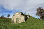
Sattlehen Canal Bridge ObjectID : 129599 |
Kirnberg at the Mank location |
The Sattlehen canal bridge connects the cadastral communities of Furth and Kirnberg. |
ObjectID : 129599 Name: Sattlehen Canal Bridge GstNr .: 402/1; 794/1 |
|
|
Inlet chamber Mankdüker (EK 62) ObjectID : 129600 |
Kirnberg at the Mank location |
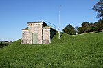
The Mank culvert crosses under the Mank with a horizontal distance of around 530 m. |
ObjectID : 129600 Name: Inlet chamber Mankdüker (EK 62) GstNr .: 792 Mankdüker |
|
|
Outlet chamber Mankdüker (AK 63) ObjectID : 129600 |
Kirnberg at the Mank location |
The Mank culvert crosses under the Mank with a horizontal distance of around 530 m. |
ObjectID : 129600 Name: discharge chamber Mankdüker (AK 63) GstNr .: 797 Mankdüker |
|

|
Entry tower 64 ObjectID : 129600 |
Kirnberg at the Mank location |
ObjectID : 129600 Name: Entry tower 64 GstNr .: 248/1 |
||

|
Entry tower 65 ObjectID : 129602 |
Kilb location |
ObjectID : 129602 Name: Entry tower 65 GstNr .: 229 entrance towers and canal bridges Kilb |
||

|
Canal bridge Hummelbach ObjectID : 129602 |
Kilb location |
ObjectID : 129602 Name: Canal Bridge Hummelbach GstNr .: 231/2; 238/3; 1302 Access towers and canal bridges Kilb |
||

|
Chain riding aqueduct ObjectID : 129603 |
Kilb location |
ObjectID : 129603 Name: Chain riding aqueduct GstNr .: 840/3; 853/6; 842/1; 842/2; 1309/1; 1308/1; 769/1 |
||

|
Entry tower 66 ObjectID : 129602 |
Kilb location |
ObjectID : 129602 Name: Entrance tower 66 GstNr .: 759 entry towers and canal bridges Kilb |
||

|
Umbachkogel Canal Bridge ObjectID : 129602 |
Kilb location |
ObjectID : 129602 Name: Umbachkogel Canal Bridge GstNr .: 784/2; 785 entry towers and canal bridges Kilb |
||

|
Entry tower 67 ObjectID : 129602 |
Kilb location see description |
ObjectID : 129602 Name: Entry tower 67 GstNr .: 612/9 entrance towers and canal bridges Kilb |
||

|
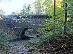
Panschacha Aqueduct ObjectID : 129604 |
Kilb location |
ObjectID : 129604 Name: Panschacha aqueduct GstNr .: 612/9; 617; 588/16; 592/1 Panschacha Aqueduct Kilb |
||
|
Teufelsbach canal bridge ObjectID : 129605 |
Kilb location |
The Teufelsbach canal bridge connects the cadastral communities of Kettenreith and Rametzberg. |
ObjectID : 129605 Name: Teufelsbach canal bridge GstNr .: 588/5; 588/14; 1220/2; 1239 canal bridge Teufelsbach Kilb |
|

|
Sierningbach aqueduct ObjectID : 129608 |
Kilb location |
ObjectID : 129608 Name: Sierningbach aqueduct GstNr .: 784; 786; 1217/3; 413 |
||

|
Hansingerbrücke, entry tower 68 ObjectID : 129607 |
Kilb location |
ObjectID : 129607 Name: Hansingerbrücke, entry tower 68 GstNr .: 1231; 1227; 812/2 Hansingerbrücke, entry tower 68 Kilb |
||

|
Entry tower 68 ObjectID : 129607 |
Kilb location |
ObjectID : 129607 Name: Entry tower 68 GstNr .: 424/1 Hansingerbrücke, entry tower 68 Kilb |
||

|
Entry tower 69 ObjectID : 129609 |
Hofstetten-Grünau location |
ObjectID : 129609 Name: Entry tower 69 GstNr .: 788/2 |
||

|
Canal bridge in Grünsbach (1) ObjectID : 129609 |
Hofstetten-Grünau location |
ObjectID : 129609 Name: Canal bridge in Grünsbach (1) GstNr .: 1163/1; 875/2 |
||

|
Canal bridge in Grünsbach (2) ObjectID : 129609 |
Hofstetten-Grünau location |
ObjectID : 129609 Name: Canal bridge in Grünsbach (2) GstNr .: 883/3; 878/8; 878/6; 880/4 |
||

|
Canal bridge in Grünsbach (3) ObjectID : 129609 |
Hofstetten-Grünau location |
ObjectID : 129609 Name: Canal bridge in Grünsbach (3) GstNr .: 950/2; 951/3; 951/2 |
||

|
Canal bridge in Grünsbach (4) ObjectID : 129609 |
Hofstetten-Grünau location |
ObjectID : 129609 Name: Canal bridge in Grünsbach (4) GstNr .: 984/1; 989/3 |
||

|
Aqueduct Lederhof 1 ObjektID : 129610 |
Hofstetten-Grünau location |
ObjectID : 129610 Name: Aqueduct Lederhof 1 GstNr .: 989/3; 1014/5 Aqueduct Lederhof 1 |
||
|
|
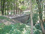
Aqueduct Lederhof 2 ObjektID : 129611 |
Hofstetten-Grünau location |
ObjectID : 129611 Name: Aqueduct Lederhof 2 GstNr .: 1014/1; 1015/2; 1052/2 |
||
|
Canal bridge in Grünsbach (5) ObjectID : 129609 |
Hofstetten-Grünau location |
ObjectID : 129609 Name: Canal bridge in Grünsbach (5) GstNr .: 1064; 1063 |
||
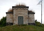
| Entry tower 70 ObjectID : 129609 |
Hofstetten-Grünau location |
ObjectID : 129609 Name: Entry tower 70 GstNr .: 1064 |
|||
|
Inlet chamber Pielachdüker (EK 71) ObjectID : 129609 |
Hofstetten-Grünau location |
The Pielach culvert crosses under the Pielach with a horizontal distance of around 675 m. |
ObjectID : 129609 Name: Pielachdüker inlet chamber (EK 71) GstNr .: 1145 Pielachdüker |
|
| Outlet chamber Pielachdüker (AK 72) ObjektID : 129612 |
Hofstetten-Grünau location |
The Pielach culvert crosses under the Pielach with a horizontal distance of around 675 m. |
ObjectID : 129612 Name: discharge chamber Pielachdüker (AK 72) GstNr .: 380/12; 361 |
||
|
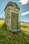
Entry tower 73 ObjectID : 129612 |
Hofstetten-Grünau location |
ObjectID : 129612 Name: Entry tower 73 GstNr .: 380/12; 361 Entrance tower 73, II HQL |
||

|
Inlet chamber Aigelsbachdüker (EK 74) ObjectID : 129613 |
Hofstetten-Grünau location |
ObjectID : 129613 Name: inlet chamber Aigelsbachdüker (EK 74) GstNr .: 475/1 Aigelsbachdüker |
||

|
Pipe bridge ObjectID : 129613 |
Hofstetten-Grünau location |
ObjectID : 129613 Name: Pipe bridge GstNr .: 475/1 Aigelsbachdüker |
||

|
Outlet chamber Aigelsbachdüker (AK 75) ObjectID : 129613 |
Hofstetten-Grünau location |
ObjectID : 129613 Name: Aigelsbachdüker outlet chamber (AK 75) GstNr .: 475/1 Aigelsbachdüker |
||

|
Canal bridges Mühlhofen 1 ObjektID : 129614 |
Weinburg location |
ObjectID : 129614 Name: Canal bridges Mühlhofen 1 GstNr .: 127/1; 126/1; 123/1 Canal bridges Mühlhofen |
||

|
Canal bridges Mühlhofen 2 ObjektID : 129614 |
Weinburg location |
ObjectID : 129614 Name: Canal bridges Mühlhofen 2 GstNr .: 127/1; 126/1; 123/1 Canal bridges Mühlhofen |
||

|
Canal bridge Im Tanne ObjektID : 129615 |
Weinburg location |
The canal bridge Im Tanne connects the cadastral communities Mühlhofen and Luberg. |
ObjectID : 129615 Name: Canal Bridge Im Tanne GstNr .: 122; 2/3 canal bridge in the Tanne |
|

|
Lubergaqueduct ObjectID : 129617 |
Weinburg location |
ObjectID : 129617 Name: Lubergaqueduct GstNr .: 2/3; 5; 27; 29 Lubergaqueduct |
||

|
Entry tower 76 ObjectID : 129618 |
Weinburg location |
ObjectID : 129618 Name: Entry tower 76 GstNr .: 77/1 entry tower 76, II HQL, Weinburg |
||

|
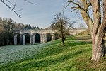
Hadinga Aqueduct ObjectID : 129619 |
Weinburg and Wilhelmsburg location |
The Hadinga aqueduct connects the communities of Weinburg and Wilhelmsburg. |
ObjectID : 129619 Name: Hadinga aqueduct GstNr .: 93; 130; 474; 177/1; 177/2 Hadinga aqueduct |
|
|
Wolkersberg aqueduct ObjectID : 129621 |
Wilhelmsburg location |
The Wolkersberg aqueduct connects the cadastral communities of Wielandsberg and Wolkersberg. |
ObjectID : 129621 Name: Wolkersberg aqueduct GstNr .: 123/1; 20; 23 Wolkersberg aqueduct |
|
|
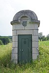
Entry tower 77 ObjectID : 129623 |
Wilhelmsburg location |
ObjectID : 129623 Name: Entry tower 77 GstNr .: 196 Entrance tower 77, II HQL, Wilhelmsburg |
||
|
|
Pommern aqueduct ObjectID : 129624 |
Wilhelmsburg location |
ObjectID : 129624 Name: Pommern aqueduct GstNr .: 196; 197; 198; 199; 144; 178 Pommern aqueduct |
||

|
Inlet chamber Traisendüker (EK 78) ObjektID : 129625 |
Wilhelmsburg location |
The Traisen culvert crosses under the Traisen in Wilhelmsburg with a horizontal distance of around 1170 m from the inlet chamber EK 78 to the outlet chamber AK 79 . |
ObjectID : 129625 Name: Inlet chamber Traisendüker (EK 78) GstNr .: 71/1 |
|
| Outlet chamber Traisendüker (AK 79) ObjektID : 129626 |
Wilhelmsburg location |
ObjectID : 129626 Name: Outlet chamber Traisendüker (AK 79) GstNr .: 38/1; 49/3; 152/1; 174; 186; 264/3; 207/1; 208/4; 266 |
|||

|
Entry tower 80 ObjectID : 129626 |
Wilhelmsburg location |
ObjectID : 129626 Name: Entry tower 80 GstNr .: 38/1; 49/3; 159/1; 152/1; 174; 186; 264/3; 207/1; 208/4; 266 |
||
| Discharge chamber Object ID: 129626 |
Wilhelmsburg |
ObjectID : 129626 Name: Drain Chamber GstNr .: 38/1; 49/3; 152/1; 174; 186; 264/3; 207/1; 208/4; 266 |
|||
| Canal bridge Grünbauer 1 ObjektID : 129626 |
Wilhelmsburg location |
ObjectID : 129626 Name: Canal bridge Grünbauer 1 GstNr .: 38/1; 49/3; 152/1; 174; 186; 264/3; 207/1; 208/4; 266 |
|||
| Canal bridge Grünbauer 2 ObjektID : 129626 |
Wilhelmsburg location |
ObjectID : 129626 Name: Canal bridge Grünbauer 2 GstNr .: 38/1; 49/3; 152/1; 174; 186; 264/3; 207/1; 208/4; 266 |
|||
| Canal bridge Windhaag ObjectID : 129626 |
Wilhelmsburg |
ObjectID : 129626 Name: Canal Bridge Windhaag GstNr .: 38/1; 49/3; 152/1; 174; 186; 264/3; 207/1; 208/4; 266 |
|||

|
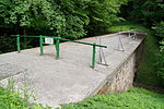
Engelbauer aqueduct ObjectID : 129627 |
Wilhelmsburg location |
ObjectID : 129627 Name: Engelbauer aqueduct GstNr .: 49/3; 153/1; 159/1 Engelbauer aqueduct |
||
|
Canal bridge Ochsenburg ObjectID : 129629 |
St. Pölten location |
ObjectID : 129629 Name: Canal Bridge Ochsenburg GstNr .: 109/1; 86 Ochsenburg Canal Bridge |
||

|
Inlet chamber Ochsenburgdüker (EK 81) ObjectID : 129628 |
St. Pölten location |
The Ochsenburgdüker passes under the Waldbach, a tributary of the Traisen , with a horizontal distance of around 400 m . |
ObjectID : 129628 Name : Inlet chamber Ochsenburgdüker (EK 81) GstNr .: 373/3; 377/1 |
|

|
Outlet chamber Ochsenburgdüker (AK 82) ObjektID : 129628 |
St. Pölten location |
ObjectID : 129628 Name: Ochsenburgdüker discharge chamber (AK 82) GstNr .: 373/3; 377/1 |
||

|
Entry tower 83 ObjectID : 129628 |
St. Pölten location |
ObjectID : 129628 Name: Entry tower 83 GstNr .: 373/3; 377/1 Entrance tower 83, II HQL, St. Pölten |
||

|
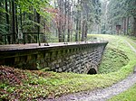
Harlander Aqueduct ObjectID : 129630 |
Pyhra location |
The Harlander Aqueduct connects the cadastral parishes of Zuleithen and Probstwald. |
ObjectID : 129630 Name: Harlander Aqueduct GstNr .: 5; 25; 120/1; 120/2; 218 Harlander Aqueduct, II HQL, Pyhra |
|
|
Canal bridge Probstwald ObjektID : 129632 |
Pyhra location |
ObjectID : 129632 Name: Canal Bridge Probstwald GstNr .: 6 Probstwald Canal Bridge, II HQL, Pyhra |
||

|
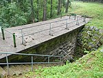
Entry tower 84 ObjectID : 129632 |
Pyhra location |
ObjectID : 129632 Name: Entry tower 84 GstNr .: 6 entrance tower 84, II HQL, Pyhra |
||
|
Canal bridge boiler ObjectID : 129633 |
Pyhra location |
The Kessel canal bridge connects the cadastral communities of Probstwald and Schauching. |
ObjectID : 129633 Name: Canal bridge Kessel GstNr .: 6; 247/2 Canal bridge Kessel, II HQL, Pyhra |
|

|
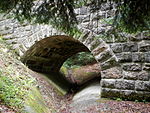
Canal bridge Reichebner ObjektID : 129635 |
Pyhra location |
ObjectID : 129635 Name: Reichebner Canal Bridge GstNr .: 327/1 Canal Bridge Reichebner, II HQL, Pyhra |
||
|
Geißelhofer Canal Bridge ObjectID : 129637 |
Pyhra location |
The Geißelhofer canal bridge connects the cadastral communities of Heuberg and Auern. |
ObjectID : 129637 Name: Geißelhofer Canal Bridge GstNr .: 231/1; 167/2 Geißelhofer canal bridge |
|

|
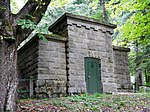
Inlet chamber Perschlingdüker (EK 85) ObjektID : 129638 |
Pyhra location |
ObjectID : 129638 Name : Inlet chamber Perschlingdüker (EK 85) GstNr .: 231/2 Perschlingdüker |
||
|
Outlet chamber Perschlingdüker (AK 86) ObjektID : 129639 |
Pyhra location |
ObjectID : 129639 Name: Perschlingdüker discharge chamber (AK 86) GstNr .: 216 Perschlingdüker |
||

|
Reintalaquädukt Object ID: 129640 |
Pyhra location |
ObjectID : 129640 Name: Pure Talaqueduct GstNr .: 280/12; 280/8; 280/6 Reintalaquädukt |
||

|
Canal bridge beneficial organism 1 ObjektID : 129641 |
Pyhra location |
ObjectID : 129641 Name: Canal bridge beneficial insect 1 GstNr .: 244; 236/1; 243; 242; 241 |
||

|
Canal bridge beneficial insect 2 ObjektID : 129641 |
Pyhra location |
ObjectID : 129641 Name: Canal bridge beneficial insect 2 GstNr .: 244; 236/1; 243; 242; 241 |
||

|
Entry tower 87 ObjectID : 129641 |
Pyhra location |
ObjectID : 129641 Name: Entry tower 87 GstNr .: 244; 236/1; 243; 242; 241 |
||

|
Inlet chamber Michelbachdüker (EK 88) ObjectID : 129642 |
Box near Böheimkirchen location |
ObjectID : 129642 Name : Inlet chamber Michelbachdüker (EK 88) GstNr .: 69 |
||

|
Outlet chamber Michelbachdüker (AK 89) ObjektID : 129642 |
Box near Böheimkirchen location |
ObjectID : 129642 Name : discharge chamber Michelbachdüker (AK 89) GstNr .: 308 |
||

|
Entry tower 90 ObjectID : 129643 |
Box near Böheimkirchen location |
ObjectID : 129643 Name: Entry tower 90 GstNr .: 107 |
||

|
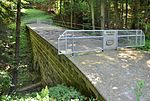
Canal bridge box ObjectID : 129644 |
Box near Böheimkirchen location |
ObjectID : 129644 Name: Canal bridge box GstNr .: 113 |
||
|
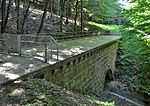
Canal bridge Lielach ObjectID : 129645 |
Box near Böheimkirchen location |
ObjectID : 129645 Name: Canal Bridge Lielach GstNr .: 26 Lielach Canal Bridge |
||
|
Canal bridge Dörfl 1 ObjektID : 129646 |
Box near Böheimkirchen location |
ObjectID : 129646 Name: Dörfl 1 canal bridge GstNr .: 70; 73; 81/1; 76/1 |
||

|
Canal bridge Dörfl 2 ObjektID : 129646 |
Box near Böheimkirchen location |
ObjectID : 129646 Name: Canal Bridge Dörfl 2 GstNr .: 81/1; 76/1 |
||

|
Entry tower 91 ObjectID : 129646 |
Box near Böheimkirchen location |
Note: assignment questionable |
ObjectID : 129646 Name: Entrance tower 91 GstNr .: 73 |
|

|
Inlet chamber Stössingbachdüker (EK 92) ObjektID : 129647 |
Box near Böheimkirchen location |
ObjectID : 129647 Name : Inlet chamber Stössingbachdüker (EK 92) GstNr .: 45/1 |
||

|
Outlet chamber Stössingbachdüker (AK 93) ObjektID : 129648 |
Stössing location |
ObjectID : 129648 Name : discharge chamber Stössingbachdüker (AK 93) GstNr .: 38 |
||

|
Höllgrabenbach aqueduct ObjectID : 129649 |
Box near Böheimkirchen location |
ObjectID : 129649 Name: Höllgrabenbach aqueduct GstNr .: 96 Höllgrabenbachaqueduct |
||

|
Kümmelhof aqueduct / Hochgschaiderbach aqueduct ObjectID : 129650 |
Stössing location |
ObjectID : 129650 Name: Kümmelhofaqedukt / Hochgschaiderbachaquedukt GstNr .: 211/5 |
||

|
Aqueduct in the Au ObjectID : 129651 |
Stössing and Neulengbach location |
The aqueduct connects the communities of Stössing and Neulengbach. |
ObjectID : 129651 Name: Aqueduct in the Au GstNr .: 211/5; 570; 1936/3; 1107/1 Aqueduct in the Au |
|

|
Entry tower 94 ObjectID : 129653 |
Neulengbach location |
ObjectID : 129653 Name: Entry tower 94 GstNr .: 1107/1 |
||

|
Entry tower 95 ObjectID : 129653 |
Neulengbach location |
ObjectID : 129653 Name: Entry tower 95 GstNr .: 1521/2 |
||

|
Grubholzbach aqueduct ObjectID : 129654 |
Neulengbach location |
The aqueduct connects the communities of Neulengbach and Neustift-Innermanzing. |
ObjectID : 129654 Name: Grubholzbach aqueduct GstNr .: 1521/2; 1184/1 |
|

|
Canal bridge Grubholz ObjektID : 129656 |
Neustift-Innermanzing location |
ObjectID : 129656 Name: Grubholz Canal Bridge GstNr .: 1756/1; 1756/2 |
||

|
Inlet chamber Laabenbachdüker (EK 96) ObjectID : 129656 |
Neustift-Innermanzing location |
The Laabenbach culvert connects the community of Neustift-Innermanzing with the community of Altlengbach (AK 97) over a horizontal distance of around 1650 meters and passes under the West Autobahn A1 , the Laabenbach and the village of Leitsberg. |
ObjectID : 129656 Name: Laabenbachdüker inlet chamber (EK 96) GstNr .: 1287/1 |
|

|
Outlet chamber Laabenbachdüker (AK 97) ObjectID : 129657 |
Altlengbach location |
ObjectID : 129657 Name : discharge chamber Laabenbachdüker (AK 97) GstNr .: 2217/3 |
||

|
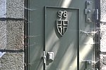
Ödgraben aqueduct ObjectID : 129658 |
Altlengbach location |
ObjectID : 129658 Name: Ödgraben aqueduct GstNr .: 2150/1; 1681; 1678 Ödgraben aqueduct |
||
|
Entry tower 98 ObjectID : 129657 |
Altlengbach location |
ObjectID : 129657 Name: Entry tower 98 GstNr .: 2132 |
||

|
Inlet chamber Gerhardsbachdüker (EK 99) ObjectID : 129657 |
Altlengbach location |
ObjectID : 129657 Name : Inlet chamber Gerhardsbachdüker (EK 99) GstNr .: 2048; 2047; 2044 |
||

|
Outlet chamber Gerhardsbachdüker (AK 100) ObjektID : 129657 |
Altlengbach location |
ObjectID : 129657 Name : discharge chamber Gerhardsbachdüker (AK 100) GstNr .: 1787/5 |
||

|
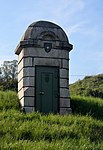
Steinhäusl Canal Bridge ObjectID : 129657 |
Altlengbach location |
ObjectID : 129657 Name: Steinhäusl canal bridge GstNr .: 3472 |
||
|
Entry tower 101 ObjectID : 129657 |
Altlengbach location |
Note: Exactly to the property |
ObjectID : 129657 Name: Entry tower 101 GstNr .: 1305 |
|

|
Lengbach aqueduct ObjectID : 129659 |
Altlengbach location |
ObjectID : 129659 Name: Lengbachaqueduct GstNr .: 1308/1; 1316/4; 3398 |
||

|
Lengbach aqueduct ObjectID : 129660 |
Maria-Anzbach location |
ObjectID : 129660 Name: Lengbach aqueduct GstNr .: 493/1; 269/1 |
||

|
Entry tower 102 ObjectID : 129661 |
Herrenhofstrasse Eichgraben location |
ObjectID : 129661 Name: Entrance tower 102 GstNr .: 420 |
||

|
Eichgraben aqueduct ObjectID : 129662 |
Eichgraben location |
ObjectID : 129662 Name: Eichgraben aqueduct GstNr .: 82; 104/3; 373/1; 373/2; 376; 978 |
||

|
Watzek pond aqueduct ObjectID : 129663 |
Eichgraben location |
ObjectID : 129663 Name: Watzek pond aqueduct GstNr .: 1937 |
||
|
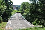
Nagelberg Canal Bridge ObjectID : 129661 |
Eichgraben location |
ObjectID : 129661 Name: Canal Bridge Nagelberg GstNr .: 62/58; 62/97; 62/84; 1937 |
||
|
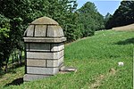
Entry tower 103 ObjectID : 129661 |
Eichgraben location |
ObjectID : 129661 Name: Entrance tower 103 GstNr .: 61 |
||

|
Sonnleitenaquädukt Object ID: 129664 |
Pressbaum location |
ObjectID : 129664 Name: Sonnleitenaquedukt GstNr .: 255/1 Sonnleitenaquedukt |
||

|
Entry tower 104 ObjectID : 129665 |
Pressbaum location |
ObjectID : 129665 Name: Entry tower 104 GstNr .: 255/1 |
||

|
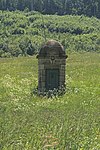
Steinhurtgraben aqueduct ObjectID : 129666 |
Pressbaum location |
ObjectID : 129666 Name: Steinhurtgraben aqueduct GstNr .: 255/1; 256/1 Steinhurtgraben aqueduct |
||
|
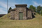
Entry tower 105 ObjectID : 129667 |
Pressbaum location |
ObjectID : 129667 Name: Entry tower 105 GstNr .: 182/2 |
||
|
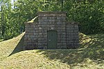
Inlet chamber Dürrwiendüker (EK 106) ObjektID : 129667 |
Pressbaum location |
ObjectID : 129667 Name: Inlet chamber Dürrwiendüker (EK 106) GstNr .: 182/6; 182/28 |
||
|
Dürrwiendüker outlet chamber (AK 107) ObjectID : 129667 |
Pressbaum location |
ObjectID : 129667 Name: Dürrwiendüker outlet chamber (AK 107) GstNr .: 217/8 |
||

|
Pfalzauaquädukt Object ID: 129668 |
Pressbaum location |
ObjectID : 129668 Name: Pfalzauaqueduct GstNr .: 245/2; 245/26; 245/36; 245/74; 217/1; 385; 384 Pfalzau aqueduct (Pressbaum) |
||

|
Access tunnel 108 ObjectID : 129667 |
Pressbaum location |
ObjectID : 129667 Name: Access tunnel 108 GstNr .: 245/26 |
||

|
Entry tower 109 ObjectID : 129667 |
Pressbaum location |
ObjectID : 129667 Name: Entry tower 109 GstNr .: 315/16 |
||

|
Brentenmaisaquedukt 1 ObjektID : 129669 |
Pressbaum location |
ObjectID : 129669 Name: Brentenmaisaquedukt 1 GstNr .: 322/15; 264/242; 315/98; 540; 368; 322/14; 410; 536; 539/2 Brentenmaisaquedukt (Pressbaum) |
||

|
Brentenmaisaquedukt 2 ObjektID : 129670 |
Pressbaum location |
ObjectID : 129670 Name: Brentenmaisaquedukt 2 GstNr .: 315/10 |
||

|
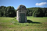
Entry tower 110 ObjectID : 129667 |
Pressbaum location |
ObjectID : 129667 Name: Entry tower 110 GstNr .: 315/16 |
||
|
Entry tower 111 ObjectID : 129671 |
Wolfsgraben location |
ObjectID : 129671 Name: Entrance tower 111 GstNr .: 61/111 Spring water pipeline in Wolfsgraben |
||

|
Beerwartberg Canal Bridge ObjectID : 129671 |
Wolfsgraben location |
ObjectID : 129671 Name: Beerwartberg Canal Bridge GstNr .: 61/110 high spring water pipe in Wolfsgraben |
||

|
Inlet chamber Wolfsgrabendüker (EK 112) ObjectID : 129671 |
Wolfsgraben location |
ObjectID : 129671 Name : Inlet chamber Wolfsgrabendüker (EK 112) GstNr .: 133/15 high spring water pipe in Wolfsgraben |
||

|
Wolfsgrabendüker outlet chamber (AK 113) ObjectID : 129671 |
Wolfsgraben location |
ObjectID : 129671 Name: Wolfsgrabendüker discharge chamber (AK 113) GstNr .: 108 high spring water pipeline in Wolfsgraben |
||

|
Entry tower 114 ObjectID : 129671 |
Wolfsgraben location |
ObjectID : 129671 Name: Entry tower 114 GstNr .: 24/9 high spring water pipe in Wolfsgraben |
||

|
Entry tower 115 ObjectID : 129672 |
Laab im Walde location |
ObjectID : 129672 Name: Entrance tower 115 GstNr .: 61/134 entrance tower 115, II HQL, Laab im Walde |
||

|
Canal bridge Fammersgraben ObjectID : 129672 |
Laab im Walde location |
ObjectID : 129672 Name: Canal Bridge Fammersgraben GstNr .: 92/1; 99; 100/1; 100/3 canal bridge Fammersgraben |
||

|
Beer fountain aqueduct ObjectID : 129673 |
Laab im Walde location |
ObjectID : 129673 Name: Bierbrunnaquedukt GstNr .: 50/2; 128/8; 130/1; 131/6; 132/2; 157/3; 170/1; 173/5; 181/1 Bierbrunnaquedukt, Laab im Walde |
||

|
Diebsgraben aqueduct ObjectID : 129674 |
Laab im Walde location |
ObjectID : 129674 Name: Diebsgraben aqueduct GstNr .: 170/2; 173/4 Diebsgraben aqueduct, Laab im Walde |
||

|
Entry tower 116 ObjectID : 129672 |
Laab im Walde location |
ObjectID : 129672 Name: Entrance tower 116 GstNr .: 173/1 entrance tower 116, II HQL, Laab im Walde |
||

|
Canal bridge Tiergarten ObjectID : 129675 |
Vienna XIII location |
ObjectID : 129675 Name: Tiergarten canal bridge GstNr .: 412 |
||

|
Reisingergraben aqueduct ObjectID : 129676 |
Vienna XXIII location |
ObjectID : 129676 Name: Reisingergraben aqueduct GstNr .: 345; 351/1 |
||

|
Inlet chamber Gütenbachdüker (EK 117) |
Vienna XXIII location |
Name: inlet chamber Gütenbachdüker (EK 117) GstNr .: 351/1 |
||

|
Outlet chamber Gütenbachdüker (AK 118) ObjectID : 129677 |
Vienna XXIII location |
ObjectID : 129677 Name: Gütenbachdüker outlet chamber (AK 118) GstNr .: 1258/1 |
||

|
Entry tower 119 (concreted over) ObjectID : 129677 |
Vienna XXIII location |
ObjectID : 129677 Name : Entrance tower 119 (concreted over) GstNr .: 788 entrance tower 119, II HQL, Liesing |
||

|
Transitional chamber wall ObjectID : 12860 |
Wittgensteinstrasse Vienna XXIII location |
ObjectID : 12860 Name: Wall transition chamber GstNr .: 1258/4; 1258/5 transition and pressure relief chamber wall |
||

|
Pressure relief chamber wall ObjectID : 12860 |
Wittgensteinstrasse 131 Vienna XXIII location |
Built in 1908, wall pressure relief chamber with monumental street facade. |
ObjectID : 12860 Name: Wall pressure relief chamber GstNr .: 980; 1693/1 Wall transition and pressure relief chamber |
|

|
Service building |
Wittgensteinstrasse 131 Vienna XXIII location |
The service building for the pressure relief chamber Mauer was built in 1915 in a secessionist-influenced Heimat style. It has a high hipped roof with towers. | Name: Service building GstNr .: 1693/3 |
|

|
Lainz water tank including inlet structure ObjectID : 12853 |
Wittgensteinstrasse Vienna XIII location |
The water tank was built in 1935–1938 and marks the end of the water pipe. |
ObjectID : 12853 Name: Lainz water tank including inlet structure GstNr .: 476/5 Water container in the Lainzer Tiergarten |
Water tanks and other structures within Vienna
In the course of the construction of the high spring water pipeline, water tanks and lifting works were also built within Vienna to supply the western outskirts. In some cases, containers that had already been erected (e.g. Breitensee or Schafberg) were integrated into the system. Not all of them have been preserved in their original form - in particular the water reservoirs Michaelerberg (2002, but with the water tower still intact), quarry, Jubiläumswarte (2006), Dreimarkstein (2012) and Kahlenberg (2017) were rebuilt.
| photo | Building | km | Location | description | Metadata |
|---|---|---|---|---|---|

|
Liesing water tank including valve building (1st and 2nd Viennese spring water pipeline) ObjectID: 9587 |
opposite Rudolf-Waisenhorn-Gasse 212 Vienna XXIII location |
The Liesing water reservoir is also fed by the I. Mountain Spring Pipeline . |
ObjectID: 9587 Name: Liesing water tank including valve building (I. and II. Viennese spring water pipeline) GstNr .: 571/2; 571/3 |
|

|
Steinhof water reservoir ObjectID : 12857 |
Johann-Staud-Straße 30 Vienna XVI location |
The high reservoir and the valve chamber Steinhof was built in 1911/12. In addition to the water reservoir, the system also includes a pump house. |
ObjectID : 12857 Name: Steinhof water reservoir GstNr .: 361/6 Steinhof water tank |
|

|
E-Werk ObjektID : 12857 |
Johann-Staud-Straße 30 Vienna XVI location |
The power station at the Steinhof water reservoir was built in 1911–1913 by Erich Franz Leischner . An office building in the Heimat style is structurally connected to the power station. |
ObjectID : 12857 Name: E-Werk GstNr .: 361/6 Steinhof water tank - E-Werk & service building |
|

|
Gallitzin water tank ObjectID : 52205 |
Gallitzinstraße 20 Vienna XVI location |
The water reservoir was built in 1911/12 by the Vienna City Building Authority. It consists of a low valve chamber in stone masonry and single-story flank buildings (servants' house and turbine house) in the local style. |
ObjectID : 52205 Name: Gallitzin water tank GstNr .: 426/2; 426/3; 426/4 Gallitzin water tank |
|

|
Standpipe container quarry ObjektID : 74702 |
Johann-Staud-Straße Vienna XVI location |
The standpipe tank at the quarry water tank was built around 1925. Today it serves as a bird watching station and is called Otto-Koenig -Warte. |
ObjectID : 74702 Name: Standpipe container quarry GstNr .: 208/1 Otto-Koenig-Warte |
|

|
Standpipe container Michaelerberg |
at Pötzleinsdorfer Höhe Vienna XVIII location |
Only the water tower of the old Michaelerberg water tank is preserved; a larger tank was opened in 2002 at a slightly offset location. | Name: Standpipe container Michaelerberg GstNr .: 492/1; 492/23 |
|

|
Water tank Hackenberg ObjektID : 12795 |
Hackenbergweg 60 Vienna XIX location |
The water tank was built between 1908 and 1910 and is an exceptional example of the transfer of forms of representational architecture to a utility building. |
ObjectID : 12795 Name: Hackenberg water container GstNr .: 484; 485; 486 Hackenberg water tank |
|

|
Standpipe container Dreimarkstein ObjektID : 71802 |
at Höhenstraße Vienna XIX location |
The standpipe container for the Dreimarkstein reservoir was built around 1925. |
ObjectID : 71802 Name: Standpipe container Dreimarkstein GstNr .: 370/1 water tower Dreimarkstein |
|

|
Hebewerk Salmannsdorf ObjectID : 12859 |
Salmannsdorfer Straße 7 Vienna XIX location |
The water tower was built in 1910. |
ObjectID : 12859 Name: Hebewerk Salmannsdorf GstNr .: 174/2 |
|

|
Cobenzl water tank ObjectID: 12796 |
Cobenzl Vienna XIX location |
The elevated tank was built between 1908 and 1909 according to plans by the Vienna City Building Office in a late historical-neo-baroque style. |
ObjectID: 12796 Name: Cobenzl water tank GstNr .: 1102/3; 1105/2 water tank Cobenzl |
|

|
Krapfenwaldl water tank ObjectID : 12793 |
Mukenthalerweg 1 Vienna XIX location |
The water reservoir with elevator was built in 1923–1925 under the direction of Friedrich Jäckel . |
ObjectID : 12793 Name: Krapfenwaldl water container GstNr .: 778/2 water tank Krapfenwaldl |
|

|
Hungerberg water reservoir ObjectID : 12794 |
Hungerbergstrasse Vienna XIX location |
Built between 1908/10 by the Vienna City Building Authority. |
ObjectID : 12794 Name: Hungerberg water container GstNr .: 453/16 Hungerberg water tank |
Individual evidence
- ↑ tiscover.com: Adventure trail - Vienna high spring water pipeline ; Retrieved Nov. 26, 2012
- ↑ Lehrerweb: water supply / buildings ; Retrieved Nov. 26, 2012
- ^ Entry on Leischner. In: Architects Lexicon Vienna 1770–1945. Published by the Architekturzentrum Wien . Vienna 2007.