List of districts of Koblenz
The list of districts of Koblenz gives an overview of the 30 (statistical) districts of Koblenz ( Rhineland-Palatinate ). The division took place within the framework of the small-scale structure on the recommendation of the German Association of Cities .
The districts of Karthaus and Südliche Vorstadt are a specialty . Thus, the Charterhouse in the statistical neighborhoods is Karthause North , Karthause-airfield and Carthusian yard area and the southern suburbs in the mid and south divided. Both areas, however, have historically emerged from uniformly grown structures and are only viewed by the population as a district as a whole. There is no resolution by the City Council of Koblenz on the status of a district of these statistical subdivisions. The two most populous districts are subdivided for statistical data collection and for subject-specific area delimitation. The historical places Pfaffendorf and Horchheim are now divided into Pfaffendorf , Pfaffendorfer Höhe and Asterstein as well as Horchheim and Horchheimer Höhe . The city council has passed a resolution as the official district of the reorganization. All other historically grown city districts are congruent with the statistical division according to the small-scale structure. For a short time there was the statistical district industrial area between the districts of Kesselheim , Wallersheim and Neuendorf , but this was dissolved again in 2006.
Nine city districts form a total of eight local districts , whose concerns are represented to the city by a local advisory board and a local councilor. The remaining 21 districts have no local councils.
Explanation
- Name : gives the name of the district
- Incorporation : Name the year in which the district was incorporated into Koblenz - without a year, the area has always belonged to the historic city of Koblenz
- Area : States the area of the district in km²
- Inhabitants : states the number of inhabitants who live in the district
- Local district : This district forms a local district according to §§ 74-77 GemO of Rhineland-Palatinate
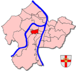
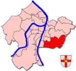
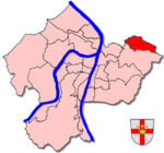
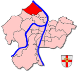
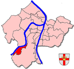
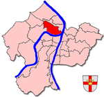
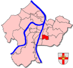
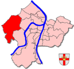
- Location map : Shows the location of the district (dark red) in the city of Koblenz
Note: The list is sortable . By clicking on a column header, the list is sorted according to this column; clicking twice reverses the sorting. Any desired combination can be achieved by clicking two columns in a row.
Districts
| Surname | Incorporation | surface | Residents | District | Situation map |
|---|---|---|---|---|---|
| Old town | - | ? | ? | - |

|
| Arenberg | November 7, 1970 | 6.47 | 2,769 | Yes (together with Immendorf) |

|
| Arzheim | November 7, 1970 | 4.87 | 2,192 | Yes |

|
| Asterstein | July 1, 1937 (formerly part of Pfaffendorf, official renaming on October 22, 1981) |
? | 2,572 | - |

|
| Bubenheim | November 7, 1970 | 3.14 | 1,411 | Yes |

|
| Ehrenbreitstein | July 1, 1937 | 1.61 | 1.921 | - |

|
| Gold mine | - | ? | 4,460 | - |
|
| Guls | November 7, 1970 | 7.95 | 5,532 | Yes |

|
| Horchheim | July 1, 1937 | 7.70 | 3,221 | - |

|
| Horchheimer Höhe | July 1, 1937 (formerly part of Horchheim) |
? | ? | - |
|
| Immendorf | November 7, 1970 | 2.53 | 1,425 | Yes (together with Arenberg) |
|
|
Charterhouse (with the statistical districts Karthause North , Karthause-airfield and Carthusian yard area ) |
- | ? | 10,822 | - |

|
| Kesselheim | 7th June 1969 | 4.84 | 2,648 | Yes |
|
| Lay | November 7, 1970 | 2.49 | 1,812 | Yes |
|
| Lützel | July 1, 1891 | ? | 7,826 | - |
|
| Metternich | July 1, 1937 | 4.80 | 9,377 | - |

|
| Moselle white | April 1, 1902 | 3.13 | 3,103 | - |

|
| Neuendorf | July 1, 1891 | 5.46 | 5,634 | - |

|
| Niederberg | July 1, 1937 | ? | 2,883 | - |

|
| Oberwerth | - | ? | 1,293 | - |

|
| Pfaffendorf | July 1, 1937 | 4.03 | 2,713 | - |

|
| Pfaffendorfer Höhe | July 1, 1937 (formerly part of Pfaffendorf) |
? | ? | - |
|
| Rauental | - (originally called Western Suburb, officially renamed 1975) |
? | 4,578 | - |

|
| Rübenach | November 7, 1970 | 12.88 | 5,095 | Yes |
|
| Stolzenfels | 7th June 1969 | 2.48 | 382 | Yes |

|
|
Southern suburb (with the statistical districts center and south ) |
- | ? | 10,231 | - |

|
| Wallersheim | October 1, 1923 | 2.62 | 3,651 | - |

|
literature
- Energieversorgung Mittelrhein GmbH (ed.): History of the city of Koblenz . Overall editing: Ingrid Bátori in conjunction with Dieter Kerber and Hans Josef Schmidt
- Vol. 1: From the beginning to the end of the electoral era . Theiss, Stuttgart 1992. ISBN 3-8062-0876-X
- Vol. 2: From the French city to the present . Theiss, Stuttgart 1993. ISBN 3-8062-1036-5
