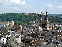
Koblenz old town
|
Old town
City of Koblenz
|
|
|---|---|
| Coordinates: 50 ° 21 ′ 38 " N , 7 ° 35 ′ 48" E | |
| Residents : | 4883 (Sep 30, 2012) |
| Postal code : | 56068 |
| Area code : | 0261 |
|
Location of the Old Town district
|
|
|
Koblenz old town, aerial view (2017)
|
|

The old town of Koblenz is the original cell of the city. The district includes the settlement area of Koblenz from the Roman foundation 9 BC. Until 1890. Then the city fortifications were laid down and the city was able to expand its settlement area. Many localities in the vicinity were incorporated by 1970 and today form the city of Koblenz.
After the heavy destruction caused by heavy air raids in World War II , the old town was rebuilt in the following years. Today, the restored old town with its restaurants, pubs, shops and historical buildings attracts many visitors, but also locals, to linger. The old town of Koblenz has been a UNESCO World Heritage Site of the Upper Middle Rhine Valley since 2002 .
Attractions
There are five churches, Basilica St. Kastor , Liebfrauenkirche , Florinskirche , Jesuitenkirche and Herz-Jesu-Kirche , in this district. Other striking buildings are the Deutsches Eck , the Electoral Palace , the Old Castle , the Kunstgässchen, the Deutschherrenhaus , the Koblenz Theater , the Schängelbrunnen , the Four Towers , the Metternich House , the Alte Münze , the Bürresheimer Hof , the Old Department Store , the Schöffenhaus , the Dreikönigenhaus , the Krämerzunfthaus , the German Kaiser and the Löhr Center . With the Münzplatz, Am Plan, Jesuitenplatz and Görresplatz with the history column , four squares shape the old town.
Federal Garden Show 2011
For the 2011 Federal Garden Show in Koblenz, the Rhine facilities and the area around the Electoral Palace were redesigned. The banks behind the Deutsches Eck along the Rhine and Moselle were renovated. The Konrad-Adenauer-Ufer was expanded into a riverside boulevard and made car-free. A cable car over the Rhine connects the Rhine facilities at the level of the Kastorkirche with the forecourt of the Ehrenbreitstein Fortress . The level house was given a glass roof and functions as a lookout point. By opening the castle, an axis was created from the new rail stop in Koblenz Stadtmitte via Schlossstrasse through the castle itself to the Rhine. On the banks of the Rhine behind the castle, a 100 meter wide staircase was built. The flower courtyard between Deutschherrenhaus and Kastorkirche was also used as a venue.
See also
- History of the city of Koblenz
- Confluentes
- City fortifications Koblenz
- List of cultural monuments in Koblenz old town
literature
- Reinhard Kallenbach : The Koblenz old town. Development, planning and fate of the historic town houses, Koblenz 1995.


