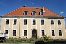
Loga (Neschwitz)
|
Loga
Łahow commune Neschwitz
Coordinates: 51 ° 13 ′ 48 ″ N , 14 ° 19 ′ 56 ″ E
|
|
|---|---|
| Height : | 163 m above sea level NN |
| Residents : | 125 (December 31, 2016) |
| Incorporation : | April 1, 1936 |
| Incorporated into: | Saritsch |
| Postal code : | 02699 |
| Area code : | 035937 |
Loga , Upper Sorbian , is a place in the center of the Bautzen district in East Saxony and has been part of the Neschwitz community since 1993 . The place is part of the official Sorbian settlement area in Upper Lusatia .
geography
Loga is located about nine kilometers northwest of the large district town of Bautzen in the valley floodplain of the Schwarzwasser , which flows here from the south towards the Schwarze Elster . The area is hilly. In the direction of Schmochtitz there is the 204.2 m high hill called Roter Berg.
The neighboring towns are Saritsch in the north, Milkwitz in the east, Strohschütz in the south-east, Dreikretscham in the south-west and Pannewitz in the north-west.
history
In the eastern part of the village, on the left of the road to Milkwitz, there is the so-called “Logaer Schanze”, the remains of one of the largest Slavic fortifications in Upper Lusatia.
The Burgward Lagowe was first mentioned in a document in 1226. The settlement, which is laid out as a lane village , developed around the manor . It was first recorded under its current name in 1510. Until the 19th century, the place was under the rule of the manor resident here, which also owned shares in the neighboring towns.
Until April 1, 1936 Loga formed an independent rural community; then it was incorporated into Saritsch . Before the district reform in 1994, Loga was reclassified to Neschwitz on July 1, 1993.
population
For his statistics on the Sorbian population in Upper Lusatia, Arnošt Muka determined a population of 171 inhabitants in the 1880s; including 142 Sorbs (83%) and 29 Germans.
In 1925 Loga had 190 inhabitants, of which 164 were Protestant denominations (86%).
The place had been a Protestant pastor to Göda since the 16th century before it came to the parish of Neschwitz in 1809.
Infrastructure
Loga is connected to the B 6 and B 96 via the state road 107 ( Göda - Radibor ) . The nearest links to the A4 is Salzenforst , about seven kilometers to the southeast.
literature
- Cornelius Gurlitt : Loga. In: Descriptive representation of the older architectural and art monuments of the Kingdom of Saxony. 31. Booklet: Bautzen Official Authority (Part I) . CC Meinhold, Dresden 1908, p. 143.
Web links
- Loga in the Digital Historical Directory of Saxony
Individual evidence
- ↑ Saxony Atlas of the Free State of Saxony ( notes )
- ↑ Ernst Tschernik: The development of the Sorbian population . Akademie-Verlag, Berlin 1954.


