M 02
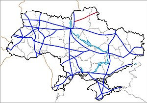
| M02 trunk road in Ukraine | |

|
|
| |
|
| map | |
| Basic data | |
| Operator: | |
| Overall length: | 242.5 km |
|
Oblasts : |
|
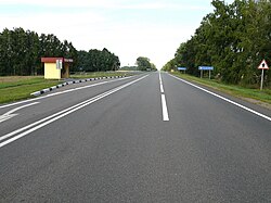
| The M 02 at Baturyn | |
The M 02 is a Ukrainian trunk road. It leads from Kipti in an easterly direction to the Russian-Ukrainian border . It is part of the road connection Kiev - Moscow and thus also the European route 101 .
course
| 0 km | Kipti |
| 51 km | Wertijewka (near Nischyn ) |
| 93 km | Borsna |
| 126 km | Baturyn (at Konotop ) |
| 168 km | Krolevets |
| 208 km | Hluchiw |
| Russian border , continued as M 3 |

