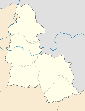
Krolevets
| Krolevets | ||
| Кролевець | ||

|
|
|
| Basic data | ||
|---|---|---|
| Oblast : | Sumy Oblast | |
| Rajon : | Krolevets Raion | |
| Height : | no information | |
| Area : | 31.54 km² | |
| Residents : | 23,125 (2018) | |
| Population density : | 733 inhabitants per km² | |
| Postcodes : | 41300 | |
| Area code : | +380 5453 | |
| Geographic location : | 51 ° 33 ' N , 33 ° 23' E | |
| KOATUU : | 5922610100 | |
| Administrative structure : | 1 city , 8 villages | |
| Address: | вул. Радянська 19 41300 м. Кролевець |
|
| Website : | http://www.krolevets.com/ | |
| Statistical information | ||
|
|
||
Krolevets ( Ukrainian Кролевець [ kroɫeʋɛt͡sʲ ]; Russian Кролевец Krolevets , Polish Królewiec ) is a city in the Ukraine in the north of Sumy at the confluence of the rivers Ret ( Реть ) and Swydnja ( Свидня ).
Krolewez is an industrial city with 23,000 inhabitants (2018) and the administrative center of the raion of the same name .
geography
Krolevets is located about 150 km northwest of the Oblastzentrum Sumy , 60 km north of Konotop and 40 km south of Shostka on the highway M 02 / E 101 , which Kiev with Moscow links.
The city has a train station on a railway line of the South-Western Railway , which also connects Kiev with Moscow. The border with the Russian Oblast Kursk is about 80 km east of the city.
Until 2017, the municipality consisted only of the city of Krolewez itself and has an area of 3,154.68 hectares. On January 4, 2017, the city became the center of the newly founded municipality Krolewez ( Кролевецька міська громада Krolewezka miska hromada ). At this still count the eight villages Artjuchowe , Bozmaniw ( Боцманів ) Hrybanjowe ( Грибаньове ) Hruske ( Грузьке ) Mostyschtsche ( Мостище ) Nischynske ( Ніжинське ) Retunynzi ( Реутинці ) and Tarassiwka ( Тарасівка ).
history
5 hryvnia - commemorative coin: "400 years of Krolevets" obverse
Krolewez was founded in 1601. The place was named in honor of the king ( King: Król in Polish ). After the armistice of Deulino , the city fell to Poland at the end of 1618 and became a district town in 1632. The location at the intersection of two trade routes contributed to the rapid growth of the city, so that in 1644 the city was granted Magdeburg law by the Polish King Władysław IV . In the Russo-Polish War of 1654-1667 , the city was badly affected and in 1686 finally fell to Russia .
Population development
| 1897 | 1959 | 1970 | 1979 | 1989 | 2001 | 2013 |
|---|---|---|---|---|---|---|
| 10,375 | 13,996 | 18.307 | 23,804 | 25,962 | 25.183 | 23,231 |
Source: 1897: Russian Census of 1897; 1959–1979:, 1989–2013:
sons and daughters of the town
- Aron Gurstein (1895-1941); Yiddish writer, literary scholar and literary critic
- Mykola Lukasch (1919-1988); Translator, linguist and polyglot
Rajon
Founded in 1956 and administered from Krolewez, Krolewez Rajon is located in the northwest of Sumy Oblast and borders on Chernihiv Oblast in the west . It has an area of 1,284 km² and a population of around 46,000 inhabitants. The population density of the Rajons is 36 inhabitants per km².
Web links
- Entry on the place in the Encyclopedia of the History of Cities and Villages of the Ukrainian SSR (Ukrainian)
- Entry on the place in the Encyclopedia of Modern Ukraine (Ukrainian)
- Entry on the place in the geographical directory of the Kingdom of Poland and other Slavic countries
- Krolevets Raion website (Ukrainian)
- City history (Ukrainian)
- Region page on Oblast website (Ukrainian)
Individual evidence
- ↑ a b Cities and Settlements in Ukraine on pop-stat.mashke.org ; accessed on January 27, 2019
- ↑ Відповідно до Закону України "Про добровільне об'єднання територіальних громад" уо Сумсьмад "уо Сумсьмаір облей
- ↑ 400 years of Krolevets (Ukrainian)
- ↑ Censuses of the USSR


