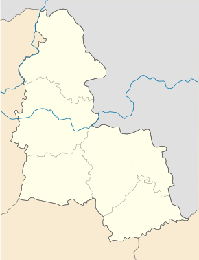
Trostyanets
| Trostyanets | ||
| Тростянець | ||

|
|
|
| Basic data | ||
|---|---|---|
| Oblast : | Sumy Oblast | |
| Rajon : | Trostyanets district | |
| Height : | 118 m | |
| Area : | Information is missing | |
| Residents : | 20,638 (2017) | |
| Postcodes : | 42600 | |
| Area code : | +380 5458 | |
| Geographic location : | 50 ° 28 ' N , 34 ° 58' E | |
| KOATUU : | 5925010100 | |
| Administrative structure : | 1 city | |
| Address: | вул. Миру 6 42600 м. Тростянець |
|
| Website : | trostyanets-miskrada.gov.ua | |
| Statistical information | ||
|
|
||
Trostjanez (Ukrainian Тростянець ; Russian Тростянец , Polish Trościaniec ) is a town under district administration in the northern Ukrainian Sumy Oblast . The city is the center of the Rajons of the same name and is located 57 km south of the Oblast capital Sumy on the banks of the Boromlja River , a tributary of the Worskla .
The city with 21,000 inhabitants (2017) has numerous architectural monuments, including a neo-Gothic circular courtyard from 1749, the late Baroque Annunciation Church from 1750, a Galitziner palace from the 18th century and the “Nymphs Grotto”, which was inaugurated in 1809 for the centenary of the Battle of Poltava has been.
history
Trostyanets was founded in the 1650s, in 1877 the settlement of Смородине / Smorodyne in the east around the station was added, and Trostyanets has had town status since 1940.
sons and daughters of the town
The Ukrainian writer and publicist Mykola Chwylowyj was born in the city in 1893 .
Web links
- Trościaniec . In: Filip Sulimierski, Władysław Walewski (eds.): Słownik geograficzny Królestwa Polskiego i innych krajów słowiańskich . tape 12 : Szlurpkiszki – Warłynka . Walewskiego, Warsaw 1892, p. 504 (Polish, edu.pl ).
- unofficial site of the city (Ukrainian)
- Municipal Council website (Ukrainian)
Individual evidence
- ↑ Cities and Settlements in Ukraine on pop-stat.mashke.org
- ↑ Trostyanets town history in the history of the towns and villages of the Ukrainian SSR ; accessed on 2017 (Ukrainian)

