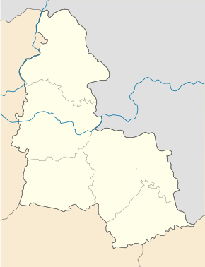
Worozhba
| Worozhba | ||
| Ворожба | ||

|
|
|
| Basic data | ||
|---|---|---|
| Oblast : | Sumy Oblast | |
| Rajon : | Bilopillia district | |
| Height : | 151 m | |
| Area : | 4.039 km² | |
| Residents : | 7,363 (2014) | |
| Population density : | 1,823 inhabitants per km² | |
| Postcodes : | 41811 | |
| Area code : | +380 5443 | |
| Geographic location : | 51 ° 10 ' N , 34 ° 14' E | |
| KOATUU : | 5920610300 | |
| Administrative structure : | 1 city | |
| Address: | вул. Ворошилова 8 41811 м. Ворожба |
|
| Website : | http://vorozhba-mr.in.ua/ | |
| Statistical information | ||
|
|
||
Worozhba ( Ukrainian and Russian Ворожба , Polish Worożba ) is a city in the center of Sumy Oblast in Ukraine with 7300 inhabitants (2014). The city is a railway junction on the Kiev – Kursk railway line .
history
The village, which was elevated to a town in 1959, was founded in 1665. From October 7, 1941 to September 3, 1943, the city was occupied by Wehrmacht troops.
geography
Vorozhba is located in Bilopillja Rajon on the left bank of the Wyr , a 62 km long tributary of the Seim 5 km northwest of the district center Bilopillja and about 54 km northwest of the Oblast center Sumy . The border with the Russian Oblast Belgorod is about 10 km northeast of the city.
Personalities
- Gennadi Konoplew (1945–1997), politician in the Lithuanian SSR, banker and manager
Web links
Commons : Woroschba - collection of images, videos and audio files
- Worożba . In: Filip Sulimierski, Władysław Walewski (eds.): Słownik geograficzny Królestwa Polskiego i innych krajów słowiańskich . tape 14 : Vorovo – Żyżyn . Walewskiego, Warsaw 1895, p. 5 (Polish, edu.pl ).
Individual evidence
- ↑ Population figures of Ukrainian localities on pop-stat.mashke.org, accessed on September 1, 2014
- ↑ City history on the city's official website ( page no longer available , search in web archives ) Info: The link was automatically marked as defective. Please check the link according to the instructions and then remove this notice. , accessed September 1, 2014


