
Meimsheim
|
Meimsheim
City of Brackenheim
|
|
|---|---|
 |
|
| Height : | 184 m |
| Area : | 7.21 km² |
| Residents : | 2559 (2009) |
| Population density : | 355 inhabitants / km² |
| Incorporation : | April 1, 1972 |
Meimsheim is a village in the Heilbronn district in Baden-Württemberg , which has belonged to Brackenheim since April 1, 1972 .
history
The area around Meimsheim was settled in prehistoric times. Finds from the Neolithic, Bronze Age and Iron Age as well as traces of Celtic and Roman settlements were discovered at various points in the district. The roads to Dürrenzimmern , Hausen , Lauffen and Kirchheim are of Roman origin and met at the church of Meimsheim outside the center of the village. In addition to the six buildings in the Kaywald estate , Roman remains were also discovered near the church. Meimsheim seems to have been a traffic center, if not an administrative center, during Roman times. 23 row graves from the Alemannic or early Franconian times were found in the area of Bahnhofstrasse . Today's place developed as a settlement south of the Roman ruins at the latest in Franconian times. The town's church, which probably existed as early as the 7th century, was built directly on the Roman foundations, which is why it is spatially separated from the town to this day.
Meimsheim was first mentioned in a document as "Meginbodesheim" in 788 in the Lorsch Codex on the occasion of a donation to the Lorsch Monastery . The mention as a villa in a document from 805 indicates that the place already had a village-like character and was not just a single farm. The Hirsauer Codex also contains entries that refer to Meimsheim, but some of the place names mentioned there such as “Meginsheim” or “Meginesheim” could also refer to the abandoned village of Magenheim below the nearby Michaelsberg . In the Reichenbach donation book, on the other hand, Meimsheim is mentioned several times without a doubt as “Meginbotesheim”. From the sources mentioned, it is deduced that the place should have belonged to the Counts of Calw in the 11th and 12th centuries , although the local nobility of Brackenheim, the lords of Eberdingen , the lords of Magenheim and others were wealthy in the village.
In the 12th and 13th centuries, the Lords of Meimsheim were local nobility who are said to have lived in a castle or a palace in Meimsheim. The remains of the wall found on the Rosenhöhe south of the village are said to be the foundations of this manor house. Around 1345 the Counts of Vaihingen appeared as Würzburg feudal people in Meimsheim, at which time a lower regional court in Meimsheim is also mentioned.
The diverse and fragmented mediaeval ownership and dependency relationships led from the 14th century to the end of the 16th century to a division of the village for almost 200 years. Around 1360, Württemberg received the northern part of the town, which had previously belonged to the Archdiocese of Mainz and the Diocese of Würzburg, and in 1402 the Lords of Gemmingen came into possession of the southern part, which had previously belonged to the Counts of Calw. Dorfstrasse (today: Bahnhofstrasse) formed the borderline between the property. Stephan von Venningen and his wife Margareta von Gemmingen sold their Meimsheim property to Plicker von Gemmingen in 1517. In 1585 the lords of Gemmingen sold their part of the village to Duke Ludwig von Württemberg , making Meimsheim entirely part of Württemberg. In 1618 the former Gemmingen residents were incorporated into Württemberg. A town hall was built around 1595 and the town had around 400 inhabitants.
Meimsheim shared the history of numerous villages in the Zabergäu in the 17th and 18th centuries . From the beginning of the 17th century, epidemics such as the plague claimed numerous deaths. In the Thirty Years' War fled or died, much of the population, the subsequent wars of succession brought to the middle of the 18th century further suffering, and the Napoleonic Wars in the early 19th century, caused mainly by billeting foreign troops further complaints. The poor conditions in the village led to the emigration or emigration of around 300 residents in the 19th century.
Meimsheim belonged to the old Württemberg office of Brackenheim and, during the implementation of the new administrative structure in the Kingdom of Württemberg , which had existed since 1806, remained assigned to the current Oberamt Brackenheim .
In 1822, the municipality , which is characterized by agriculture and viticulture , acquired the manorial wine press , but had to sell part of the fields belonging to the Meimsheimer Markung to neighboring communities as early as 1825 due to its debts. In 1838 the community sold further areas, but in the following year had to take out further loans to expand the school building and the streets.

The historic town hall was rebuilt in 1846, and a postal expedition was opened in 1873. On August 28, 1896, the Royal Württemberg State Railways opened the initially narrow-gauge Zabergäubahn from Lauffen am Neckar to Güglingen (extended to Leonbronn in 1901). The Meimsheim station building was built as a unit station of type IIa. In 1905/06 the construction of a water pipe took place, in 1914 the new schoolhouse was inaugurated. In the First World War 44 of 161 Meimsheim soldiers were killed.
In 1919 the place was electrified. In 1933 there were 896 inhabitants, in 1939 there were 979. During the administrative reform during the Nazi era in Württemberg , Meimsheim became part of the Heilbronn district in 1938 . During the Second World War , around 70 were killed and missing among 260 men who had entered. However, the war brought an influx of refugees and later also displaced persons, so that at the end of 1945 1066 people lived in Meimsheim. The place survived the war almost unscathed. Only when the place was occupied by French troops on April 1, 1945, fire fighting work on a building burned down resulted in four fatalities - including the long-standing mayor Wilhelm Schmid, who has been in office since 1909 - and two injured.
Since the place had become part of the American zone of occupation , it belonged to the newly founded state of Württemberg-Baden since 1945 , which in 1952 became part of the current state of Baden-Württemberg.
After the Second World War, the water supply of the town was improved in 1949 by adding two more springs and a sports field was inaugurated. In 1950 the place was on the newly built bus route from Heilbronn to Ochsenburg . In 1951 a winegrowers' cooperative was founded and the community hall built, and in 1952 a trade association was founded. The winegrowers ' cooperative acquired the community's own wine press, but due to a lack of sufficient wine cellars, they joined the Württemberg central wine-growing cooperative in Möglingen as a full supplier. A home day held in 1953 made the place known to numerous visitors from near and far. In 1956 a new kindergarten was built, and in 1961/62 the Martinskirche was renovated. In 1963, the municipalities of Brackenheim , Cleebronn , Botenheim , Meimsheim, Hausen an der Zaber and Dürrenzimmern merged to form the "Abwasserreinigung Untere Zaber" association. In 1968 the Steinäcker building area was developed and a building in Hausener Strasse was acquired as the new town hall, and in 1969 the historic town hall was demolished.
On January 16, 1972, at a hearing in the course of the municipal reform, a majority of the citizens voted for a connection to Brackenheim , which was carried out on April 1, 1972.
coat of arms
The blazon reads: In blue a silver fishhook turned to the left.
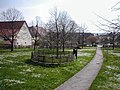
Attractions

- The Protestant Martinskirche was built on the foundations of a Roman estate, is one of the oldest church buildings in the Heilbronn district and was the mother church of the branch churches in the surrounding villages. The tower, choir and sacristy in the late Gothic style date from the 15th and early 16th centuries, the nave was renewed in the 18th century.
- Immediately in front of the Martinskirche is the Lindenplatz , which points to the 500- and 1000-year-old linden trees. The younger linden tree had to be felled in 1980 and the older linden tree in 1994 because of the danger of death and collapse. The linden trees may once have been judicial linden trees . Today there is only one young linden tree that was bred from a shoot of the 1000-year-old linden tree. Street and building names such as Lindenstrasse and Lindenhof are still reminiscent of the linden trees.
- A school in Meimsheim is documented from the 16th century, the schoolmaster's position also included sacristan service and court clerkship. The current school building dates from 1914.
Lindenplatz

Rectory from 1743

Schoolhouse from 1914


- In the center of Meimsheim there are several mainly baroque houses, including the rectory from 1743.
- The ox fountain dates back to the Renaissance and was renovated in 1970. The bakery dates from 1841, and the former cooperative wine press has been preserved in the village .

Bakery from 1841

Ox well

Former Cooperative press


Personalities
- Wilhelm Kohlhammer (born August 26, 1839 in Meimsheim, † 1893), publisher
- Friedrich Hack (1843–1911), Lord Mayor of the City of Stuttgart from 1872 to 1892
- Albert Hirth (1858–1935), engineer and inventor
- Fritz Wider (1877–1965), politician, member of the state parliament
literature
- Gerhard Aßfahl: Meimsheim . In: Heimatbuch der Stadt Brackenheim and its districts , Brackenheim 1980
Individual evidence
- ↑ Minst, Karl Josef [transl.]: Lorscher Codex (Volume 5), Certificate 3525, May 19, 788 - Reg. 2018. In: Heidelberger historical stocks - digital. Heidelberg University Library, p. 206 , accessed on February 23, 2018 .
- ^ Rainer Stein: The Württemberg standard station on branch lines . In: Eisenbahn-Journal Württemberg-Report . tape 1 , no. V / 96 . Merker, Fürstenfeldbruck 1996, ISBN 3-922404-96-0 , p. 80-83 .
- ↑ Communications of the Württemberg Stat. State Office No. 4/5 of December 10, 1940: Results of the population and occupational census on May 17, 1939
- ^ Results of the population census and determination of residence on December 4, 1945 in northern Württemberg
- ^ Federal Statistical Office (ed.): Historical municipality directory for the Federal Republic of Germany. Name, border and key number changes in municipalities, counties and administrative districts from May 27, 1970 to December 31, 1982 . W. Kohlhammer, Stuttgart / Mainz 1983, ISBN 3-17-003263-1 , p. 451 .
Web links
- LEO-BW, discover regional studies online , Meimsheim
