
London Borough of Merton
| London Borough of Merton | |
|---|---|
  |
|
| status | London Borough |
| region | Greater London |
| Administrative headquarters | Murder |
| surface | 37.61 km² |
| Residents | 206.186 |
| was standing | June 30, 2018 |
| ONS code | 00BA |
| Website | www.merton.gov.uk |
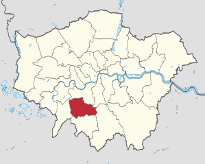
The London Borough of Merton [ ˈmɜːtn̩ ] is a borough of London and is located in the south-west of the city. When the Greater London Administrative Region was founded in 1965, it emerged from the Municipal Borough of Mitcham , the Municipal Borough of Wimbledon and the Merton and Morden Urban District in the county of Surrey . The name of the district is derived from a former village in its center and was chosen as a compromise between the affluent Wimbledon and the rather poor north.
In 2008 the population was composed of 72.8% white, 11.8% Asian, 8.1% black and 1.5% Chinese.
In 2003 the Ahmadiyya Muslim Jamaat opened the Bait ul-Futuh mosque .
Districts

* - There are still no articles of their own for the respective districts, only forwarding here.
The borough of Norbury is also part of other London boroughs.
Personalities
- David Brabham (* 1965), Australian racing car driver
- Adrian Cruft (1921–1987), composer
- Ford Madox Ford (1873-1939), writer
- Robert Graves (1895–1985), writer
- David Gray (* 1979), snooker player
- Geoffrey Hinton (* 1947), scientist
- Ralph Merton (1817–1883), metal trader
- Michael Moorcock (* 1939), writer
- Jamie T (* 1986), musician
Web links
- Merton Borough Council (county council)
Individual evidence
- ↑ Mid 2018 Estimates of the population for the UK, England and Wales, Scotland and Northern Ireland
- ^ ONS mid-2007 Ethnic Group Population Estimates. (PDF, 89 KB) (No longer available online.) Greater London Authority, October 2009, archived from the original on July 19, 2011 ; accessed on May 23, 2011 (English). Info: The archive link was inserted automatically and has not yet been checked. Please check the original and archive link according to the instructions and then remove this notice.
Coordinates: 51 ° 25 ′ N , 0 ° 12 ′ W