Moselsteig
| Moselsteig | |
|---|---|
 Waymarks |
|
| Data | |
| length | 365 km |
| location |
Rhineland-Palatinate , Germany |
| Supervised by | Mosellandtouristik GmbH |
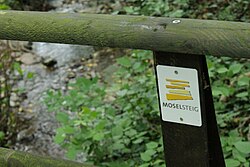
| Markers | Symbol of 5 yellow stacked slates; underneath the lettering ' MOSEL STEIG' |
| Starting point |
Pearl 49 ° 28 ′ 23.3 " N , 6 ° 22 ′ 10.7" E |
| Target point |
Koblenz - Deutsches Eck 50 ° 21 ′ 52.1 ″ N , 7 ° 36 ′ 21.5 ″ E |
| Type | Long-distance hiking trail |
| Height difference | 356 m |
| The highest point | Mehringer Berg ( 416 m above sea level ) |
| Lowest point | Deutsches Eck ( 60 m above sea level ) |
| Level of difficulty | easy to difficult |
| season | all year round |
| Viewpoints | Bremmer Calmont , Mehringer Berg |
| particularities | Prädikatswanderweg |
The Moselsteig is a 365-kilometer long- distance hiking trail that was opened in April 2014 on the Moselle in Germany.
Route description
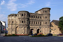
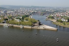
It leads from Perl on the Upper Moselle via Trier , Bernkastel-Kues , Zell (Mosel) and Cochem to Koblenz at the confluence of the Rhine and Moselle rivers. On the way are the Porta Nigra , the Reichsburg Cochem , the Bremmer Calmont , Burg Eltz , the Neumagen wine ship and the ruins of the fortress Mont Royal .
Prädikatswanderweg
The Moselsteig Trail was planned according to the criteria of the German Hiking Association , and it received the quality seal for Wanderable Germany in September 2014. Even before its opening on April 12, 2014, the climb was awarded the European hiking seal Leading Quality Trail - Best of Europe .
Stages
| No. | from | to | Length (km) |
|---|---|---|---|
| 1 | Pearl | Palzem | 24.0 |
| 2 | Palzem | Nittel | 16.5 |
| 3 | Nittel | Conc | 22.5 |
| 4th | Conc | trier | 20.0 |
| 5 | trier | Keep quiet | 19.5 |
| 6th | Keep quiet | Mehring | 13.0 |
| 7th | Mehring | Leiwen | 16.5 |
| 8th | Leiwen | Neumagen-Dhron | 12.0 |
| 9 | Neumagen-Dhron | Kesten / Osann-Monzel | 14.5 |
| 10 | Kesten / Osann-Monzel | Bernkastel-Kues | 15.5 |
| 11 | Bernkastel-Kues | Urzig | 18.5 |
| 12 | Urzig | Traben-Trarbach | 15.0 |
| 13 | Traben-Trarbach | Reil | 14.0 |
| 14th | Reil | Zell (Moselle) | 12.5 |
| 15th | Zell (Moselle) | Neef | 20.0 |
| 16 | Neef | Ediger-Eller | 11.0 |
| 17th | Ediger-Eller | Beilstein | 18.0 |
| 18th | Beilstein | Cochem | 14.0 |
| 19th | Cochem | Treis cards | 23.5 |
| 20th | Treis cards | Mosel core | 12.5 |
| 21st | Mosel core | Löf | 13.0 |
| 22nd | Löf | Kobern-Gondorf | 14.5 |
| 23 | Kobern-Gondorf | Winningen | 14.0 |
| 24 | Winningen | Koblenz | 15.0 |
Moselsteig side jumps
Around the Moselsteig there are also four circular hiking trails between nine and 20 kilometers in length, the so-called side jumps. They either border directly on the actual climb or are located in its vicinity. They are all planned according to the criteria of the German Hiking Association and mostly run on nature trails and paths. Further Moselsteig partner trails are in the planning stage. The located in the Moselle region Traumpfade partially extend close to the Mosel sidewalk.
Trivia
On the occasion of the official opening, a SWR television team tested a section of the Moselsteig Trail. Specifically, the stage between Enkirch and Traben-Trarbach (approx. 10 kilometers) was carefully examined. The conclusion of the four hikers, who didn't know the route before: “It was very varied.” However, “only for people who can walk well.” But everyone wanted to come back and would be happy to recommend the hiking trail to others.
Individual evidence
- ↑ Press release of the German Hiking Association. In: wanderbaren-deutschland.de , September 5, 2014. Retrieved October 28, 2014 (PDF; 365 kB)
- ↑ Moselsteig was recognized as a quality trail. In: Wochenspiegel , September 8, 2014. Retrieved September 26, 2014.
- ↑ Opening of the Moselsteig Trail: hiking between wine tastings. In: Der Spiegel , April 6, 2014. Retrieved April 12, 2014.
- ↑ From 2014: Hiking on the Moselsteig Trail. In: gastlandschaften.de , accessed on April 12, 2014.
- ↑ Affair on the Moselle. In: gastlandschaften.de , accessed on September 26, 2014.
- ↑ Moselsteig ignites wandering fever. In: Trierischer Volksfreund , September 26, 2014. Retrieved September 26, 2014.
- ↑ Moselsteig partner trails. In: Mosellandtouristik.de . Retrieved December 17, 2014.
- ↑ Hiking check: The Moselsteig is a European quality hiking trail. In: swr.de , accessed on April 14, 2014.
Web links
- Official website of the Moselsteig
- Tour planner Rhineland-Palatinate - Official GPS data for the Moselsteig Trail
- Moselsteig trail in the GPS hiking atlas including GPS data and stage descriptions
- Literature about the Moselsteig in the catalog of the German National Library


